The location of the buoy (41004) is shown below, with the current location (red dot) and predicted future track of the hurricane shown as well.

The pressure (green line) and wind plots (sustained and gusts) at the buoy are shown below. You can see how the winds peaked in the eyewall of the hurricane, with gusts as high as 85 knots, and dropped to near zero in the middle of the eye where the pressure was a minimum. Just amazing.

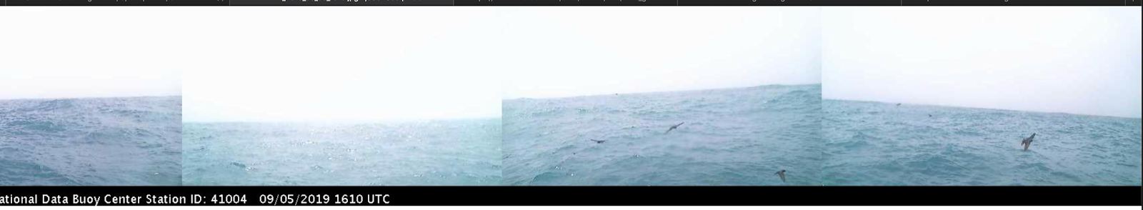
But now the amazing part....the pictures from the buoy! Here is one, inside the eyewall at 1810 UTC (click to expand). Huge waves, like a wall in front of the camera.

One hour earlier, you can see more...with big waves and a huge amount of spray

The differences in wave height inside the eye and in the eye wall surprised me. Here is the plot of significant wave height (average of top 1/3 of waves). Increased to around 25 ft in the eyewall, follow by a drop to 11 feet in the eye.


Incredible!
ReplyDeleteThanks,
ReplyDeleteWe have relatives along the GA & S.C. coasts. This H. has been of great interest.
John
A Signal 2 typhoon passed over me in the Phillippines a decade ago, tearing off the roof of the condo in the middle of the night. Inside the eye it was sunny and calm -- but everyone knew that the second half was still to come!
ReplyDeleteI also experienced a Typhoon in the Philippines. Haiayn (Yolanda) in 2013. I was surprised how short duration the eyewall portion of the storm was. Only 20 mins of intense wind that actually sounded like a jet taking off right above the house. Scary. But just like that it was calm than the other side of the eyewall, than just alot of heavy rain after that for a few hours. It came in intermittent intense downpours
DeleteCan anyone estimate the diameter of the eye when it passed over buoy 41004? It would seem that, the larger the eye is, the greater the expected difference in wave height between at the wall and at the center.
ReplyDeleteI wonder if a ship could safely ride out a storm by staying in the eye. (assuming it could get there)
ReplyDeletein theory, yes... but it would have to have been in the eye for a LONG time and stay there, adjusting position, for a LONG time as the storm moved. It's sort like asking: Could a guy stay married to a gal for 30 years and never annoy his wife? In theory: yes. In practice: it's never happened.
Deletehttps://www.aoml.noaa.gov/hrd/tcfaq/G16.html Looks like, at lower latitudes, probably?
DeleteSometime I'd like to experience the passage through a hurricane, including the eye, from a safe place of course. Trouble is, you never know the storm's path much in advance.
ReplyDeleteAny thoughts on NOAA's dressing down of the NWS Birmingham office regarding Dorian? Seems very chilling.
ReplyDeleteHave you noticed all our record high minimum temps recently? Quite disturbing.
ReplyDeleteWhy is NOAA still using inches of mercury to indicate pressure?
ReplyDelete