The forecast models did quite well during the past day, with the cold air and light snow moving in yesterday and this morning.
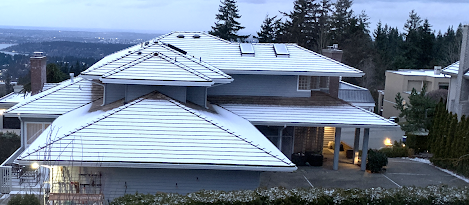
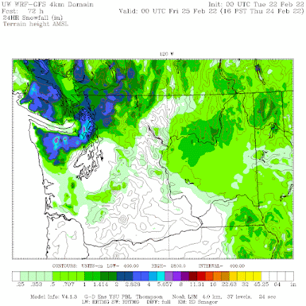
Yesterday light snow fell over the northeast Olympic Peninsula, with a band extending over northern Kitsap and Camano Island. And this morning, very light snow fell over Puget Sound (see picture below). A few flurries are now occurring, but those should end soon.
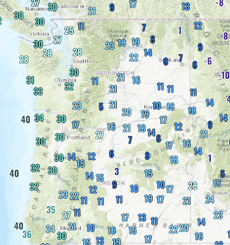
The lows last night in the west ranged from the mid-20s around Bellingham to roughly 30F in western WA and Oregon away from the water. Teens were prevalent in eastern WA, with some single digits into terrain. But the coldest temperatures were in valleys of the uplands of eastern Oregon, where one station got to 1C.
The air is now cold enough to snow throughout the region, but precipitation is essentially over as the upper-level trough that provided uplift moves away.
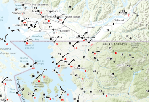
Winds coming out of the Fraser River valley were extraordinary last night, with gusts getting to 55 knots (63 mph) in Bellingham. Take a look at the winds at 1 AM this morning....a strong, cold current of air was flowing out of the narrow Fraser River Gorge. Wind chills near 0F.
Today will be a cold, dry day with highs in the upper 30sF in the west and 20s east of the Cascade crest. The sun is too strong now to stay uber-cold during the day.
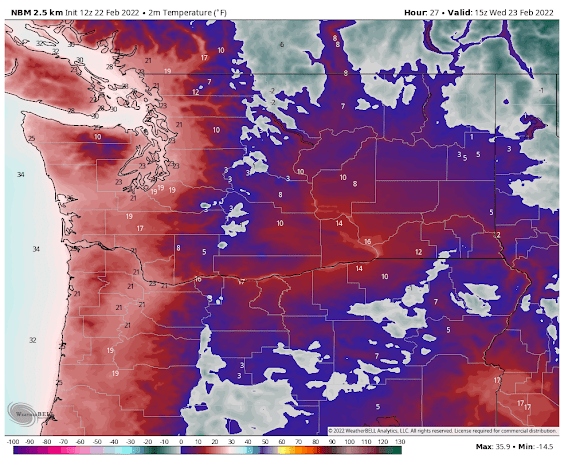
But tonight, with the sun down and earth radiating to space in cloudless skies, the temperatures will plummet, with lows in the lower 20s in the west and single digits to around 10F in the Columbia Basin (see the forecast for 8 AM Wednesday below from the National Blend of Models). I have already talked to the city of Seattle emergency management folks about opening shelters for the homeless.


Extraordinary snow and rainfall just south of Stanwood. Monday AM measured 3.6 inches snow which converted to 1.03 inches equivalent water, plus 0.37 inches earlier rainfall, total precip 1.40 inches. CoCoRaHs obs Stanwood 3.7 S similar at 2.8 snow and 1.48 precip. Clinton, Langley, Greenbank slightly less, but much less elsewhere. Looks like 2 convergence zones merged!! One east/west and another north/south and merging near Stanwood
ReplyDeleteIt snowed on South Whidbey too, not just Camano. 5-6 inches in Langley.
ReplyDeleteDusting here on the NW side of Greenlake-N. Seattle
ReplyDeleteWe woke up to 4 inches of snow yesterday morning, above Lake Goodwin, 550' elevation. Total snow 5.5 inches. Totally not expected.
ReplyDeleteMy kid freaks out over every atypical weather event as a climate apocalypse. They're in college in the far NE and got upset that I pointed out last night that Seattle would, unusually, be colder than there last night.
ReplyDeleteIt appears that the Jet Stream is pulling air from the Pacific off Baja into eastern North America. Is the current Jet Stream running down the West Coast and across the Mexican border states extremely rare, or just somewhat infrequent?
That's what happened in the summer of '93. It was warmer and dryer in Anchorage than in Seattle that summer.
DeleteTemp forecast for Ellensburg (8°) was right on. Blewett Pass at 3° seems reasonable. That's at 4,100 feet, 2,400 feet higher. 5 miles northeast of KELN, I had 7°.
ReplyDelete21.9 degrees on the Bothell-Mill Creek line last night. A record?
ReplyDelete