What controls our spring weather? Why is our spring weather different than other locations?
I talk about such things in my podcast (see links below). Plus, I provide the forecast....and there is a LOT of potential weather action this weekend.
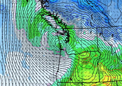
For example, n Monday morning a powerful Pacific cyclone will approach the region, resulting in strong winds on the Oregon and southern Washington coasts (see the pressure forecasts for Monday morning at 5 AM below). This is a very strong storm for April.
A large pressure difference will form over the Fraser River Valley and a jet of strong northeasterly winds push into northwest Washington.
The other big issue is the unusually cold air that will spread over the region on Saturday and Sunday. Sunday morning will bring temperatures dropping into the mid-30s over western Washington. A weak disturbance will approach. And with that combination, there could be a few snowflakes mixed into the precipitation.
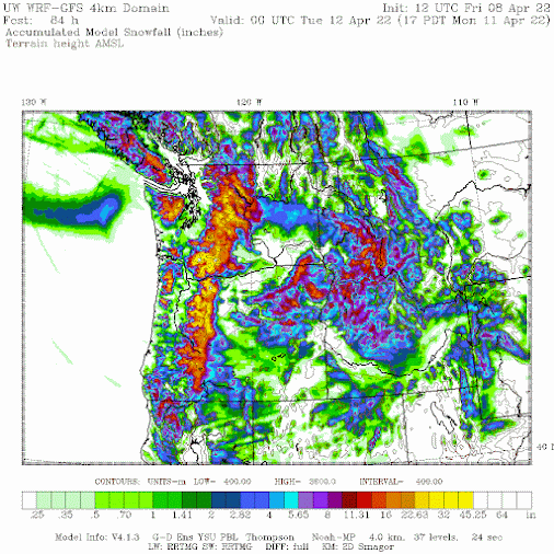
But with cold temperatures and precipitation, one thing is for sure, the mountains will get a lot of new snow, as shown by the snow accumulation forecast through 5 PM Monday. As much as 2-3 feet in the mountains.


No comments:
Post a Comment
Please make sure your comments are civil. Name calling and personal attacks are not appropriate.