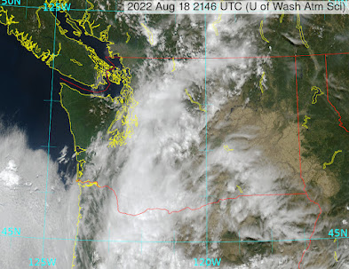
There are clouds and a few light showers moving into western Washington this afternoon as monsoonal moisture heads northward.
The latest radar image shows some of the light rain (see below). No lightning is being detected at this time.
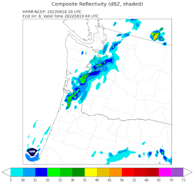
The NOAA HRRR model, making forecasts every hour, shows some of the light rain moving up into western Washington tonight (the forecast of the simulated radar image for 9 PM tonight is shown).
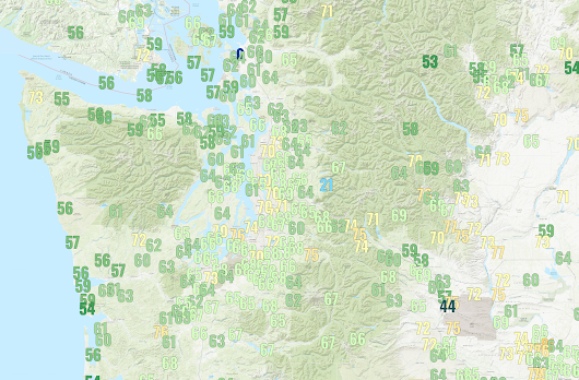
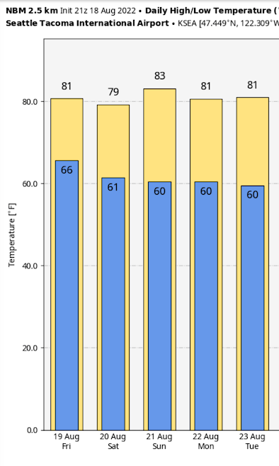
Why so warm in some locations? We started with a sunny, warm day yesterday, and then the clouds streamed in from the south around sunset. Clouds (and the associated bountiful moisture in the atmosphere) act like a blanket, slowing the normal nighttime cooling.
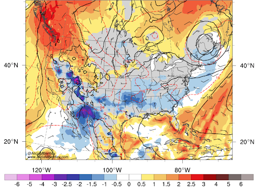
Tonight, the upper-level ridge of high pressure that has given us the warmth will weaken and move northeastward as an upper-level trough of low-pressure approaches.
_________
Atmospheric Sciences 101
Like last year, I am teaching atmospheric sciences 101: a general introduction to weather and climate, this fall. You can learn more about the class on the class website. I talk about everything from the basics of the atmosphere to weather prediction, thunderstorms, hurricanes, and local weather to global warming and climate.
I will be teaching the class in person at the UW, but will also make it available over zoom. Thus, folks can take it remotely.
If you are over 60, you can take the class through the ACCESS program for a very nominal charge (something like $15). Last year I had over 100 folks do so.
If you are a UW student looking to learn about weather or a non-student interested in the topic, I welcome you to join me this fall. My first class is on September 28th.



Now if only we'd get some rain. No rain,just humidity & lightning, it ain't a monsoon
ReplyDeleteDewpoint is 65 degrees at Seatac! That ought to buy us enough CAPE to create a thunderstorm, no? It feels just like Connecticut... where are the cumulonumbus clouds?
ReplyDeleteAlready sick to death of this summer, we're now supposed to enjoy our 4th heat wave, beginning in the middle of next week (Portland). Basta!
ReplyDeleteI'm surprised not to see more commentary of the miserable heat from Thursday night! Two of our thermometers (near UW) registered 78 degrees at 12:30 am--which I know because I was not sleeping because of the heat, even with several fans on...I understand the cloud cover cause for the heat, but it still seems super anomalous.
ReplyDeleteMy phone said 70° at 3:24 am Thursday morning ... ugh!!! Pretty bad when we say it'll "cool down to the 80s". That *used* to be a heat wave. I cannot wait for autumn!!!
ReplyDelete