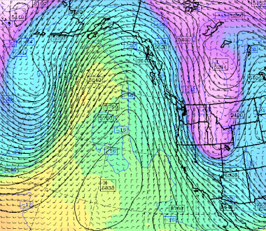
In my new podcast (see information below), I talk about a major weather transition that will occur over the West Coast, with the development of a huge, persistent ridge of high pressure (see upper-level map below for Sunday morning).
And in the second part of the podcast, I talk about the claims of supposed weather data voids over the Pacific. Such an absence of weather data existed 60 years ago, but no longer.
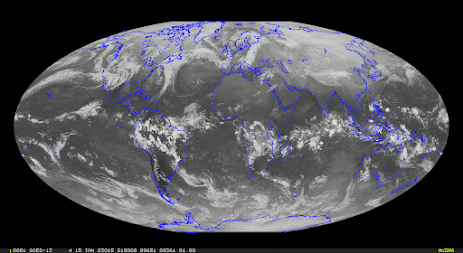
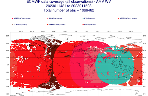
Today massive satellite, aircraft, and buoy data provide huge amounts of 3D weather data worldwide (see examples below), and form the basis for a huge improvement in weather prediction. I provide details in the podcast.
View of the planet in the infrared from geostationary satellites.
Atmospheric motion information using wavelengths
in which water vapor is active


This month has been quite dry so far at BLI and environs. The airport has received just 0.74" of precip through 1/16 - 30% of normal. It's also been rather warm with the monthly avg temp at BLI nearly 6F above normal through 1/15.
ReplyDeleteBellingham has about 80% of normal precipitation since October 1. Not a serious issue and easily made up. A big contrast with the very wet year before.
ReplyDeleteI'm not sure I would characterize the prior year as "very wet" at BLI. While the 2021-22 water year as a whole was about 3" above normal (38" instead of 35"), that was due to 6 days in November 2021 that resulted in that month being 9" above normal. The rest of the 2021-22 water year ended up being 6" below normal. Similarly, calendar year 2021 was about 7" above normal at BLI, but again only because of the extra 9" of rain in November. The period from late February through mid-September 2021 was very dry and quite a bit below normal. I think the warm flooding rains in November 2021 tend to distort the numbers.
DeleteCliff you must get a kick out of armchair scientists commenting on your blog. The patience of a saint you have!
DeleteI think you may be thinking the 20/21 water year where we had that stream of atmospheric rivers that hit the Puget Sound area for much of fall/early winter through I think January, which did include the snow that fell between Christmas Eve 2021 and NYE that same year that resulted in a cold snap that last week of 2021.
DeleteThe storms mostly died off by the time January ended last year, though it stayed largely wet through much of spring, but not enough to give us significant rainfall totals and this fall was not as stormy as it had been the year before, wet yes, but I don't think as much rain has fallen however.
Here on the east side of the crest we are much below oir usual snowfall. We had a good few weeks of snow prior to Dec 25th when it turned to rain and has been light rain/dry ever since. The snowpack in the forests is opening up and feels more like spring than mid winter. Kachess lake and others are low. Hopefully winter returns or else it could be a bad wildfire season on the east side. If La Nina is dead perhaps it will be an early spring?
ReplyDelete