Thousands of lightning strikes have hit the Pacific Northwest during the past several days.
A stormfest of lightning!
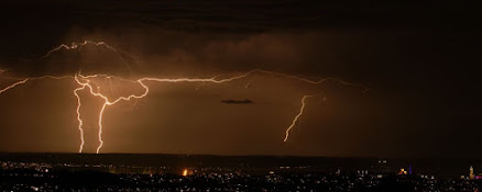
Lightning over the Kitsap Peninsula
Picture courtesy of Adam Sapek
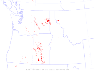
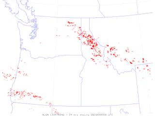
For the 24-h ending at 1 AM this morning (Friday), lightning was widespread over the entire region (each + or - sign is an individual lightning stroke)
During the previous day, eastern Oregon and Washington enjoyed the lightning shows
Wednesday had a strong band crossing northern Idaho and more over southwest Oregon
While Tuesday had lightning filling southwest Washington and western Oregon.
So why has the Northwest enjoyed this flashy period?
Every Northwest resident instinctually knows the answer: Blame California!
And they would be right.
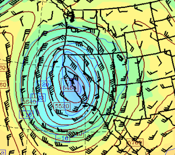
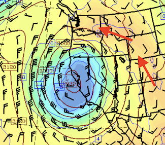
During the past several days, a low center has been parked along the California coast (see the 500hPa chart--for about 18,000 ft--from Tuesday afternoon). The winds are also shown, indicating southerly winds over the U.S. southwest and southeasterly (from the southeast) winds over the Northwest.
This flow is very favorable for instability and thunderstorms over the northwest.
First, easterly flow in the lower atmosphere pushes the cool, marine influence out to sea.
Cool, dense low-level air near the surface is problematic for thunderstorms, which depends on rapid cooling with height.
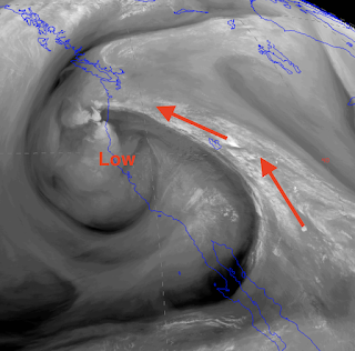
Second, the wind circulation swings in moist, warm air aloft over our region. This is made starkly clear from a moisture-channel satellite picture, which shows the distribution of water vapor over the west on Tuesday afternoon. You can see the moisture revolving around the low.
Water vapor is good for thunderstorms, since its condensation into clouds and precipitation releases latent heat. And such heating helps make the air more buoyant.
The circulation is also pulling warm air in the lower atmosphere into our region, which is also good for thunderstorms (the temperatures and wind at around 10,000 ft for late Tuesday is shown below).
So for a number of reasons, a low along the California coast is favorable for Northwest thunderstorms.
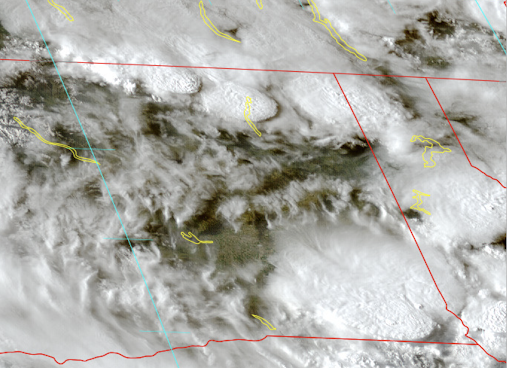
And some of these storms have been quite impressive and beautiful. Below is a visible image around 6 PM Thursday. Each of the oval cloud structures is the cirrus anvil of thunderstorms.
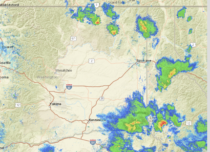
The radar imagery at this time (below) shows some substantial echoes, indicating heavy precipitation (red and orange are heaviest)
Some good news....expect drying conditions on Saturday as the California low has weakened.
__________________
The Northwest Weather Workshop agenda and information are online. This meeting, which will take place on May 12-13th in Seattle, is the major weather meeting of the year in the Northwest. We have a varied and interesting agenda. The meeting is open to everyone and if you want to attend you must register (on the website).
We will also have a banquet/talk at Ivar's Salmon House on Friday May, 12. This is a fun meeting and will be hybrid (in person and on zoom).


.png)


No comments:
Post a Comment
Please make sure your comments are civil. Name calling and personal attacks are not appropriate.