December 29, 2024

Severe Turbulence Hit an Alaska Airlines Flight from Seattle to Phoenix. Why?

On Thursday, at approximately 1:35 PM PST, an Alaska Airlines flight (ASA 700) flying at 33,000 ft between Seattle and Phoenix, hit severe turbulence near Las Vegas, dropping approximately 200 ft over a few seconds.   Several flight attendants and one passenger were injured.

What is the meteorological explanation and could this unpleasant event have been avoided?

A few details first.   Below is the flight path, with the star showing the aircraft's location when severe turbulence hit.   Weather radar is also shown (color shading).  There was no precipitation in the neighborhood.   


An infrared satellite image at this time (below) shows that the turbulence occurred in an area of mid-level clouds.  It appears that the plane was probably not in clouds so this was a clear air turbulence event.


Turning to information provided by the NOAA Aviation Weather Center, below are the turbulence reports for the few hours ending at  2 PM.  The double red triangles indicate extreme turbulence.  The one associated with Alaska Airlines aircraft is indicated, but there are three others at altitudes ranging from 25,000 to 38,000 ft.


The shading indicates the forecast turbulence levels by a NOAA prediction system driven by model forecasts of wind, temperature, and other parameters. 

Let me show you the predicted turbulence at the time of the accident at 30,000 ft (below).  The prediction for 36,000 ft was similar.

A band of moderate turbulence was predicted over the region and well-positioned with the locations of the incident.  But the forecast underplayed the intensity.


What was the origin of the turbulence?

Clear air turbulence like this can have two origins: large vertical changes in wind speed or direction (wind shear) or breaking mountain waves (atmosphere waves produced by air flowing over mountain barriers).

Considering the location (red pointer) of the incident compared to the local terrain, I concluded that the potential for strong mountain waves was small.   Winds approaching the crest level of the upstream mountains (about 7000 ft) were too weak, among other problems.


Next, I plotted the forecast winds at roughly 35,000 ft, just above the height of the aircraft (33,000 ft).  (see below).

OMG.    At  4PM (0000 UTC) there was a very strong jet stream, with winds exceeding 150 knots.  At the time of the incident, this band of winds would have been perfectly positioned to produce very strong winds above the site of the incident.


Strong winds in themselves don't produce clear air turbulence, which often results in large changes in the wind with height---or vertical wind shear.   However, having strong winds aloft can produce a strong wind shear if the winds decline rapidly below.

To determine whether there was strong vertical wind shear, I plotted the radiosonde observations at Las Vegas at 4 PM that day (below).  The balloon is actually launched around 3 PM and takes about 2-h to ascend.
 
If you can't read the wind barbs at the right, let me translate.  

There was a huge wind shear in the vertical at the elevations of the Alaska flight.  The aircraft was flying at approximately 33,000 ft (about 10,000 meters).   Winds increase from about 50 kt around 7500 meters to over 150 knots around 11,000 meters.   


Let me make this even easier with a plot of wind speed versus height below.  The arrow shows you the rough elevation of the aircraft.


Mama Mia!   That is some real wind shear. 

 Another factor is that the stability of the air in the layer traversed by the plane was low (you will have to trust me with this, but meteorologists in the crowd will look at the temperatures plotted above (right black line) will not be in agreement. 

This kind of strong vertical wind shear and modest stability is what is needed for clear air turbulence.  These conditions cause the atmosphere to develop intense turbulence motions that result in strong vertical accelerations of aircraft.

What Can Airlines Do?

Pilots often tell folks to use their seatbelts if reports of strong turbulence are observed in their vicinity.  On Thursday for this case, there were no severe turbulence reports before the incident.  

There were forecasts of moderate turbulence, but those are not rare and generally not a serious issue.  NOAA turbulence forecasts are useful, but often miss the mark, particularly for severe clear-air turbulence, something I can explain in a future blog.

Perhaps passengers should always be told to buckle when moderate turbulence is predicted or when traversing a region of large predicted wind shear, with cabin service discontinued.

One day, effective turbulence sensing systems should be installed on all passenger aircraft, so that planes can be warned of such turbulence ahead.  Doppler Lidar is one potential technology.  

Perhaps, a reborn Boeing could make use of this technology in new aircraft. 😊


_________________________________________________

Steve Pool Scholarship Fund

We are over halfway to our goal of the $100K needed to create a permanent undergraduate scholarship in honor of Seattle's most well-known weather communicator,  the late Steve Pool.   

Please consider making a contribution (tax-deductible) to this University of Washington fund.   And thanks to the hundreds of folks who have already contributed.

Here is the info:

A Steve Pool memorial undergraduate scholarship has been established in his honor (see below)

Once funded by contributions, this new undergraduate scholarship will provide financial assistance to promising Atmospheric Sciences students, fostering the training of the next generation of meteorologists and atmospheric scientists.

If you want to contribute or learn more about Steve, check out the webpage below.   Thanks so much....cliff


December 27, 2024

Was Yesterday's Forecast a Success?

 Time for a little "inside baseball" on weather forecasting, particularly regarding yesterday's wind event.

There were a few comments about the forecast not being as dramatic as "predicted".   I will let you be the judge after we examine the model forecasts and what actually occurred.

Early uncertainty.

I refrained from discussing this event until the prior day (Wednesday).  

Why?  Because there was substantial uncertainty regarding the track and intensity of the key low center.  

The main tool meteorologists use to examine uncertainty is evaluating ensembles of many forecasts.

To illustrate, below is the ensemble of sustained wind forecasts on Tuesday for Seattle Tacoma Airport based on many forecast runs (UW high-resolution WRF model).  The purple circles show observed winds and each line is a different forecast.  The black line is the average of the many forecasts.

The event occurred around 18Z on the 26th (18Z is 1800 UTC or GMT).

HUGE uncertainty.   Forecasts ranged from high winds (35 kt) to less than 5 kt.


Seeing this I held off.   

As time progressed, agreement among the various model forecasts increased, and by the night before (initialized at 00Z 26 December, 4 PM PST 25 December), most forecasts were going for a significant event.  As shown by the purple dots (observed winds), the ensemble mean (black line) UNDERPLAYED the winds if anything.

So how did the forecast work out more generally?  Based on the model forecasts, I highlighted two areas in my blog--the south Sound and the easterly slopes of the Cascades.

On the eastern slopes of the Cascades, several locations had wind speeds exceeding 90 mph, with one location above Ellensburg hitting 112 mph.  Ridge tops within the Columbia Basin reached  60-75 mph.   So the forecasts for strong winds on the Cascade eastern slopes were fairly good.

Strongest wind gusts on Thursday

Now considered Puget Sound (blow up below of observed max winds on Thursday)   As predicted, the strong winds were mainly south of Seattle, with gusts reaching 40-50 mph (see below).  Even stronger near the Columbia River.


Thousands of customers lost power over the South Sound (see below), but the damage was mitigated by several previous events that already tested weak branches.


Looking forward, another minor wind event is expected tomorrow (Saturday): see the Seattle City Light windwatch site predicting below.  Plus more precipitation.  

Yes, this is late December in Seattle.


December 25, 2024

Major Wind Threat over the South Sound and Eastern Slopes of the Cascades

 I have been watching the predicted development and path of a small low center and the trend of the runs has been ominous.

The predicted path is nearly optimal for producing strong winds from Seattle to Olympia, with a near certainty of power outages.  So if you live in this region...get ready.   Quite a blow is now only 6-15 hr away.

Here is the situation.  

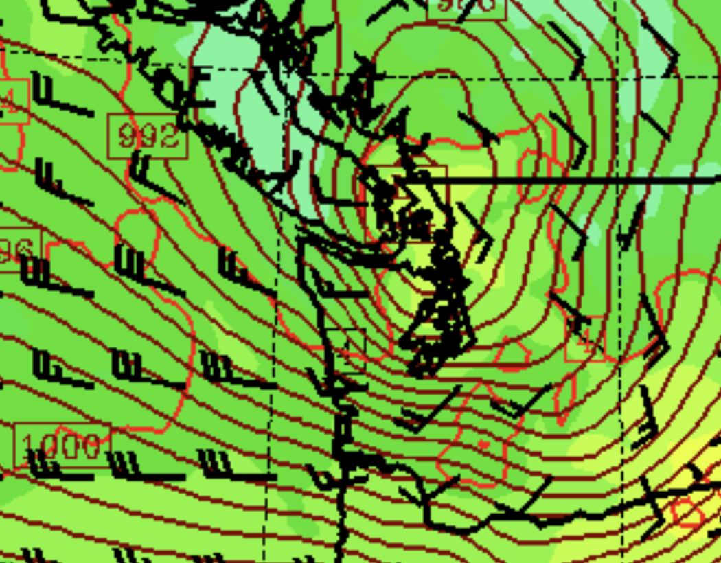
By 4 AM Thursday morning, a 981 hPa low center will be positioned over the NE side of the Olympics


Three hours later it will move over NW Washington, with an intense pressure gradient over southern Puget Sound.  This means very strong winds there.


The low then moves northeastward into southern BC.  This is a near-optimal path for strong winds over Puget Sound.


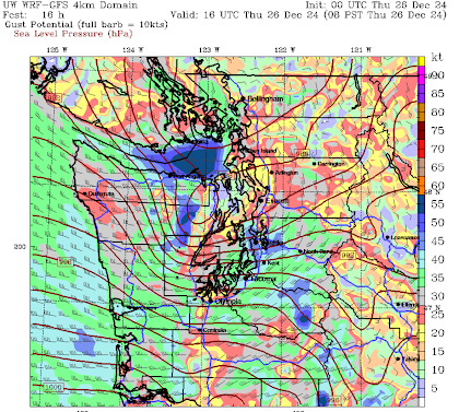
Now let me show you the predicted wind gusts.   At 7 AM, there are gusts of 40 kt and more over the south Sound.


One hour later things are getting crazy in the Strait of Juan de Fuca, and over Seattle and the south Sound (blue colors).


Five hours later, Puget Sound winds have calmed, but intense downslope winds have developed on the eastern slopes of the Cascades.


Seattle WindWatch shows the multiple predictions of strong winds over Seattle.


Bottom line: if you are in the vulnerable areas, prepare.  Charge your electronics, etc.


Strong Winds, Heavy Precipitation, Massive Snowfall, and Big Waves

Sometimes the atmosphere throws the kitchen sink at us.  

This is such a time.   

Heavy rain and local flooding. Check.  Strong winds and some power outages. Check.  Massive snowfall and temporarily closed passes. Check.  Huge waves and coastal impacts. Check and more checks.

Let's start with precipitation.

A massive atmospheric river, extending thousands of miles to the southwest, has now reached the West Coast (see satellite moisture channel image below).


The results will be very heavy precipitation from British Columbia to central California.   

Below is the UW WRF model forecast of accumulated precipitation through Sunday morning.  The mountains will be hit very hard, with some locations securing over ten inches of liquid water.  

Puget Sound will be rain shadowed by the Olympics but will still get 1-2 inches.


The precipitation starts today and will continue with minimal breaks for the next few days. Several local rivers, such as the Snoqualmie, will approach bank-full.

And then there is the mountain snow.  We are fortunate that temperatures are cold enough aloft to produce mainly snow above 3000 ft.   If the freezing level was high (warmer temperatures), then serious flooding could have occurred. 

By Thursday morning, there will be substantial snow, with 1-2 feet of new snow above 4000 ft. 


But the snow will not be over, with OVER THREE FEET at higher elevations by Saturday morning (below).   To put it mildly, this will be wonderful news for Northwest skiers.


And now the strong winds, which will occur in two acts.

The first is today, when a strong front, associated with a deep low over the Gulf of Alaska, reaches our coast (see sea level pressure map).


This front will produce very strong winds along the coast and moderate winds over NW Washington (see predicted gusts at noon).   VERY strong winds on the lee (NE) slopes of the Olympics.


Stage 2 is more interesting and perhaps more impactful. A moderate low center will pass north of western Washington, producing a very strong pressure gradient across the South Sound.


As shown by the wind gust prediction for 8 AM tomorrow (sea level pressure is also shown),  strong winds from Hoquiam through Tacoma could well produce gusts reaching 45 knots.  That means power outages.  PSE needs to be ready for this.  


Still not enough?    All the offshore storms will produce massive waves that will reach our coast tomorrow (see below).  Waves of 20-30 ft.


This is the kind of weather that brings a smile to the faces of local meteorologists.

December 23, 2024

Another Northwest Bomb Cyclone with Localized Strong Winds

 Don't tell the media folks, but another midlatitude cyclone will be "bombing" off our coast today, with some local impacts.

A reminder:  A bomb cyclone is a midlatitude cyclone that intensifies rapidly (the sea level pressure drops by roughly 24 hPa in 24 hr).  A hPa (hectopascal) is a unit of pressure 

The recent moisture channel satellite image of the storm is impressive, with the darkened area a potent sign of rapid intensification.


Let me show you the latest European Center sea level pressure forecast to illustrate the rapid development.  Earlier this morning (6 AM) the low center was only 1004 hPa.


By 1 PM, the central pressure drops 23 hPa to 981 hPa.  Wow


And by 9 PM tonight it has deepened to 961 hPa....another 20 hPa!
Impressive..... this is quite a bomb cyclone!

Fortunately for us, the bomb cyclone is quite far offshore.  Note the much higher pressure inland and the late pressure difference across the Cascades....that will be important.


As the storm approaches northern Vancouver Island the gusts around its southern portions will be extreme, reaching 60-80 mph (see map below at 1 AM Tuesday).


Many of you are wondering about winds and power outages, so let me provide you with the latest.   The greatest wind threat will be:
  • Along the coast
  • Over Northwest Washington
  • The Cascade foothills
Let me show you the gusts forecasts at a few times (in knots)

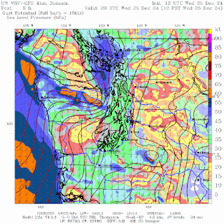
At 4 PM, the strongest winds are along the coast associated with the cyclone.  Also strong easterly winds in the Strait.  Downslope easterly winds are developing on the lower western slopes of the Cascades...with the highest gusts around 40 kt.  The strong easterly winds are driven by a large pressure difference across the Cascades.


By 7 PM, the coast wind gusts are really starting to rev up (blue colors) and the easterly winds start pushing down the Cascade slopes towards Issaquah and Kent.  Nothing like November.

At 10 PM, wind strength will increase over NW Washington (gusts of 40-60 knots) and over the Cascade crest.


Here in Seattle, the Seattle WindWatch application suggests winds gusting to about 30 mph in the city (see below).  Not enough to provide many power outages.


There may well be a few power outages over the western foothills of the Cascades and just downwind (e.g., the windy Enumclaw to south Issquauh to Kent area), but nothing like the November storm.  


December 22, 2024

Big Waves in Hawaii. Why?

 There is a lot of excitement in Hawaii today, as large waves from the northwest reach the north coast of Oahu, making possible the Eddie Aikau Big Wave Invitational, a surfing competition only open to the most elite surfers.    This competition REQUIRES waves reach at least 40 ft in height at the venue:  Waimea Bay.

NOAA has a buoy just offshore and so far it has only reported a significant wave height of around 6 meters (20 ft).   But the highest waves can substantially exceed the significant wave height and waves can grow as they feel bottom close to the shore. (The significant wave height is the average of the highest third of the waves).


NOAA runs a computer forecast model that predicts significant wave height and direction, called Wave Watch 3.   Here is its forecast for 10 AM.   The arrows show the wave direction (from the northwest), with significant wave heights of 15-20 ft.


What was the source of these waves?

Well, to get big waves you need three things (in addition to water!).  Strong winds, a long fetch for the winds to act on the water, and substantial duration of the wind interacting with the water surface.

To get perfect big waves on the NW Oahu coast generally requires a strong low-pressure center to move west to east north of the islands.     

And you need the low to follow the right path.   Too far away and the waves have a chance to decline before reaching Hawaii.  Too near the islands and conditions are too stormy and unpleasant at the venue.   

To put it another way, you need the storm in on Goldilocks track.

In this case, a low-pressure center at 10 PM last night was in the perfect position northwest of the islands and was usually strong (indicated by the shading, which shows the difference of the pressure from normal).  Goldilocks indeed.


Now, it case some of my Northwest readers are disappointed regarding the big wave action reaching the Hawaiian Islands, I have some good news.   Some very big waves should reach our coast tomorrow (Monday, see below).  Surfing anyone?


Coastal Ocean Update

 Several folks have asked me about the coastal water temperatures, including whether the recent storms have had an impact.     So let's ...