March 29, 2016

El Nino is Weakening Rapidly

The strong El Nino that has influenced our weather for much of the winter is now rapidly weakening.  But there is considerable uncertainty what will happen next: will next year be a neutral (La Nada) or La Nina period?

Lets start by look at the sea surface temperature anomalies (differencea from normal) for a few areas in the tropical Pacific.  The Nino3.4 area is often cited, and as you can see, this temperature anomaly has dropped from 3 to 1.5 C...a big drop.  Even more dramatic is the decline in the temperature of the Nino1+2 area near the coast.


Even more dramatic, is the change in heat content of the upper ocean in the central and eastern tropical Pacific (see below),  from well above normal to BELOW normal.
You can visualize this change by looking at vertical cross sections through the upper tropical Pacific ocean at several times during the past few months.  The red area...a layer of warm water near the surface has greatly weakened and thinned.

So what will happen next winter?  This is a bad time to ask the question, since the skill of our models, both dynamical (physics-based) and statistical, are poor during the early early to mid spring.  Virtually all show a weakening of the strong El Nino of this winter, but some show a weak El Nino continuing, some showing near neutral conditions, and a few even suggesting a La Nina (cooler than normal waters).


In short, there is large uncertainty in our predictions for next winter and we will have to wait until June or July to have a better idea.


March 27, 2016

Huge Ridge and Extraordinary Weather Ahead

A front went through last night, behind which cool, unstable air flooded into the region (see high-res visible satellite below).  How can one tell?  Those popcorn-looking clouds over the Pacific are associated with convection, which in turn is produced by an unstable atmosphere with cold air going over relatively warm water.

As typical in spring, the passage of a front and the veering of winds towards the west along the coast, resulted in the development of a strong Puget Sound convergence zone, with intense precipitation over central and northern Puget Sound (see image).  In contrast, there is bright sun and clear skies to the lee of the mountains of Vancouver Island and the Olympics.  The advantage of the Northwest...you can choose your weather.


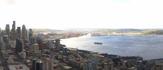
Here are shots from the Space Needle Cam at 9:20 AM. Heavy rain to the north and sun to the south.  (North, West, South).  Classic.  Pick your weather.


But the big weather story this week is the development of a huge ridge of high pressure over the eastern Pacific.  Let me show you the upper level (500 hPa) forecasts of the UW WRF modeling system.

First on Tuesday at 5 AM.   Wow.   Mega ridge with troughs on its flank.  This is called an omega block and is very stable.


 Thursday at 4AM, the ridge is still strong and has moved towards the coast.


Friday morning, still there.


 Now, this is one model run...can we trust it?  The way to tell is to look at ensembles of many forecast runs.  One application of ensembles is to look at the ensemble mean, which typically is more skillful than any individual member.  The average height anomaly at 500 hPa (the average difference of the ensemble members from normal)  for Wednesday afternoon shows a huge positive anomaly...much higher than normal, over the eastern Pacific.


Another way is look at spaghetti maps, in which height lines from all the ensemble members are plotted.  Here is such  map for Wednesday at 5 PM. Virtually all the members are going for the ridge.  This prediction looks solid.


The implications of this predicted eastern Pacific ridge is profound, with warm temperatures and sunny skies.   Here is the latest forecasts from weather.com.  Mid to upper 60s for much of the upcoming week.  Enjoy.


The Atmosphere is Providing Water Where It is Needed

There is a deep connection between meteorology and religion, and there are times when one wonders about divine intervention in our weather. ...