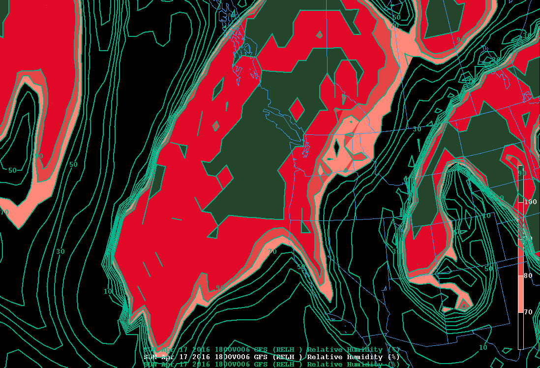
It looks like quite a few of you will experience 80F again during the next few days.
Another major heat event is coming, with temperatures well into the 60s on Saturday, mid to upper 70s on Sunday, and even low 80s on Monday. As you know, I have a lot of respect for the forecasts from weather.com and here are their numbers:
Considering that the average max temperature this time of the year is around 58F, we are talking about record territory for some days, with highs about 20-25F above normal.
The origin of this warmth? You can guess it. A strong ridge of high pressure over the West Coast (see the upper level map, 500 hPa level, at 2 PM Sunday).
I can't tell you how many people have told me they are worried about a repeat of last year: very warm spring, water issues, low snowpack, wildfires galore, terrifying blobs, and all the other unpleasantness of last spring and summer. They ask: are we seeing a permanent shift of our climate due to global warming?
What does the data and best science tell us?
This summer should be nothing like the last in terms of those unpleasant impacts.
The first thing to consider is while last winter brought normal precipitation, this year we had the wettest winter in Northwest history. That makes a difference.
Reservoirs are full, groundwater is in good shape, rivers are running full.
Let's have some fun and do some more detailed comparisons.
The previous winter we had near normal or slightly below normal precipitation over the region. This winter? Here is the total from October 1, 2015 to April 14, 2016 precipitation anomaly (difference from normal). This year, most of the region is
above normal, with western Oregon and Washington much above normal.
Last year the snowpack was the worst in history. This year it is normal, which means our full reservoirs will be topped off with lots of snow melt. (see current snowpack figure for Washington below).
So, with wet conditions this winter and plenty of snow, river levels will be good into the summer. Here is the 120 day stream fow forecast for eastern WA from the NWS River Forecast Center (percent of average). We are talking about mid-August. The Yakima River will be way above normal and the lowest rivers are near normal (about 80%).
The Yakima River authorities are forecasting plenty of water for farmers: BOTH senior and junior rights holders.
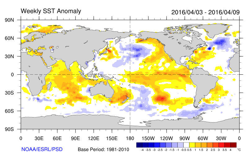
What about heat? We can start by looking at the water temperatures offshore. Below are the weekly sea surface temperature (SST) anomalies from normal for last year and this year in April. MUCH cooler till year. Forget the blob.
A contributor to the warm water has been the VERY strong El Nino of the last year (and the moderate one the year before). However, El Nino is weakening rapidly right now, so much so that the National Weather Service has released a
La Nina alert for next winter. A weakening El Nino should lead to cooling, both over the water and over land. However, it will take some time (months) for its impacts to start to fade.
What about the persistent high pressure of last winter and spring? Aren't we seeing some big ridges the last few weeks? We have. But the ridging and warmth have not been as steady and persistent as last year....that is why we have gotten precipitation quite frequently.
Here is the last NMME seasonal (June, July, August) forecasts provided by NOAA, based on an ensemble of seasonal climate models.
Precipitation is near normal.
Temperatures are moderately (.5 to 1C) above normal. Last summer was 2-5C above normal.
Bottom line repeated: we are in much better shape this summer. Last summer was a fluke, resulting mainly from natural variability. Global warming may have contributed a small about (perhaps .5C) to the warming, but it can not explain the key feature that caused all the trouble: the persistent high pressure ridging.
So enjoy some very pleasant weather this weekend with no guilt.
_________________
Announcement: Jazz and Astronaut Fundraiser for KPLU on May 14th!
How often do you get to meet and hear from an astronaut at a wonderful location (Museum of Flight, Seattle), with great jazz right before? I am going!
For more information:
http://www.brownpapertickets.com/event/2534871