On Wednesday night, a warm front crossed the area, bring light rain and radically warmer temperatures aloft. The 5 PM surface map on Tuesday shows the warm front (line with half circles) approaching.

Temperatures above Seattle warmed by around 12F Tuesday night as the front moved through. The atmosphere should dry out on Wednesday and with a lot of sun and a warmer lower atmosphere, temperatures should soar--here is the forecast temperature at 5 PM Wednesday: lower 70s over Puget Sound and 80s near Portland and around the Willamette Valley. Amazing. There could be a few mountain thunderstorms on Wednesday afternoon.

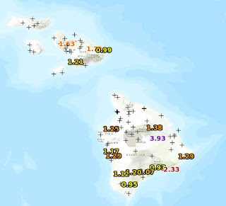
But the real weather "fun" will be on Thursday afternoon. Temperatures will surge into the mid to upper 80s in eastern Washington, and around 80F over the eastern side of Puget Sound. Much warmer than Maui, Hawaii was on Sunday! Look closely, and you will see cooler air surging eastward in the Strait and along the coast--an onshore or marine push will be underway.

But wait! There's more! The lower atmosphere over western Washington and Oregon (and southern BC) will be unusually unstable, something indicated by large values (at least for around here) of CAPE (Convective Available Potential Energy)--think of it as the "juice" for thunderstorms (see map).

With the onshore surge of marine air providing lift (and an approaching upper trough providing support aloft) plus lots of instability, the potential exists for significant thunderstorm activity over the region later on Thursday. (Instability is released by upward motion) Consistent with this idea, the high-resolution UW WRF model shows lots of showers starting 5 PM on Thursday, increasing by 10 PM, and continuing into Friday AM, progressively moving to the east (see maps).


Friday will be cool, cloudy and showery west of the Cascade crest. Too bad. But a few warm days will be a salve to our collective (and chilled) souls.
_______________________
How will Northwest Weather Change Under Global Warming? Help Us Determine the Local Impacts of Climate Change
Society needs to know the regional impacts of climate change and several of us at the UW are trying to provide this information with state-of-the-art high resolution climate modeling. With Federal funding unavailable, we are experimenting with a community funding to build this effort. If you want more information or are interested in helping, please go here. The full link is: https://uw.useed.net/projects/822/home All contributions to the UW are tax deductible.