June 14, 2016

Winter in June

It is snowing in the mountains right now and the temperatures aloft are more appropriate for January than mid-June.

Let me "warm up" by showing you the latest cam shots at Mt. Rainier's Paradise Ranger Station at approximately 5500 ft, where temperatures are around freezing and it is snowing.  You want to throw a snowball...no problem.


Or a Hurricane Ridge in the Olympics, at a similar elevation?  Yes, snow is falling.

And Crystal Mountain is a winter wonderland:


Or Stampede Pass, in the central Cascades, at only 4000 ft?   You  guessed it:  its snowing:

Our friends at the Seattle NWS office even have a winter weather advisory for parts of the Cascades, warning of winter-like conditions and 4-8 inches of snow!


The temperatures over us are unusually cold and much more like the typical conditions of January.  I can prove this using the marvelous upper air climatology capability available from the NOAA/NWS Storm Prediction Center.   Here is the climatology of 500 hPa (about 18,000 ft) temperatures at Quillayute on the Washington Coast.  Red shows daily record highs, blue indicates daily record lows and black is average.  The black dot show this morning's observation.

Today is a virtually tie for the record low for this date, or any date in June.  BELOW NORMAL TEMPS ANYTIME OF THE YEAR.

No...this is not global cooling, just the impact of a very deep trough over the West Coast.

Over the lowlands, it will be a cool, blustery day with convection and thunderstorms.  The latest visible satellite image shows a large fields of cold air with lots of convection ready to move into our region.   Only portions of central Puget Sound, shielded by the Olympics, may escape the showery fun.


Announcement

   My graduate student, Connor McNicholas has developed a wonderful FREE weather app that collects pressures on Android smartphones and gives you all kinds of valuable weather information.  We believe we can revolutionize weather prediction using dense collections of pressures from smartphones.  We need folks to try this app (and it already has been evaluated by dozens of folks) to ensure it works well.  If you are willing to help, you can get more information and download it here: https://www.cmetwx.com/

June 13, 2016

Snow Coming to Our Mountains! Supertrough! And More!

We generally aren't thinking about fresh snow in the mountains down to upper pass levels in June, but that is what you can expect during the next two days.  Plus thunderstorms!   Life is good.

Not this bad

An extremely deep trough will develop over western North America this week, as illustrated by the upper level (500 hPa) map at 2 AM Thursday morning.   I have rarely seen so many lows at one time within a large eastern Pacific trough. Let's call it Supertrough.  The jet stream (where the lines are close together) is not only strong, but extends across central CA.  Not the usual situation-- more like January.


The deep trough is associated with cool low-level air.  To illustrate, here is the 850hPa temperatures (roughly for 5000 ft) for 8AM Wednesday.  Down to 0C!  Cold enough for mountain snows.


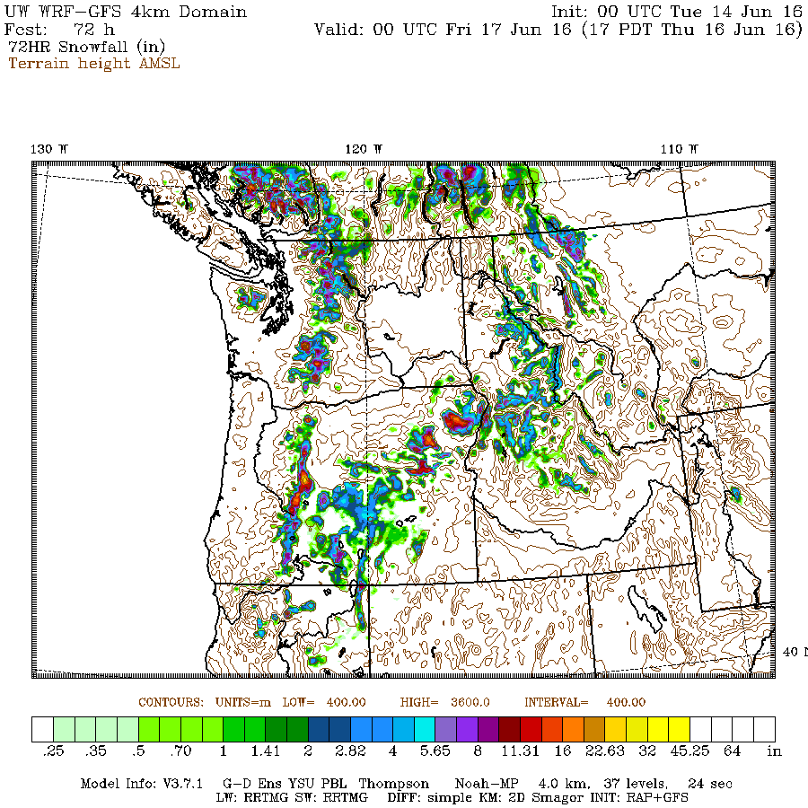
So take a look at the forecast snow total for the 72h ending at 5 PM Thursday.  As much as 4-8 inches above roughly 4500 ft.


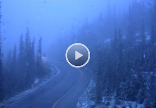
And did I mention that is was SNOWING tonight (Monday) at Paradise Ranger Station at 5500ft?  It will get quite wintry up there during the next few days.

Cam from road near Paradise Ranger Station, Mt Rainer

Total precipitation for the same period?  Except for the dry Columbia Basin, everyone will get wet,  with .5-1 inches in the mountains and even more over eastern Oregon.   This will help delay the fire season or serious drought worries.  The only concern is some errant lightning-caused fire.


And finally, thunderstorms.  Cold unstable air will move in on Tuesday and Wednesday, with the upper trough giving lift.  Thus, good chance for isolated boomers.   The NOAA Storm Prediction Center notes at least a 10% chance of thundesrtorms over western WA:

The latest WRF model predicts unusually large amounts of "thunderstorm juice" known as CAPE (Convective Available Potential Energy) for tomorrow afternoon.

So please be careful if you planning on playing golf tomorrow afternoon.  Lightning loves to hit golfers, particularly those with metal spikes on their shoes.   And if you where a hat like this, you might check you life insurance policy.  You won't last long out there.

Finally, the upper trough will not be in a rush to leave us.  As proof, the forecast map for Saturday shows that our cool/wet guest weakens but still is hanging around.

Announcement

   My graduate student, Connor McNicholas has developed a wonderful FREE weather app that collects pressures on Android smartphones and gives you all kinds of valuable weather information.  We believe we can revolutionize weather prediction using dense collections of pressures from smartphones.  We need folks to try this app (and it already has been evaluated by dozens of folks) to ensure it works well.  If you are willing to help, you can get more information and download it here: https://www.cmetwx.com/

Lowland Fog Season

The visible satellite image this morning was an October classic:   Low clouds (stratus and fog) within the valleys of western Washington, Or...