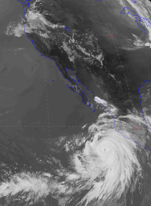
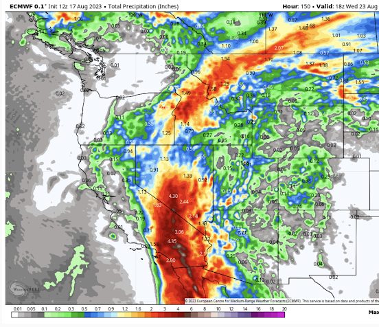
This blog will discuss the key reason for the Maui disaster, one not discussed by the media and others: a high amplitude atmospheric wave forced by strong winds interacting with the mountains of northwest Maui.
An atmosphere wave that produced powerful, dry downslope winds on the western slopes of West Maui mountains.
A vertical cross-section of the predicted mountain wave.
Explained in detail below
The terrible disaster in Maui has been leading the news cycle for a week now, with media and others proposing many causes: climate change, drought, dry invasive grasses, and Hurricane Dora to name a few.
But none of them have identified the key reason why so many people died last week and why the damage was so extensive. None explained the 60-90 mph gusts that hit a very localized area. Winds strong enough to shear off wooden power poles, tear roofs apart, and down lines of power lines.
And it wasn't Hurricane Dora, a relatively small tropical storm that passed 700 miles to the south of Hawaii.
Something else happened in Maui last week. Something capable of creating intense wind damage in one location and light winds a few miles away.
A phenomenon skillfully predicted by modern high-resolution models, and thus a feature we could have warned Lahaina's population about. A phenomenon that would have been picked up by surface weather observations, if only West Maui had invested in inexpensive weather stations.
The Terrain
To understand what happened one must consider the terrain of West Maui (see below), which is dominated by terrain reaching approximately 5500 ft.
Looking eastward from a boat off of Lahaina, the terrain looms impressive (see below).
Picture courtesy of Professor Dale Durran, UW
Last Tuesday, strong winds approached the crest of the West Maui Mountains, not because of Hurricane Dora, but because of an unusually strong high-pressure area to the north.
We know this for several reasons. A map of sea level pressure (black lines), surface winds (wind barbs), and the standardized sea level pressure anomaly (difference) from normal (colors) at 9 AM Hawaii time on Tuesday are shown below.
High pressure is centered north of Hawaii and this high pressure was far more intense than normal just north and over Maui (indicated by the orange, red, and brown colors). The pressure anomalies due to the Hurricane Dora were very small in scale and limited to far south of Hawaii.
Hurricane Dora had little impact on Hawaii during this event, something confirmed by an expert at the National Hurricane Center.
Since winds approaching the West Maui mountains will be so important consider the situation at the same time for an elevation of around 2600 ft (925 hPa pressure)-- see below. You can see the high to the north, the location of Maui (white arrow), and the hurricane (red arrow).
The wind anomaly from normal of the winds at this level is shown in color. Look carefully and you will see gray color over Maui.... five standard deviations from normal....which means VERY unusual. You will also note the clear separation of the strong winds of Dora from what hit Maui.
Not not only were strong winds approaching the West Maui mountains, but another feature that can foster a very strong mountain response also occurred: an area of stable air near the crest level of the terrain.
This is illustrated by the vertical sounding at Hilo on the Big Island six hours earlier (see below). The black line on the right shows the temperature with height. When the temperature does not fall rapidly with height, the atmosphere is generally stable. When it is constant with height or warming with height (an inversion), it is very stable.
Trust me, this stable layer is important. When strong winds accompanied by a stable layer near or just above crest level hits a terrain barrier, a high-amplitude mountain wave can form.
A wave that can produce intense downslope winds.
And this is exactly what happened last Tuesday over Maui.
The Smoking Gun
Last week, I asked David Ovens, a highly skillful atmospheric modeler in my group at the UW, to run a forecast of the Maui event using the WRF model at very high resolution (1.3 km grid spacing).
I was stunned by the simulation, which revealed the real cause of the disaster: a high-amplitude mountains wave with very strong downslope flow on the West Maui Mountains.
Below is a forecast vertical cross-section of the situation around 2100 UTC August 8th (11 AM Hawaii time). Winds are shown by color shading and arrows. The solid lines are potential temperature.
An extraordinarily high amplitude wave had formed, with air descending the western side of the Maui Mountains, accelerating as it plummeted towards Lahaina. At low elevations, the flow abruptly ascended, in a feature often termed a hydraulic jump.
Analogous flow can occur for water flowing over a dam.
The descending flow was not only strong, but very, very dry, as shown by the vertical cross-section of relative humidity (see below). Relative humidities below 20% descended down the mountains, with the driest air well under 10%.
The combination of strong winds and dry air hugely promotes fire, including rapidly drying surface fuels such as grass.
It did not matter whether the grass or light vegetation were wet or dry the days or weeks before: this extraordinary atmospheric animal would ensure they were dry enough to burn. Prior dry conditions during the weeks before were immaterial.
Lack of Wind Observations on West Maui: How Do We Know the Model Forecasts are Correct?
The lack of wind observations on West Maui is stunning. I know of no other heavily populated areas with such a singular lack of wind observations. Very bad.
So how do we know these model simulations are correct?
First, there is the damage, even before the fires got going. Power poles snapped in two. Powerlines down. Great physical damage to structures. Such damage is consistent with winds gusting to 60-90 mph.
Second, there are videos indicating such strong winds, and a number of people estimated wind gusts over 60 mph.
Check this video.
Maui's lack of observations is not responsible and cripples the ability of the county and local authorities to warn people of such events.
Confirming the Model's Prediction on Hawaii
Similarly strong winds were predicted by the model over the northwest side of the Big Island, where strong flow hit similarly high terrain (see map below and wind forecast beneath it)
Strongest winds indicated by the orange color
But unlike Maui, we do have a good observation on Hawaii, at the USDA RAWS site at Kohala Ranch (see red arrow above).
During this event, the winds gusted to 82 mph! (see proof below). Confirmed!
The Bottom Line
The Maui event was the result of a high amplitude mountain wave and strong, dry downslope flow on the western slopes of the mountains of West Maui. The mountain wave was the result of strong approaching flow and a stable layer near the crest level of the Maui Mountains.
Strong dry winds support fire and result in rapid movement of the flame front, as well as moving embers ahead. The winds could well have started the fire by damaging infrastructure. As noted in my earlier blog, a huge reserve of dry, flammable grasses was in place.
This event was not the result of climate change, Hurricane Dora, or an extended drought. It resulted from an unusually intense mountain wave/downslope windstorm produced by a fairly rare convergence of conditions.
This event was highly predictable using modern weather prediction technology. The combination of a reasonable weather observing network (which does not exist on Maui) and the use of state-of-science weather modeling, the population of Maui can receive far better warnings that can prevent this tragedy from occurring again.