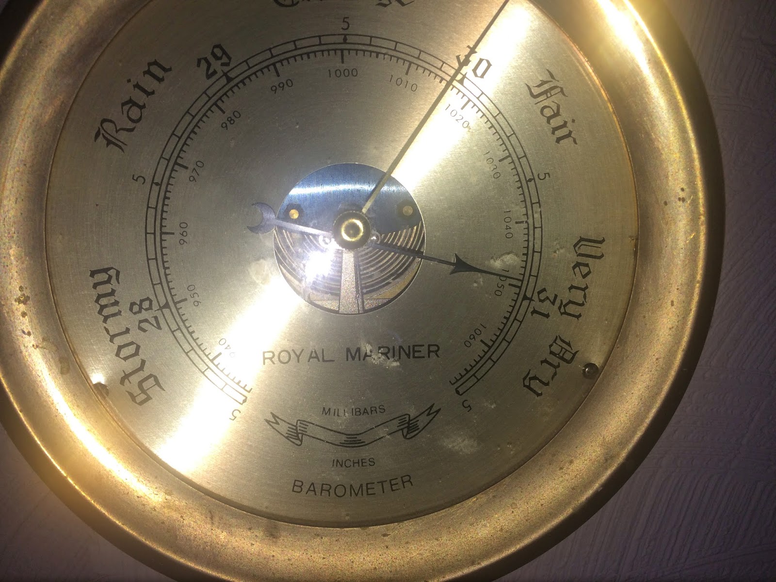
The highest sea level pressure ever recorded at some northwest stations. For others it is the highest December sea level pressure on record.
Some folks are complaining about strange sinus pain and headaches, among other maladies. I know I am feeling a strange tightness in my head.
And the pressure is still rising as I write this!
Picture courtesy of John Thoreson
So what kind of pressures are we talking about?
At Seattle-Tacoma Airport this morning at 11 AM the pressure reached 1045.5 hPa (hPa or hectopascals is a unit of pressure). Another unit of pressure is inches of mercury (often used on TV). In that unit, the pressure reached 30.87 inches. Wow.
At the same time, here are some other amazing sea level pressures:
Bellingham 1046.4 hPa
Whidbey Island NAS 1046.2
Portland 1043.9
Pasco and The Dalles 1048.9
Now let's talk about records, and keep in mind that average sea level pressure around here is approximately 1013 hPa.
Seattle's pressure this morning (1045.5 hPa) is THE ALL TIME RECORD FOR ANY DATE. The old record was 1043.1 hPa set on December 1, 2011.
(The period of record goes back to 1948)
Astoria breached its ALL TIME SEA LEVEL PRESSURE RECORD by climbing to 1042.9 hPa or 30.80 inches. The old record was 30.74 inches.
Many locations have reached their all-time December records (such as Portland, Yakima, and Walla Walla)
To get some perspective on the pressure distribution, here is the official National Weather Service analysis at 7 AM. Their analysis shows the highest pressure (1056 hPa) high in British Columbia. The highest pressure EVER observed ANYWHERE in the continental U.S. was 1064 hPa on December 24, 1983 at a location in Montana.
To give you an idea of how unusual this pressure is, take a look at the plot of sea level pressure at Seattle Tacoma Airport for the last 12 weeks. Nothing even close to what is happening now.
Why is the sea level pressure so high?
We start with a strong ridge along, as illustrated by the forecast upper level (500 hPa, about 18,000 ft) map at 10 AM (see below). The solid lines are heights (like pressure) and colors are temperature. You can see a high-amplitude upper-level ridge extending over the northwest.
This kind of pattern is conducive to the movement of cooler air over our region (northeasterly flow). Cool air is more dense, so that increases the pressure even more. To show this, here is the 850 hPa (about 5000 ft) heights and temperatures (color shaded). The purple and blues indicate cool air.
So this pattern got everything right: high pressure aloft and cool air near the surface...both leading to high sea level pressure.
For those who are suffering from the high pressure there is a cure....drive up into the Cascades or up one of our local hills. Pressure drops about 1 hPa every 8 meters. Even taking the elevator up the Columbia Center Tower or the Space Needle will help. But some warning. Some folks get headaches, sinus pain, and arthritis flair ups when pressure drops rapidly!


Inches of Mercury is still used in Aviation also. Yes, this whole year has been a year of the unusual and records.
ReplyDeleteStrange, super high pressures, but the high altitude winds create the appearance that the ridge is still off the coast aways. Windyty.com see altitudes (lower right corner) 30,000-45,000 ft
ReplyDeleteWhat's up?
So WHY are we having this record high pressure? Is it going to crash in some dramatic way, or will we just return to normal? And yes, my sinuses have been killing me for the past day or two and Bartell's was out of Sudafed.
ReplyDelete1038mb up here in Port Townsend. At least 10 mb higher than we've seen in the past two years. Wow.
ReplyDeleteWow. I noticed the temp was a chilly 24F on my home thermometer this AM, but didn't even look at the barometric pressure. Glad I have a 24h history to check. I don't recall ever seeing it above the mid 1030s since I've had this system (10 yrs), which is quite accurate compared to NWS readings. I usually marvel at the low readings... what was it? I recall 980something.
ReplyDeleteWe recorded here (at 160 ft) a corrected SLP of 1045.6 at just after 10am on Tuesday, Dec 30, 2014.
ReplyDeleteMy weather system's pressure-derived altitude was 90' above MSL, which is off by over 600 feet! It's relaxed a bit now, my site has "risen" to 144 feet.
ReplyDeleteIt rained in LA this afternoon and evening, And now the wind indicated by those tightly space isobars is slowing air traffic and postponing our arrival at SeaTac into the wee hrs of the morning. A little too much excitement landing for the plane change in Oakland--bravo for the Southwest pilots who brought us in a safely. I'm hoping for even more skill for the bumpy ride we are being promised on the second leg of our trip!
ReplyDeleteIs there any possible link between this high pressure and the unusually high water temperatures just offshore? For example, could warm air be rising there, drawing in cold, dense air from over Canada?
ReplyDeleteThe METAR archives I have has the previous record at 1043.4 at 753UTC on 2 Dec 2011.
ReplyDeleteKSEA 010753Z 05008KT 10SM FEW025 04
/03 A3079 RMK AO2 SLP434 T00440028 400720028
.. A fairly good example, apparently, of warmer and more moist air, being surrounded / boxed in—even to the south in this case—by colder air, also of higher pressure.
ReplyDelete