OUR clouds and precipitation are being sent down to those poor folks in drought-plagued California. They desperately need the precipitation. And we need the late fall sun.
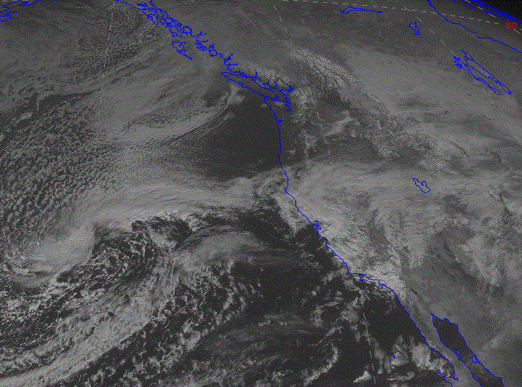
Let's take a look at this grand exchange, by starting with the visible satellite image this afternoon.
Pretty much clear in Oregon and Washington, but California is enshrouded. Good to see.
The 7 PM Sunday surface chart shows the situation. High pressure over us and a frontal band bisecting California.
The 24h rainfall totals ending Sunday at 9 PM show the respectable totals around much of the Golden State. Over 1.5 inches near the coastal mountain SW of San Francisco and .5 -1 inches over much of California's mid-section...the most extensive rain they have had since last year.
Here is the storm total (last two days) from the San Francisco radar--lots of areas got 1-2 inches!
Californian's are seeing something there are not used to: rainbows. Perhaps a sign from providence that their suffering is ending.
And yes, the weather gods seem to be taking a liking to CA folks. Let's take a look at some upper-level (500 hPa) maps, starting with Tuesday evening. A closed low off CA, with strong flow (lines close together) heading into central and southern CA.
4 AM Friday? A trough offshore and moist southwesterly flow heading into CA. You can bet on precipitaton.
They need a lot more than this, but a good start. This is an weak to moderate El Nino year, and El Nino years (particularly strong ones) bring enhanced rainfall to southern CA. The latest NWS Climate Prediction Center 3-month precipitation forecast is going with that idea.
This event is literally a drop in the proverbial bucket for California, but it is a welcome first step, considering the historic drought hitting that state.


.gif)
.gif)

.gif)


This is GREAT news, Cliff! I don't mind being dry when we're cold -- lowland snow does not thrill me at all beyond the first ten minutes of "kids' flakes" -- and California needs a great deal of precipitation to catch up. We've already had a wet fall, right? November was slightly below average for Bellevue (4.25" vs. 5.19") but I think October was well ahead of average, 6.75" instead of ~3.2". California can take it!
ReplyDeleteHey Cliff - I've had a question for you that I've been wondering for a while: how do you think climate change will affect the Pacific Northwest? I know there are a ton of unknown's at the moment regarding this area, but what do you think?
ReplyDeleteJGD,
ReplyDeleteCliff has covered this very well a couple of times in the past. Just look through his past postings to get an idea.
Here was a good one from a while ago.
http://cliffmass.blogspot.com/2014/07/will-pacific-northwest-be-climate.html
JGD http://cliffmass.blogspot.com/2014/07/will-pacific-northwest-be-climate.html?m=1
ReplyDelete