Looking over the past four weeks at Seattle and Yakima shows almost an identical story...except for the one cold-spell in late November/early December, the temperatures have been above normal, with low temperatures often falling to the average highs for the day (red lines are average highs, blue lines average lows)
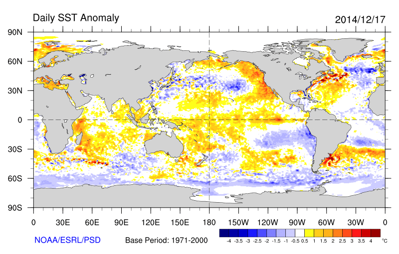
The main cause of the warmth has been the unusual persistence of warm southerly and southwesterly flow, but the unusually warm water off our coast has not hurt (see graphic, which shows the sea surface temperature anomaly yesterday. Red areas are considerable above normal).
A strong ridge will build over the region over the weekend (see upper level map for 10 AM on Monday).
And this kind of flow brings warmth and moisture into us. Take a look at the total precipitation for the next 72 days. 5-10 inches over some locations in the coastal mountain and Cascades. Northern CA will get a piece of this, which is very good. But not good for our snowpack.
But some good news...colder air make get here by the 24th, so that the mountains may get a bit of snow by Christmas.


Is this from El Nino?
ReplyDeleteIt's the winter version of the great "Blob".
ReplyDelete