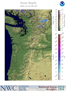
But the real fun is coming this week, as we temporally transition into cooler, northwesterly flow aloft.
Here is the forecast 7-day total snowfall from the vaunted European Center model for the entire Northwest and our local area. Lots of areas getting a foot, with some localized (higher) regions getting to two feet. Enough to make you want to wax your skis.
Going to a higher resolution view (4-km grid spacing) and the UW WRF model snow projection for the next 72h (see below) suggests up to roughly a foot in the north Cascades and few inches down the crest to California. Yellowstone gets hit pretty hard.
The next 72h looks favorable for southern BC (see below) and good for the higher runs at Whistler.
Why the snow? Because we are getting a break from the amazing persistent pattern of the last month... a strong trough offshore and ridging (high pressure) inland. Instead, as shown in the upper level (500 hPa) map below for 4 PM Wednesday, there will be offshore ridging, a trough over California, and cool northwesterly flow over our region.
Northern California can expect some significant (5-10 inch) precipitation over the next 10 days, as shown by the cumulative 10-day precipitation from the National Weather Service GFS model. Good for filling the N. CA reservoirs.
The models are now warming things up after a week...so enjoy the snow while it lasts.
_________________________
Announcement: Meeting of the Puget Sound Chapter of the American Meteorological Society at 10 AM Saturday Nov 19 at Seattle's Lake City Library.
As many of you know, a potentially historic wind storm was forecast to impact the Pacific Northwest on October 15th. Ultimately, the experienced winds were lower than predicted. Many wondered what went wrong--was it the forecasts, poor communication, or what? National Weather Service's Andy Haner, UW's Cliff Mass and KOMO's Scott Sistek will be presenting about the ides of October Storm windstorm. In addition, we will have discussions about future meetings, general elections and, of course, refreshments! Anyone interested in weather is invited.
Getting to the Library:
http://www.spl.org/locations/lake-city-branch/lcy-getting-to-the-branch


Dr. Mass, are you planning on discussing the National Weather Service's recent forecast calling for a greater than 50% chance of a La Nina event occurring this Winter?
ReplyDelete