The intense front has bogged down over central Puget Sound and very heavy rain is causing serious flooding.
The latest one-hour radar-based precipitation estimate (ending 3:11 PM) shows 3/4 inches in that period/

The National Weather Service has a flood warning out now for central Puget Sound. A number of roads are flooding, particularly at dips and valleys.


And here is an amazing video by Joe Zagrodnik of water jetting out of manhole covers:
And look what happened in Lynnwood:
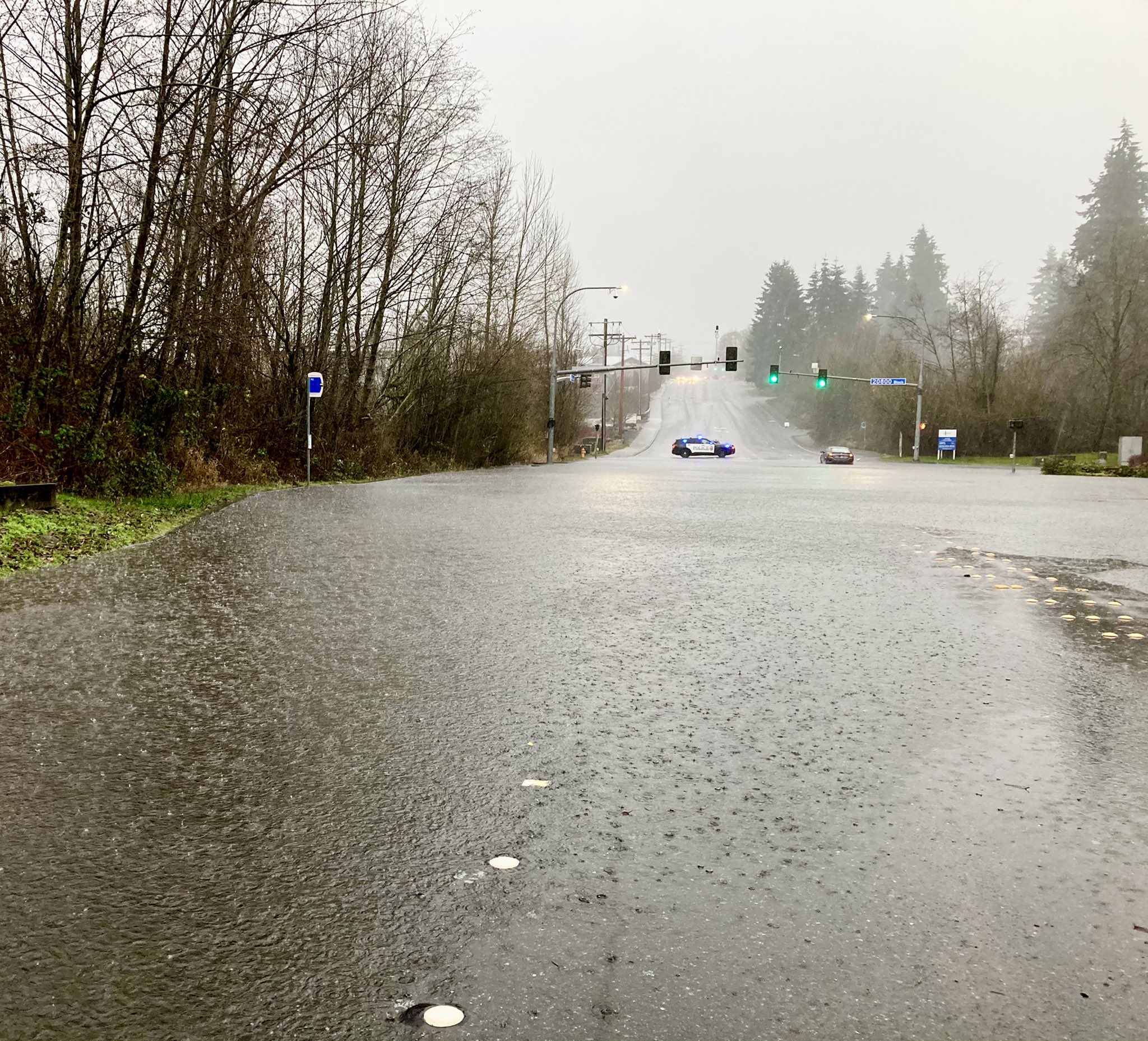
Be careful not to drive through deep water.
This reminds me a bit of the 2006 event that led to the tragic death of a woman in the Madison Valley in her basement. After that event, Seattle supported the development of a protective system: RainWatch--the brought together radar and rain gauge information, plus the best model forecasts. Unfortunately, the city decided to defund RainWatch, so the warnings it would have provided of this event are not available to city managers.


Have about 3/4 of inch of snow on our deck @ 4:30pm, 150' above sea level in B'ham. It's sticking to side roads too. Earlier, the rain ran down our fairly flat gravel driveway & flooded my tiny garage partway. Scooped about 80 gallons of water at the entrance.
ReplyDeletePretty astonishing front that went through. The temperature dropped close to fifteen degrees in a matter of minutes this afternoon!
ReplyDeleteMany storm drains are flooding and burbling water up in Seattle. It doesn't help that many, many people don't clear the street gutters and drains fronting their property. They also allow their lazy "landscape" goons to blow leaves and debris from their property into the street where it's magically supposed to disappear. Well, it does not disappear. It makes the streets filthy, clogs the storm drains and then the streets flood when we get rain like this.
ReplyDeletesnowing in bellevue now! not even slush, but it is wet
ReplyDeleteGood thing the city defunded RainWatch. How else are they going to pay for Kshama Sawant's legal defense?
ReplyDeletethick snowflakes in bellevue... its accumilating on road....
ReplyDeletestarted raining... :(
ReplyDeleteGot down to 38 here in Shelton...still some rain and wind up until about 5 PM or so. Too warm for snow. Looks to be creeping upward again.
ReplyDeleteLooks like measurable snow at Sea-Tac.If verified,this just may be the first time in Seattle weather history that measurable snow fell on a day that a record high temperature was set!Unprecedented!Also could be the warmest,or at least one if the warmest,days that snow( excluding ice pellets) has occurred in station history.
ReplyDeleteI'm in Lynnwood. Exciting weather day for sure. Went to pick up groceries at 11:00 AM. Dry. Realized I'd left my parking lights on at 3:00 PM - heavy rain. Looked out a bit later and 2-3 inches of snow everywhere, after torrential rain downpours. The street I live on is covered in snow. The temps went from 50 something to almost 30 in what seemed less than an hour. I think 33 was the lowest. It's back up to 36 now and I think the rain and snow stopped. Plus the planets are doing an amazing thing tonight as well. Definitely one for the record books. Wowzers!
ReplyDeleteThe east coast is laughing, but another 3/4 inch of snow fell before it warmed.
ReplyDeleteWeird how the apparent inversion affected the temperature. Baker showed 32 then 39 degrees or so while B'ham was @ 40 and dropping rapidly. When it's 47 degrees or colder in town, Baker usually gets dumped on. The amount of precip today would suggest at least 20 inches up there. Now it's 26 at Baker & 34 in town.
Amazing 12 hours of precip here in Glacier! In 12 hours, between the 7 am CoCoRaHS reading and 7 pm: 2.13" (1.67 of that was rain, the other .46 was SWE of 3.5" snow); but it kept on coming. I just finished digging-out, and the additional 2.5" snow was also very wet. Total as of midnight (17 hours): 1.67" rain + 6" snow (melted to .82) = 2.49" precipitation.
ReplyDeleteMt. Baker? I expect the ski area to report plenty 'new'. Love this time of the year!
Kitsap managed to stay at its usual boring default. 50 degrees and rain. Nothing interesting happened here since the Olympics are obviously the weather fun police.
ReplyDeleteOrcas Island Mount Constitution: 3.5 inches of total liquid precip since about 2am 12/21 including about 2-3 inches of snow. Dropped to 33 during the day, back up to 37 the last 12 hours and holding. The most I have measured in the 24 hour period in 20 years.
ReplyDeleteIt didn't really snow in Port Orchard, but we got 2.5 inches of rain from the whole system. It sleeted heavily for a while, and this morning there is a layer of ice over everything.
ReplyDeleteIn renton I measured 59 at noon and 34 with wet snow falling at 6pm. When cold front passed I measured .37" of precip in one hour which is alot for the Olympic rainshadow. Total precip was about 1.5" with a dusting of snow. I have never seen the temperature change so much in one day. There wasn't much cold air in Brittish Columbia so I was suprised that it got so cold. When I looked at statewide temperatures this morning I also noticed that the cold air did not make it over the cascade crest Winthrop was warmer than Renton this morning. Usually when it gets cold enough to snow the cold air overwhelms then entire state this is a very strange weather pattern.
ReplyDelete