Today was a very wet day over Washington State and southern British Columbia.
And you can blame a river...an atmospheric river of moisture streaming out of the subtropics for most of the wet action.
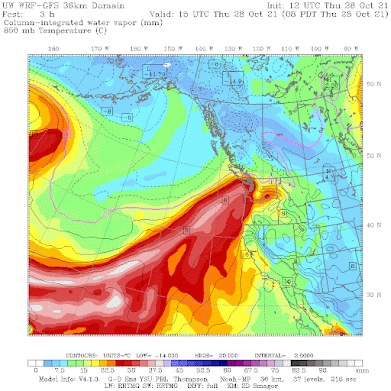
A model forecast of the amount of water vapor in a vertical column of air, valid at 8AM this morning, shows a "juicy" plume heading right into the Northwest.
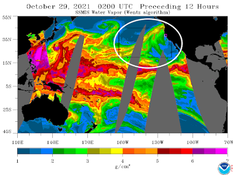
A satellite view shows the plume of moisture (highlighted by the white oval), as well as its origins in the tropical Pacific. The air of the very warm western tropical Pacific is particularly laden with water vapor.
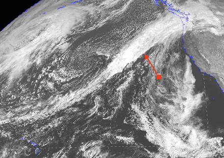
And the visible satellite image this afternoon shows a plume of clouds associated with the moisture river. A front is found at the southern edge of the cloud mass....the brighter white clouds indicated by the red arrow.
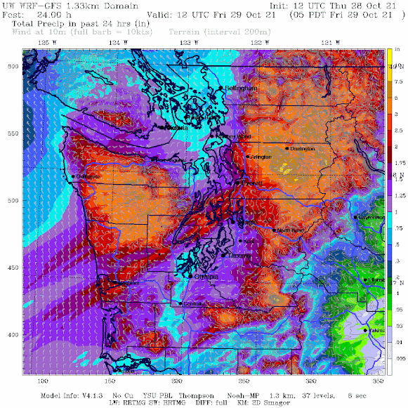
When the atmospheric river hits our mountains, it is forced to rise, releasing massive amounts of precipitation. The UW model total precipitation forecast for the 24h ending 5 AM tomorrow morning (below) is impressive, with as much as 5 inches at higher elevations and even a few inches at some lowland locations.
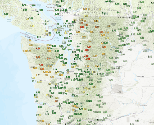
You are probably wondering, how much did we get today so far? Here are the numbers (for the 24 h ending at 7 PM).
We have already received 4-5 inches on the windward (southwest) side of the Olympics and the western slopes of the North Cascades.
With saturated soils from the previous rains, several of the rivers are surging with all this precipitation, particularly those draining the north Cascades.
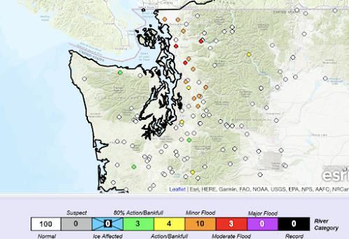
Take a look at the latest river stage information from the NOAA/NWS River Forecast Center in Portland (see below). Several rivers are at minor to major flood stage (orange and red colors). Several others are near bankfull.
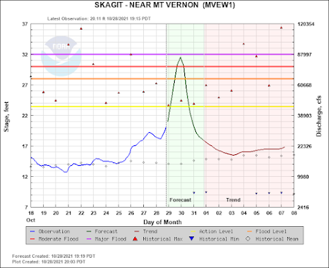
The Skagit River, for example, will approach major flood stage tomorrow....so be careful up there.
The good news is that a ridge of high pressure will build over the weekend, resulting in dry conditions, plenty of sun, and a wonderful opportunity to either rake leaves or view fall colors near their height.
________________________________
The Second Edition of My Northwest Weather Book is Now Available!
My new book is greatly improved and expanded over the first edition, with new chapters on the meteorology of Northwest wildfires and the weather of British Columbia. A completely revamped chapter on the effects of global warming on our region. And it has been brought up to date with recent weather events and the imagery is improved greatly.
Where can you get it?
Or secure a copy from the publisher:
UW Press.And yes, there are online sellers like
Amazon and Barnes and Noble.


That rain gauge map is cool! Can we access that publicly?
ReplyDelete