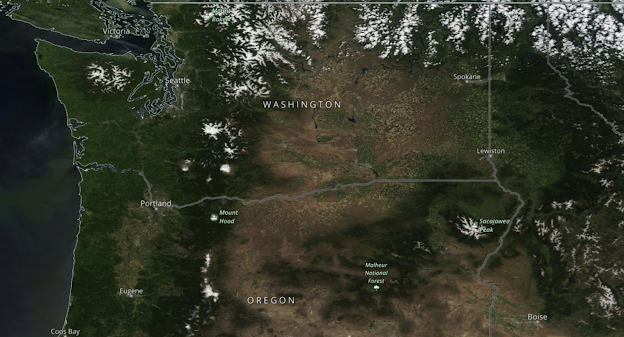
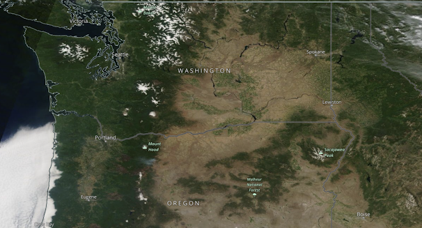
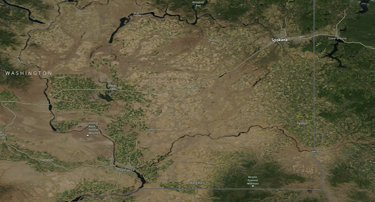
What a difference a year makes. The bountiful precipitation and cool temperatures have resulted in a far greener Washington and Oregon east of the Cascade crest.
Let me show you.
Consider the visible satellite picture yesterday (see below)
Although there has been a lot of talk of drought and problems for dryland farmers in eastern Washington, the truth is that things look good.
But don't take my word for it. Below are the statistics available from the Washington Association of Wheat Growers and taken by the Federal National Agricultural Statistics Service data collection as of June 19th. The condition of spring wheat is 89% good or excellent, for barley 86%, and peas 88%. Winter wheat that began during the dry winter is 71% good or excellent.
In short, dryland cops in eastern WA seem to be in good shape. There are some crops that have been damaged/slowed by the cool/wet conditions such as cherries.
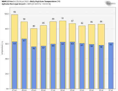
After we finish this mini heatwave tomorrow (Monday), expect normal conditions on both sides of the Cascades (see temperature forecasts for Seattle and Ephrata below). Low to mid 70s will dominate western Washington. Close to perfect. And I might note there are NO significant fires anywhere in the Northwest.


Much of the corporate media outlets in metro Seattle/Spokane have a narrative to sell: Global Warming. But facts are stubborn things.
ReplyDeleteWish all years were like this. It's also striking in Klickitat County and W of Vantage.
ReplyDeleteAny ideas on when the burn ban will be implemented east of the pass? Yes we had more than normal rainfall but it's dry enough to burn now
ReplyDeleteThanks for the dry-land crop info. Its a great indicator to follow. And important of course.
ReplyDeleteThank you for posting clear data and pictures to reinforce your points.I wish NOAA would do the same.
ReplyDeleteIt seems to me that official climate data and temperature histories are made almost impossible to see or interpret.
It has been said that NOAA is reporting as late as June 20,2022 that the North American average temperatures have been declining since 1997.
Has anyone found access to NOAA’s average North American temperature record back to 1990?
"It has been said that NOAA is reporting as late as June 20,2022 that the North American average temperatures have been declining since 1997."
DeleteWho specifically is saying this? Where did you find this information? What are the credentials of the person who said it? Where did they get their information from?
I'm genuinely curious because if this is true I'd like to learn more about it, but I can't find anything about it online.
The argument that climate change halted in the late 90s has been refuted since. You can find articles that effect (from 2018, so definitely not 2022) reviewing the data and with citations of the primary sources.
Deletehttps://www.climate.gov/news-features/climate-qa/why-did-earth%E2%80%99s-surface-temperature-stop-rising-past-decade
I also found this EPA page with downloadable temperature data dating to 1901. Not sure if this is what you're looking for, but it seemed relevant. Tracked this down with a superficial search so I'm sure you can dig up more with relevant data with a more careful search
https://www.epa.gov/climate-indicators/climate-change-indicators-us-and-global-temperature
Thanks- that is a fun comparison. The snow still in the Okanogan and northeast Washington is also impressive.
ReplyDeletere: "No significant..." why would you say that out loud? ;-)
ReplyDeleteI participated in the PNW DEWS drought webinar, and asked about mismatch of very wet with continued Drought status for Lincoln, Douglas, Grant counties. Part of their polite answer was its a deficit of Groundwater. Do you know public sources for me to confirm/challenge that? I can only find 1 site via USGS in all 3 of those counties (though yes, its low).
ReplyDelete