The number one question I have been asked the past few weeks is certainly this: when will the rain return?
And I can answer that now: the middle of this week.
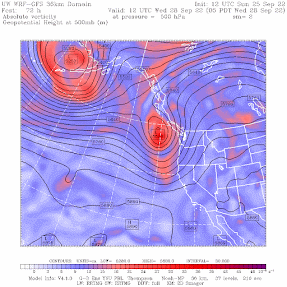
Today was another nice warm day, with the origin being a strong upper-level ridge over the West Coast (see upper level map at 5 AM this morning, below). Yes, another ridge.

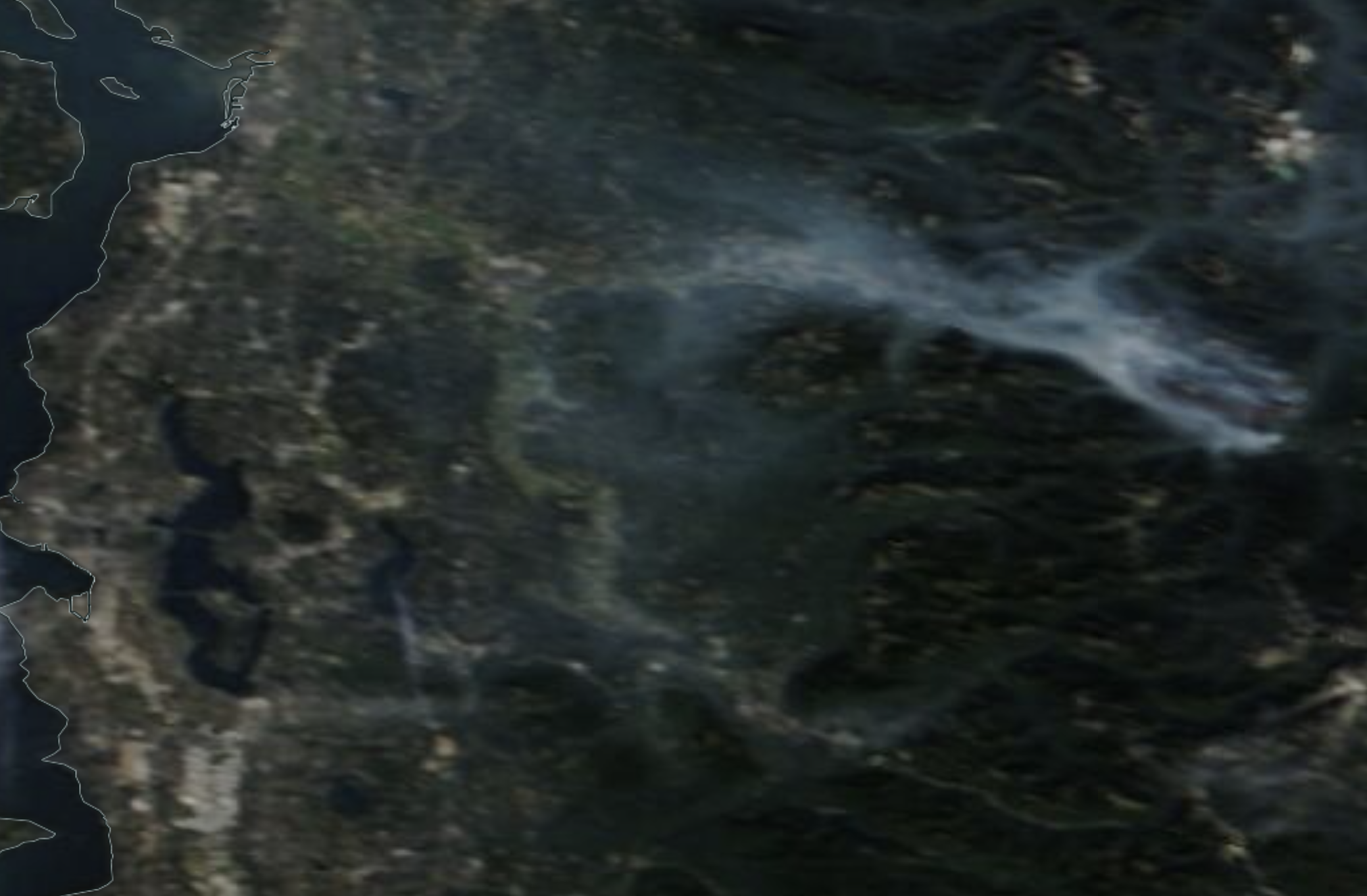
This ridge was associated with low level easterly flow that pushed more of the smoke from the smoldering Bolt Creek fire into some communities on the eastern side of Puget Sound country (see noon satellite image below)
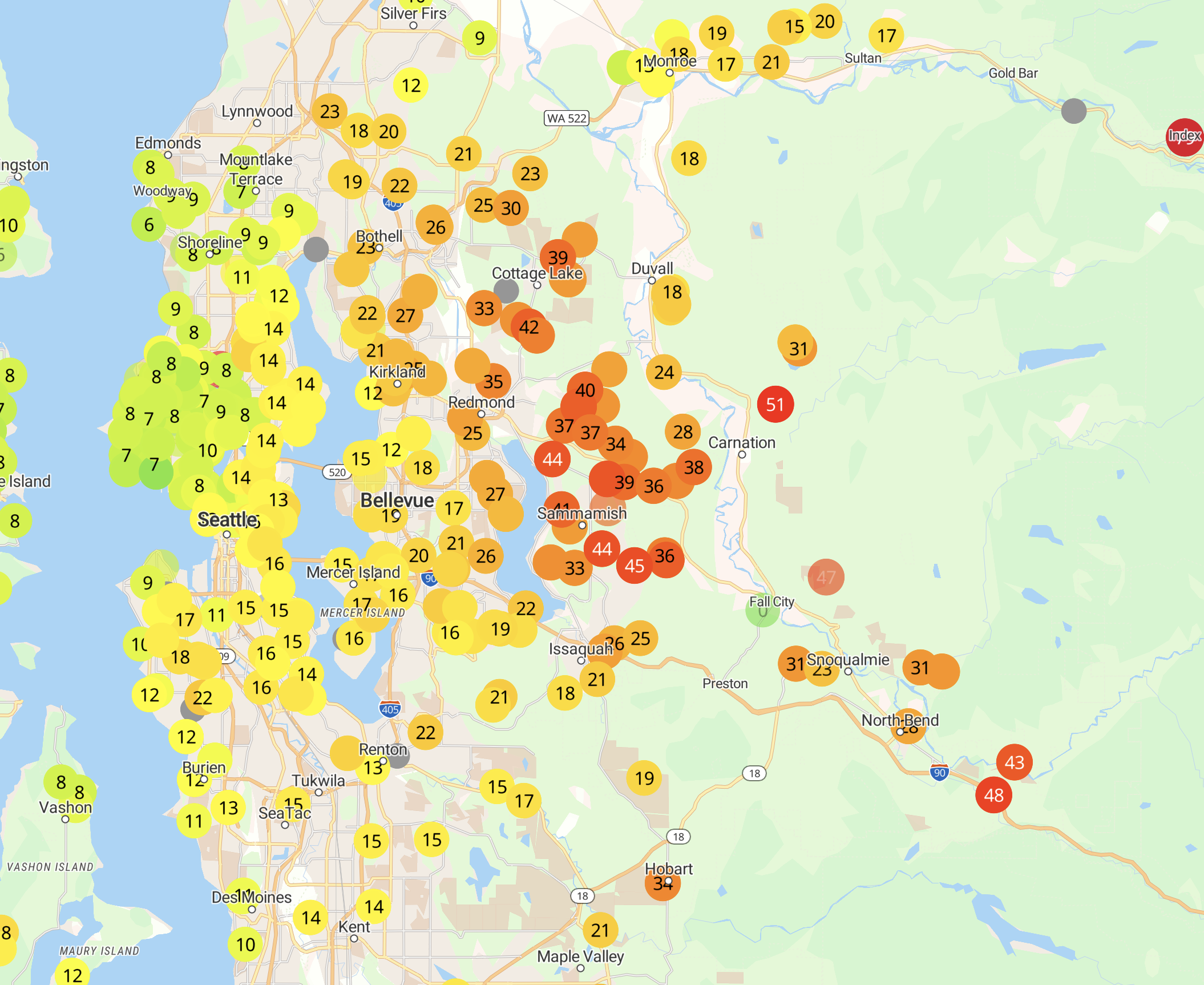
You can view the air quality implications wutg the Purple Air map around 3 PM (orange and red are worst). Not as bad as last week, but some haze is apparent on the east side. Some have smelt smoke.
Tomorrow will be the last warm day in the sequence. Everything changes on Wednesday, as a moderate upper-level trough moves in (see upper-level map at 5 AM Wednesday). And it won't be the last.
Light rain is forecast for Wednesday into early Thursday, with much cooler temperatures. The map below whows the 24-h totalys ending 11 AM Thursday. Typical early fall precipitation event.


The summer has been drier and warmer than normal, something I will discuss in a subsequent blog. Enjoy the warmth while you can....


This was definitely not a cool/wet La Nina summer like we had in past years, oh well.
ReplyDeleteSo the 8 or 9 months of cool/wet weather we already get isn't enough for you huh?
DeleteNot enough for me.
DeleteNor me. I'm thoroughly disappointed that the chance of rain on Weds went away. I watered my yard AND got my car washed, hoping for rain. Sigh ...
DeleteFor those who have been clammering for rains to return and wonder when, this event we've been experiencing is not unprecedented. When it's been cool, and wet in the spring, and does not dry out much until mid July, then our summers will run through all of Sept, if not the first week of October before the fall rain pattern gets established.
ReplyDeleteGrowing up here in the 70's/80's and 90's it's often like this, if summer starts late, it ends late, if spring is dry and summer is as well, like in recent years when by the end of May (memorial day weekend) we begin to dry out, and by the 4th of July, it's all brown already, we will likely have an early fall season. Summers typically ARE cooler/wetter through the 4th of July, then it becomes hot and dry (relatively on the temps as our hot average is 77F or so during July/August).
This year was La Nina, which ran through July, and while the 4th of July was nice, we still had to get through last vestige of the cooler/wetter conditions before drying out, which is normal as Cliff keeps saying, we are normally very dry through at least the first half of Sept, but often does not start until the day after the 4th. As said up this comment, it can run early, or it can run later, thus the ending of the hot season will vary accordingly.
Yes, I agree: the two worst summers I can remember, 1993 and 1999, both started late (although '93 had an OK spring) but had a late sunny streak .
DeleteI totally agree! I grew up in the 50s and 60s and can verify your general commentary...some years, I would show up at West Green Lake beach in mid-late June, and would shiver in the low-60s temperatures...after 4 July, temps would change...As a kid, I just did not care about the weather much, being very happy for summer vacation!
DeleteThe thing I find most hilarious is when the local forecasters here scream about how low this year's summer's rain totals have been, despite the reality that we're only comparing about one inch of rain for the summer versus 1/10 of an inch. Ridiculous.
ReplyDeleteYes- but a well-distributed 1 inch of rain during mid to late August would have gone far to mitigate fire risk. And in the mountains, there is usually considerably more than here in the lowland. I can remember summers hiking in August with several days of rain.
DeleteProfessor Mass, I watch tropical systems all through the hurricane/typhoon season, but especially in the Autumn. My inclination to watch them in the Autumn emits from my youth when the Columbus Day storm struck the NW. My knowledge of it has always been that while it wasn't a tropical storm it was a mid-latitude cyclone that was born from the remnants of an old typhoon. Is it historically the case that in the Autumn our return to a rainy season is fueled generally in part by tropical storm activity in the Western Pacific that feeds moisture into the jet stream which transports it into Alaska, BC, WA, and OR?
ReplyDelete~50 raindrops last Wed, nothing more in sight for next 10 days. Fog and clouds arent rain. Lets hope rains start soon and gently enough to start moistioning the soil, rather than just running off. Hope some of the clearly drought stricken trees - even ones with deep roots i ses in whatcom county, survive.
ReplyDelete