The models were scary good tonight.
As predicted, a double convergence zone formed this evening, producing heavy rain, thunder, small hail, and yes....snow.

Snow has been reported around Everett (Paine Field), Marysville, and at SeaTac Airport.
And snow was reported earlier on the higher hills around Bellevue (see below)
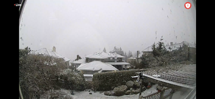
Snow at 1170 ft in Bellevue. Picture courtesy of Dr. Peter Benda
In the radar image above, the orange and red areas indicate heavy precipitation and small hail associated with strong convection, including embedded thunderstorms. Several have reported thunder. And there are major power outages in south Seattle that I suspect are due to the thunderstorm activity (see below)

Expect the precipitation to fade out overnight, making way for a chilly Tuesday morning.


Hi Cliff. Great job on the forecast! Its been a weird day in Easton as the weather has been hung up on the pass all day and then around 4pm it seemed to strengthen and push east and by 6pm heavy snow. Can you explain why sometimes the storms stay at the pass and others they move across?
ReplyDeleteAt this time in S. Everett...strong snow flurry just re-coated the neighborhood with half-inch of snow..very localized...maybe just a parting gift from the Snow Gods!
ReplyDeleteCan't wait for your future post about next week's cold/snow potential!
ReplyDeleteChris... I have been watching it. I have made it a principle never to blog about snow more than 180hr out....cliff
DeleteEven Tacoma got a dusting, maybe a half inch, at best on cars and the like, a dusting elsewhere. It all began I think 8 or so when I was taking care of food scraps to the food waste bin out on my deck, noted what may have been hail on the uncovered part of the deck. But between 8 and 9pm, it was snowing lightly. Stopped sometime overnight and it's clear and the sun out, but cold still as rooftops are still covered for the most part, though streets and sidewalks are mostly all clear, but wet or slushy at around 9:37AM.
ReplyDeleteHi Cliff. Long time reader, love your blog and podcast.
ReplyDeleteThere is an event developing in Ohio completely ignored by the mainstream media - can you help estimate the path of the smoke from the accident?
Also, do you think there is any truth to this:
https://open.substack.com/pub/2ndsmartestguyintheworld/p/palestine-ohio-train-wreck-its-the?
Thank you,
Robert
Today was the sunniest day of the year-to-date in Bellingham. I measured 8.22MJ/m^2 at my location; ~1/3 of a clear day in late June.
ReplyDelete