January 30, 2025

The Cold/Snowy Period Reveals Itself

As we get closer to the big transition, more powerful and higher-resolution modeling tools become available.

So what do they say?  

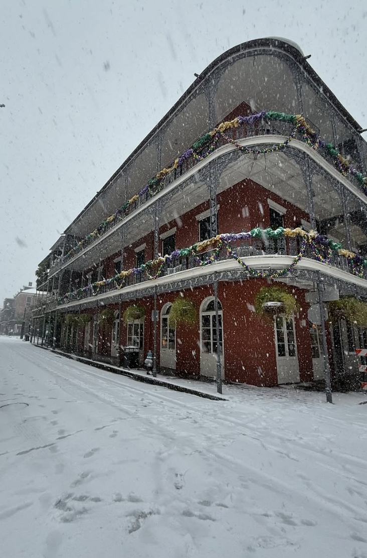
Almost everyone will see some snowflakes, but for many in the lowlands, it will not add to much.


For the 36-h through 4 AM Saturday, the mountains will be hit hard by snow and NE Washington will get several inches as well.  Nearly no snow near sea level.


In contrast, the snowfall during the next 24-h (through Sunday at 4 AM) starts to spread into the lowlands, with three main foci (below).  One snow band extends westward across Bellingham and the San Juans.  A weaker band is found just north of Everett and some snow is found over the higher elevations between Olympic and Portland.

Not much over eastern Washington for that period.  Almost everyone in western Washington will see a few flakes in the air by this time.


The snow is not over yet.  During the next 24 hours (ending 4 AM Monday), the entire region will experience some snow showers, with heavier amounts near sea level over northwest Washington and over the mountains.


Not satisfied?   The subsequent 24 hours bring light snow over much of the region, particularly over the northern Washington coast.


Add it all up, and the total snowfall through Tuesday morning is impressive-looking (below)

 But never forget that total snowfall, is NOT snow depth on the ground...which is generally much less for many reasons.

Below is the predicted snow depth over the region on Tuesday morning.  Not much over the Puget Sound lowlands.  Sorry kids....no snow days this time for most of you.  But skiers should be very happy.


Finally, let's not forget the cold.  

This is going to be the coldest period of the year so far.

 Here in Seattle, highs will only reach the mid-30s, and lows well down in the 20s.   Cold enough to kill unprotected folks living outside.


January 29, 2025

The Upcoming Period of Cold and Snow

 We are going into a very complex, difficult weather situation, with substantial uncertainty.


But some things are clear:

  • There will be heavy snow in the mountains.
  • There will be a return of serious precipitation on Friday, starting as rain
  • Some areas near sea level will have snow starting on Saturday.
  • Very much colder air.....cold enough to snow at low levels...will move in on Saturday and stick around for days.
  • The surface and road surfaces have cooled to freezing and will not be warm enough to melt incoming snow.

Step 1:   Friday "Warm" Storm

On Friday, a moderate low-pressure center will sweep off the Pacific and move into British Columbia.  As shown by the sea level pressure forecast for 1 PM Friday, warmer southwesterly winds will move into the Northwest.  Yellows and light green colors (at around 800 meters ASL) are relatively toasty.


But over the Pacific, a STRONG cold front is moving in from the west (blue colors are cold).

The precipitation totals from this system through Saturday at 4 AM will be very significant, with the mountains getting 2-4 inches of precipitation (water equivalent of snow).  About a half inch in the lowlands except northeast of the Oympics in the rainshadow.


Mountain snowfall will be substantial, reaching  20-30 inches at higher elevations.


Stage 2:  The Cold Air Moves in

Behind the cold front, very cold air will move in.....cold enough to snow at relatively low elevations.  Near sea level, the warming by the Pacific will create a shallow layer above freezing.

Consider the temperatures above the surface...in this case about 5000 ft above sea level (850 hPa pressure).   When such temperatures drop below approximately -6°C (21 F) meteorologists worry about snow reaching sea level.   

Here is the temperature forecast above Seattle at this level from an ensemble of many forecasts.   Wow.  Cold enough to snow on Saturday! 


The European Center forecasts for surface air temperatures at Seattle for the next week show highs only in the mid-30s from Monday onward.


Stage 3:  Lowland Snow

   The problem for lowland snow lovers will be a lack of precipitation after the low and front move through.   Yes, there will be a few rain/snow showers moving through.....so many folks will see a few flakes.

Two local features may produce more localized snow near sea level over the weekend.  Below is the accumulated snowfall (NOT SNOW DEPTH WHICH IS MUCH LESS) through Monday morning at  4 AM.   

One snow "hot spot" is in a Puget Sound Convergence Zone near Seattle and the other is related to the outflow of cold air from the Fraser River Valley (near Bellingham to Vancouver BC). I have put arrows indicating these regions.  

Northeast Washington also gets some snow.  Not much around Portland.


As I noted above, we don't have the protection of warm ground, as in November and December.

The snow risk is not over on Monday....but that threat will await another blow.....I have to teach a class now!


Freezing Fog this Morning

 Just a quick note that there is substantial danger of icy roads and sidewalks this morning, not only from frost, but freezing fog.   Some of the fog is freezing on contact with the cold surface, leading to substantial deposition of ice.


 The surface air temperatures, taken at around 6 ft above the surface, at 7 AM we nearly all below freezing.   Except for higher hills above the inversion.


The cold has been conducted into the earth, with the soil temperatures 2 inches down way below freezing in eastern Washington.  Temperatures are just above freezing at that depth in Washington State.

Finally, the latest visible satellite image shows the low clouds/fog over the Puget Sound basin and NW Washington.  Not much in eastern WA and over higher terrain.


Be careful out there is morning.   And the cold ground will have major implications for what could happen this weekend....more on this later.

January 27, 2025

Why has air quality declined recently?

Air quality has been moderately degraded during the past few days.

This morning, you could see hints of haze in an image from the Seattle PanoCam.


Tonight, the PurpleAir air quality network shows marginal air quality (orange and red colors) over Puget Sound.


Why the poor quality?   Because of high-pressure overhead that produces a strong inversion in the lower atmosphere.

An inversion is a situation in which temperature warms with height, the opposite (inversion) of the normal cooling with elevation.

Inversions suppress mixing in the vertical, thus allowing pollutant concentrations to increase over time.

The temperature sounding this morning at Forks, on the northern WA coast, shows a profound inversion with temperature (red line) increasing by roughly 10°C (about 18F) over the lowest few thousand feet.


A similar inversion was noted at SeaTac Airport.

The inversion is the result of a strong high-pressure area (or ridge) aloft just to our northwest (see upper-level map this morning).


Such high pressure produces sinking air aloft, sinking that weakens towards the surface (see schematic below).  Sinking air warms by compression (like in your bike pump) and greater sinking aloft produces strong warming aloft.

This contributes to producing an inversion.


Yes, there is a HEAT DOME overhead (but don't tell the media about it).

 In addition to warming aloft, the sinking air suppresses clouds, allowing the surface to radiate heat to space, thus cooling the surface more than the air above.  This also produces an inversion.

Don't worry......we have only a few more days of this situation and then the meteorological configuration will change radically.  

And yes, there is a threat of lowland snow. A lot of uncertainty at this point.  Will blog about it on Wednesday.


January 25, 2025

The Direct Connection Between Northwest Weather and Los Angeles Santa Ana Winds (and Wildfires)

 It is not an accident that while Los Angeles experiences sustained Santa Ana winds, the Northwest enjoys sunny, dry weather.

As I will show, there is an intimate connection.

Considering the dates on which Burbank Airport (see map) had wind gusts greater than 50 mph and a relative humidity less than 30%, a strong indicator of a strong Santa Ana wind event.

Burbank was surrounded by the fires and is a good location to determine if strong winds getting to near sea level--a hallmark of the recent event.


This wind and humidity criterion found the following dates:


Then I found the the average sea-level pressure distribution on these Santa Ana dates (see below).  

Wow.  A very well-defined (and highly statistically significant) pattern.  Huge/strong high pressure over the Great Basin that extends into the Northwest.  Low pressure over northwest Mexico.     Big pressure change (gradient) over the Sierras.    This pressure pattern is associated with strong easterly flow over southern CA.


But let's not stop there.  Let's also calculate the difference in pressure from normal.  Something called the anomaly of pressure from climatology in the weather biz (see below).  

Double wow.   The biggest pressure anomaly from normal is over Washington State.


So there is an LA/Washington connection!

An interesting question is whether high-pressure periods are increasing over our region...something several of you have asked about.

To check this out, I have plotted the frequency of sea level pressure getting above 1035 hPa (a relatively high pressure) at Seattle-Tacoma Airport from 1948 to now (see below).   

Lots of cases in the 50s, fewer in the 60s and 70s, and higher numbers during the past two decades.   As noted by the thin dotted line, a small upward trend over the entire periods.  But not much trend if one considers the past two decades alone.   

An issue I will be doing more research on.


The latest forecasts suggest major...and I mean major...changes in store for the West Coast for the next two weeks, with substantial rain for southern CA and a potential for some flurries over the western lowlands.

More in a future blog.


January 23, 2025

The Highest Pressure in Ten Years

 Did you feel the pressure yesterday?   

Feel a bit weighted down?    If so, it may not be due to the political energy in the air.

Yesterday morning, sea level pressure around the Northwest was the greatest in ten years.


The average sea level pressure is approximately 1013 hPa (hPa is a unit of pressure).

Yesterday morning, several northwest locations experienced 1041-1045 hPa.   This is high...very high.

Higher than any other time since 2015 in our area.  To illustrate, here are the pressures observed at 10 AM yesterday (see below).  Around 1042 hPa near Seattle and higher to the north and east.


To see how unusual such pressures are, check out the sea level pressures at Boeing Field.  Yesterday barely beat out the highest pressure in 2023 and was slightly behind late 2024.  1045 hPa is about as high as it gets around here.  On the low side, some low centers have driven the pressure down to about 980 hPa. 


At the University of Washington, a similar story.


The pressure was above normal over a vast swatch of the west, as shown by the pressure map at 10 AM Wednesday. The shading shows the difference from normal.. with red being much above normal.


This high-pressure interlude is associated with a high amplitude upper-level wave pattern, with a ridge off the West Coast and a trough over the eastern U.S. (see upper level (500 hPa level) map at the same time).


The origin of this unusual situation is most probably the result of natural variability.   My group has done regional climate simulations assuming aggressive increases in CO2.  As shown below, global warming generally leads to lower pressures.  This makes sense:  warmer air is less dense, which leads to lower pressure below.  Global warming also does not lead to transient ridges over the West Coast, something I have researched and published on.

Announcement

I will hold a special online Zoom session at 10 AM on Saturday for Patreon supporters. I will talk about our dry weather and when it will end.


January 21, 2025

Blocking Ridge, Dry Pacific Northwest, and Southern California Rain

 Not a boring time for meteorologists.  New Orleans Airport is closed with record-breaking snow and cold, while the Pacific Northwest is strangely dry and southern California will get its first decent rain of the season.

The Big Easy

All because of a highly amplified upper-level wave pattern.

The upper level (500-hPa) height map (think of this as pressure around 18,000 ft) today shows a ridge of high pressure aloft over the eastern Pacific while a trough of low pressure is found over the eastern U.S. (red indicates high pressure and blue indicates low pressure).  

Ridges/high pressure are associated with sinking air and dry conditions on their eastern sides.  Like over us.   Troughs are associated with rising air and precipitation.  Between them, cold air moves southward.


By Thursday the eastern Pacific ridge becomes crazy strong.  

Keep your sunglasses handy, as it will be sunny and dry.   What a nice break in the middle of winter for us.   But cold and wet over the eastern US.


By Saturday, something interesting...and important... will occur.   A trough will develop south of the West Coast ridge, resulting in a pattern called a Rex Block.  Very stable pattern.


Such a southern California trough will produce upward motion and precipitation.   Southern California will get wet.  Significantly wet.    

Below are the forecast precipitation totals through next Monday evening.  As much as 1.5 inches in the mountains near LA.  Significant rain over the entire coastal zone.

Such rain will moisten the light fuels and greatly reduce the fire threat until the next Santa Ana.  Very good news.


Finally, something else occurred today that I thought was interesting.....a very energetic Chinook wind on the western side of the Rockies around Great Falls, Montana.

Two days ago,  shallow cold air was entrenched over the lower elevations of Montana, with lows of -5 to -20F. (see below)


But with high-pressure building over the east Pacific and lower pressure inland, strong winds from the west descended into eastern Montana.  As the air descended the eastern slopes of the Rockies, warming by compression occurred.   This descending air also displaced the frigid dense air that was in place.

Today's low temperatures were MUCH warmer around Great Falls and neighboring locations near the eastern slopes of the Rockies, with highs getting into the 20s!


Check out the temperature and relative humidity observations at Great Falls during the past day (below).

Yesterday morning at 7 AM, the temperature dropped to around -9F.  By noon it was 12F and by noon today is was around 36F.   All associated with air sinking on the eastern slopes of the Rockies.  

   
The UW WRF model simulated this transition well. The forecast surface temperatures for 4 AM Monday were very cold over most of Montana on Monday (white is very, very cold air).  The winds are shown by the wind arrows.  Weak at low levels.


But by 10 PM PST Monday, the white was gone as westerly winds descended the Rockies.  Blue colors are relatively warm.


Chinook winds are also Foehn winds and are sometimes referred to as "snow eaters."


January 19, 2025

The Origin of The Los Angeles Wildfires

My group and scientists from the University of Albany are now studying the meteorology of the LA wildfires earlier this month and have significant early results.  At the American Meteorological Society meeting last week, I attended many wildfire meteorology sessions and talked to several colleagues who have actively studied such events. The LA fires were a topic of considerable discussion.

We have a good idea of what happened:  an extreme/unusual Santa Ana event associated with severe downslope winds.   In this blog, I will show you some early simulations and explain why this event occurred.  

I will also describe why climate change did not play a significant role.


As I will explain below, this is not only a Santa Ana event, but an unusual one, with extreme winds descending to lower elevations.  Some lower-elevation stations, such as Burbank, experienced their strongest wind gusts on record.  Model simulations suggest the development of what is known as a high-amplitude mountain wave leading to a downslope windstorm event.

Santa Ana 101

Santa Ana's are associated with strong northeasterly (from the north to east) winds over southern California.  These strong winds are accompanied by very low relative humidity and are very favorable for southern CA wildfires.   

The typical large-scale weather pattern associated with Santa Anas includes a large high-pressure area over the Great Basin, with the strongest events also having a low center to the southwest (see below). Such a pattern results in strong northeasterly winds approaching the mountains of southern CA.


The observed sea level pressure pattern at 4 PM January 7 (below) showed many of these elements, with the low to the south being particularly strong (warm colors indicate above-normal pressure, cool colors show below-normal pressures).


This pattern produced extreme, perhaps unprecedented, northeasterly winds approaching the region in the lower atmosphere.  To illustrate,  the color shading in the map below shows wind differences from normal at 925 hPa (about 2500 ft above sea level) at 10 PM Tuesday (January 7) evening.  The light gray indicates very unusual winds (more than six standard deviations from normal).  The wind direction and speed at some points are also shown.

This was not your normal Santa Ana.


High-Resolution Simulations

To understand what happened,  UW Research Scientist David Ovens, a member of my research group, ran a very high-resolution forecast/simulation of the event using the WRF model, with a grid spacing of 1.3 km (this is very high resolution).

Let me show you a surface wind gust forecast (32 hours into the prediction) for 12 AM on Wednesday, January 8.   The areas of the Palisade and Eaton fires (the two biggest ones) are shown by red outlines.   

Extreme winds (with gusts exceeding 70 knots, 81 mph) were forecast over and downwind of the San Gabriel Mountains.  HUGE threat.    Lesser, but still strong winds (50-60 mph gusts) are noted in the Palisades area extending to the west and south.   


To understand what is going on, it is useful to plot vertical cross-sections through the fire areas to show the 3-D atmospheric structure.   Below is a cross-section (at 8 PM Tuesday) through the Eaton fire; a section that crosses the San Gabriel Mountains.  The shading shows sustained winds in knots, the x-axis is the horizontal distance and the y-axis is height in pressure (700 is about 10,000 ft)

Wow.    Very strong acceleration of the air as it descends the southern slopes of the San Gabriels, with the strongest winds near Altadena, where the fire went crazy.  This was a very powerful downslope windstorm with a highly amplified mountain wave pattern.


Another cross section, this time going through the Palisades fire at 10 AM on Wed. January 8, is shown below.   Very strong winds to the lee (south) of both the interior mountains and Santa Monica mountains to the south (left side of the figure).


These and earlier simulations by the UW WRF model and NOAA/NWS models (such as the HRRR, High Resolution Rapid Refresh) consistently forecast the extreme downslope winds DAYS in advance.

It was also clear that there were unusually large amounts of dried "fuels" ready to burn.  The fuel load was particularly high after TWO unusually wet winters (2022-2023, 2023-2024).  A dry start of winter ensured massive amounts of fuels were ready to burn. 

This was clearly a situation of extraordinary extreme wildfire danger.  That is why I blogged a strong warning the day before.  Why the National Weather Service did the same.  LA officials should have know a severe threat was in place.

All that was needed was an ignition source.  For the deadly and large Eaton Fire near Pasadena, it appears that a problematic electrical transmission tower was the origin of the fire.


For the Palisades inferno, it is either some smoldering embers from a New Year's Eve fireworks blaze or the failure of some aged powerlines found north of Skull Rock.   Perhaps, arson is another possibility.  Several fire experts I talked to at the AMS wildfire meeting thought the powerlines were the most probable cause, but a definitive evaluation is not yet available.

What is clear is that LA did not shut off the power to the region even AFTER the fire was initiated and that only limited fire-fighting resources were in place before the fires began.  Not good.

Bottom Line:   A very skillfully predicted Santa Ana event with record-breaking winds hit LA earlier this month. Two wet winters resulted in unusually high levels of dried fuels. Human ignitions initiated the fires.

Influence of Global Warming

There are several media outlets and climate activists that are suggesting that LA fires were the result of global warming or significantly enhanced by human-caused warming.  


These claims are contrary to the best science, which indicates minimal impacts of human-caused warming.  

Such claims undermine the importance of key societal failures, from not shutting off power and fire-hardening homes to not having sufficient fire-fighting capabilities or adequate warnings and evacuation protocols.

Key reasons why global warming is not an important factor include:

1.  There is no evidence that global warming increases Santa Ana winds.  In fact, there are strong physical reasons (with supporting scientific literature) that global warming WEAKENS Santa Ana winds.

2.  The available fuels were unusually abundant because the two previous years have been much wetter than normal.  There is no evidence this is caused by global warming.  And there is no long-term trend for wetter winters, which would be evident if this was a climate issue.

3.  The immediately prior months were drier than normal.  This is not predicted by global warming projections and there is no historical trend to drier early winters which would occur if climate was a cause (see plot below of Los Angeles precipitation for Oct. 1-January 6 ).

3.  There are some outrageous claims that the LA fires are the result of increasing "weather whiplash" due to climate change.  This "whiplash" theory is unsupported by observations, such as the plot shown above.

I am particularly troubled by the media pushing weather/climate theories that are untrue.  A prime example is the unsupported claim that the Lahaina fire was associated with the passage of a hurricane to the south.   This was proven to be false.


There will be some lowland snow in Western Washington

The model forecasts provided excellent over the past 24 hours, predicting the cooling and the localized snow in a Puget Sound convergence zo...