Although there are very few wildfires in Washington, Oregon, California, and southern British Columbia, there are significant fires in the Canadian boreal forests of northern British Columbia and Alberta.
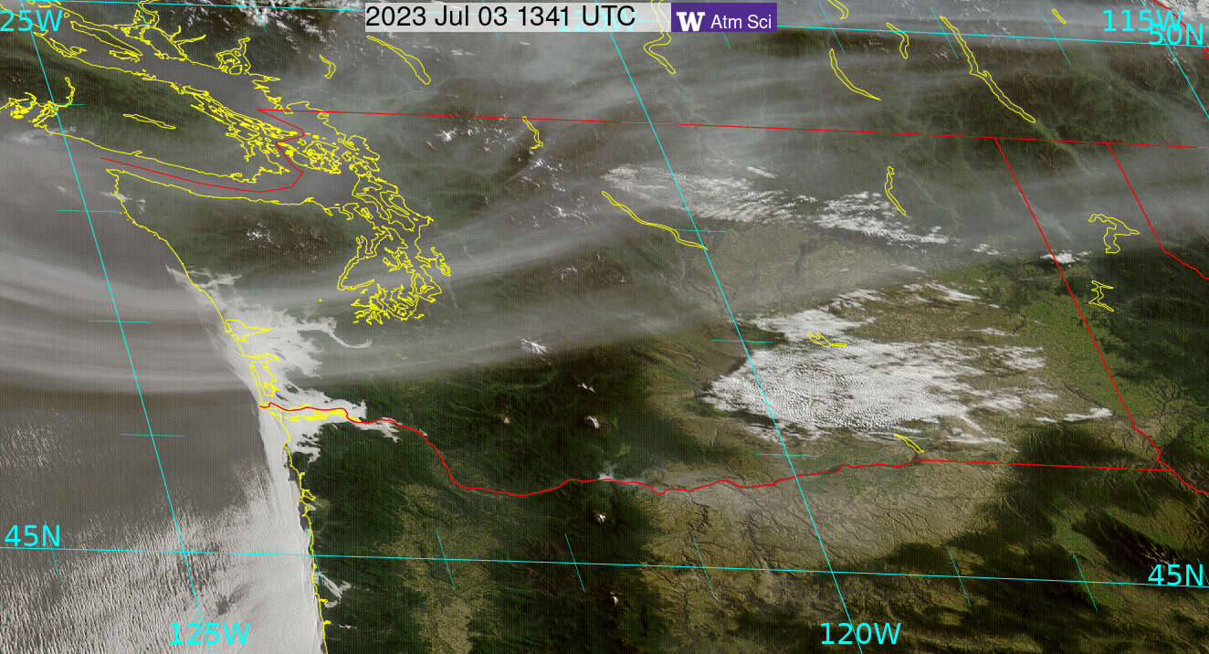
And that smoke will push in aloft over Washington State tomorrow and Tuesday.
Below is a map of current Canadian wildfires. The big red dots show current, large active fires.

The problem for the Pacific Northwest is that an upper-level ridge of high pressure will develop offshore, with a trough inland, resulting in strong northern winds providing a fast conduit for smoke from the Canadian northern forest.

The NOAA HRRR-Smoke model provides skillful forecasts of wildfire smoke. Let me show you what it predicts.
Monday morning at 9 AM moderate smoke has entered Washington State aloft


Most smoke from distant sources generally stays aloft, but if the plume is low enough, some smoke can be mixed to the surface during warm days.
Here is a vertical cross-section of smoke for 11 PM Monday. Most remain aloft at that time.

But the strong heating on Tuesday (where temperatures will rise into the mid-80s) will mix some of it down to the surface (see a cross-section at 5 PM Tuesday).

Surface air quality ALWAYS declines on July 4th from all the fireworks. This year the miasma will be "enhanced" by smoke from British Columbia.
The good news is that the upper-level flow will change (more westerly) by Thursday and will sweep the smoke away from our region.
As will discuss in a future blog, the latest forecasts keep our temperatures moderate, winds low, and the potential for wildfires modest.
Addition: Here is the visible satellite image at 6:41 AM Monday, clearly showing the Canadian smoke moving southward into Washington State: