June 13, 2023

New Podcast: The Origin of the New York Smoke and a Wet Period Ahead

After a below-average wildfire season, the region is going to get wet, particularly BC, Alberta, and northern Washington (see forecast precipitation below through Wednesday). 

 Temperatures won't get out of the 50s on Saturday and Sunday.
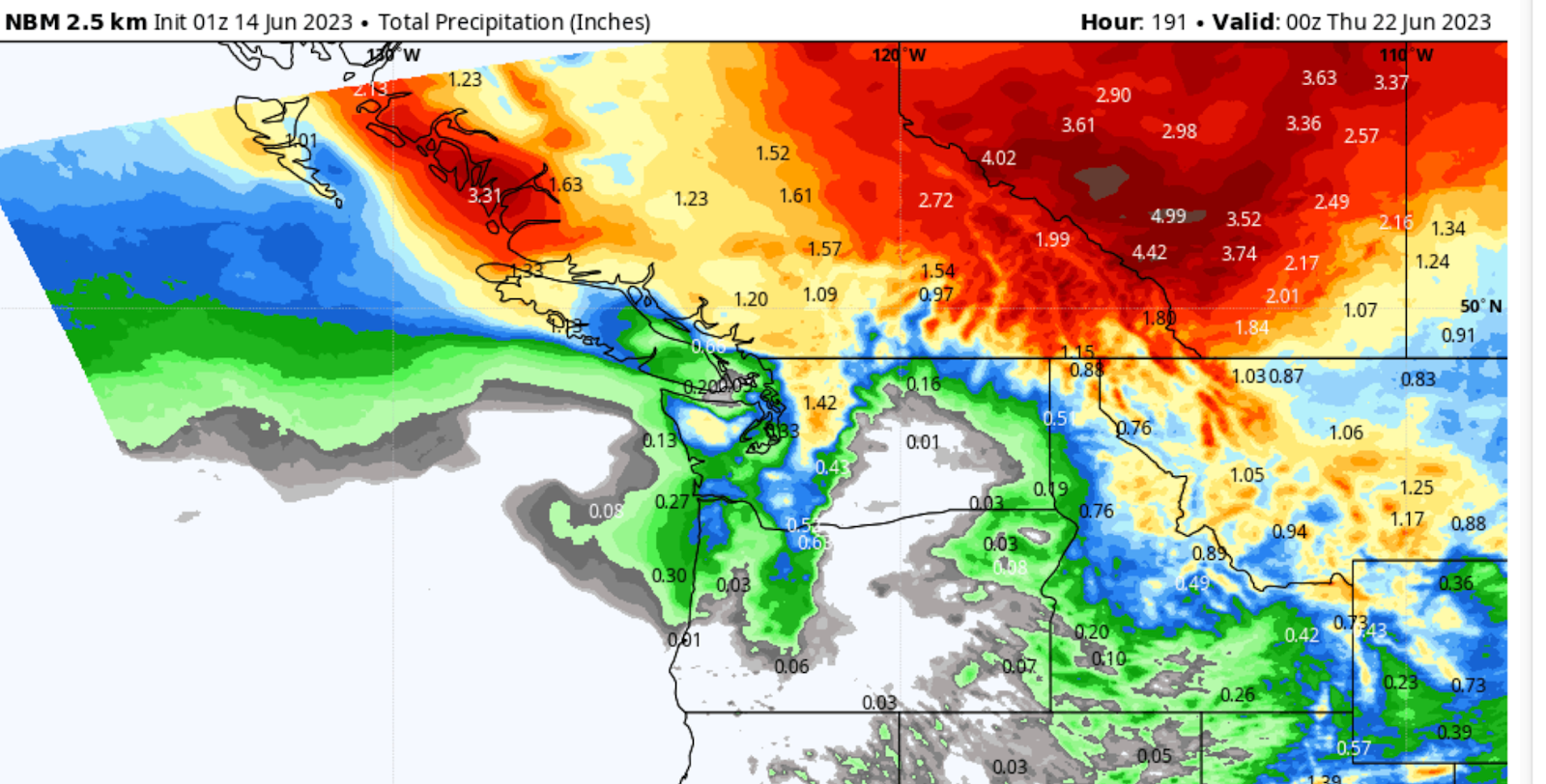
Predicted accumulated totals through Wednesday afternoon. Red is very, very wet.

Hopefully, this wet reality with sober up the climate change wildfire scaresters, such as at the Seattle Times.

After I talk about this soggy future for our region, I will turn to the New York smoke in the podcast.

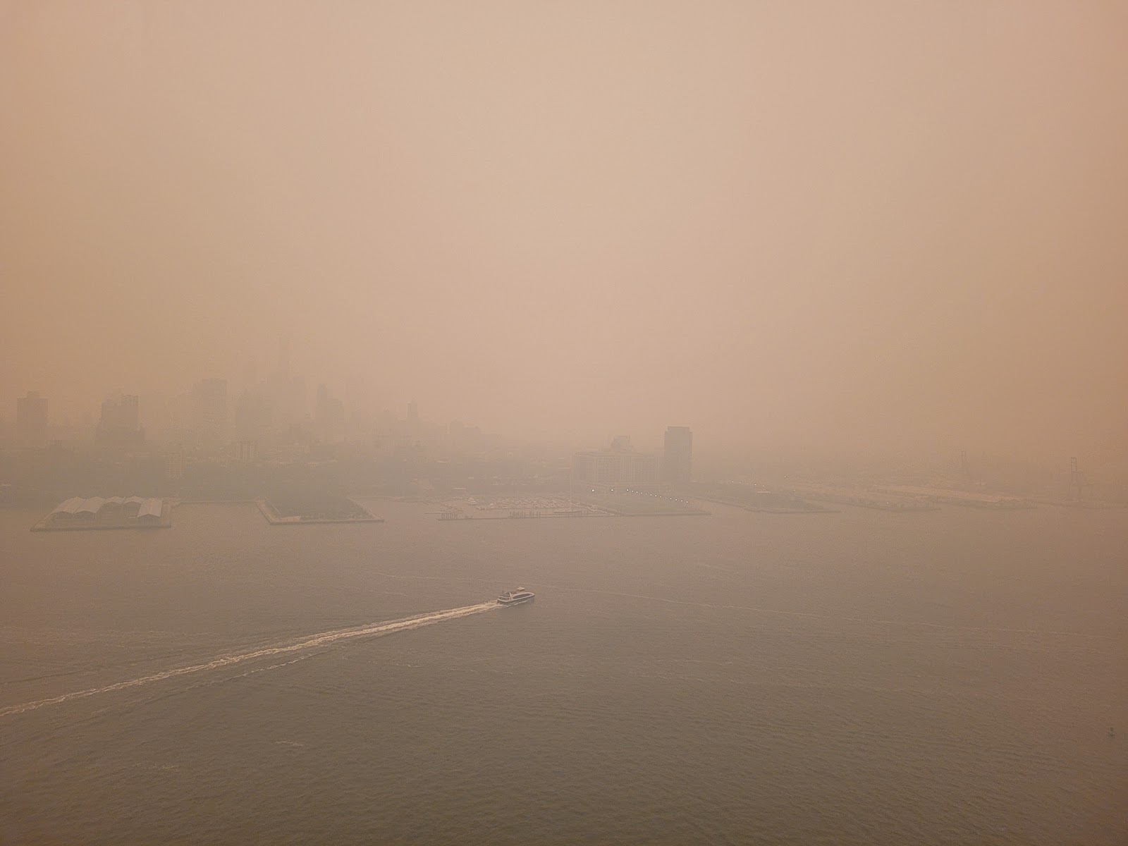
As I explain, the smoke came from fires in Quebec that were started in the short window of opportunity during late spring after the snow has melted and before new growth "greens up.".    A strong high-pressure area resulted in rapid warming up to 20-25F,  drying the dead vegetation from the previous year.

Then an upper-level disturbance moved in, producing lightning, which ignited the dried vegetation, and wind associated with the disturbance stoked the fires.

THEN, the low deepened and got "stuck" off the east coast, drawing the smoke over the NY metro areas.

A lot of random things happened at exactly the right time and way.   Like getting all sixes with multiple dice.


None of the necessary elements were significantly altered by human-caused climate change.

I wrote a commentary piece in the Wall Street Journal about the smoke event.  Check it out, and listen to more details in my podcast (see how below).

To listen to my podcast, use the link below or access it through your favorite podcast service.


Some major podcast servers:

 HTML tutorial HTML tutorial
Like the podcast? Support on Patreon 


June 11, 2023

The Northwest Will Soon Share California's Fate

 What has happened and is happening in California is extraordinary....one of the coolest/wettest ends of spring in Golden State history.  The cause has been a high amplitude and persistent trough of low pressure over southern California.  

Check out the latest upper-level (500 hPa, about 18,000 ft) weather map, with the shading showing the differences from normal (the anomaly).   Hugely lower than normal heights (a deep trough) are centered over the southern portion of the state (dark blue and purple) Huge in extent.   

Troughs are generally associated with clouds, lower-than-normal temperatures, and precipitation.   Interestingly enough, this California low pressure is directly connected with ridging (high pressure) and warm temperatures in southern Canada...and yes, the fires there.

What about this week?  Gird yourself...

By mid-week (Wednesday), a weak low center remains over southern CA (below)

and the crazy persistent low is still there on Saturday.    If you want warmer weather, head to the Pacific Northwest.  

Clearly, the weather gods are angry with southern California.


Precipitation?     Plenty over California and Nevada during the next few days thanks to the low center over California  (see totals through Tuesday morning).

Stunningly, more rain for LA and San Diego.


But in case, Northwest residents are getting smug, amused by the weather-gods vengeance on the lotus land of Southern California, the situation is forecast to change radically by next Sunday, with a VERY deep, large, and unusual low building over the Pacific Northwest (see below)     

A drought-buster if I have ever seen one, one that will bring substantial precipitation to the Pacific Northwest and southern BC.  And one that will push the potential for wildfires far into the future for us.


The Stratosphere Plummets over Seattle....and Huge Precipitation Contrasts

Today, the stratosphere was much, much closer to you than normal, and we all lived to tell the tale. As many of you know, the lowest layer o...