The mid-May wind event is now past its peak, but not before thousands of customers lost power.
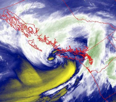
The water vapor satellite image at 4 AM this morning was impressive, with plumes of moisture circling into the clear "eye" of the storm. Not your typical May satellite image!
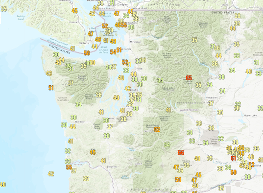
The maximum wind gusts ranged from around 50 mph on the coast and 50-55 mph over Northwest Washington to over 60 mph on the eastern slopes of the Cascades.
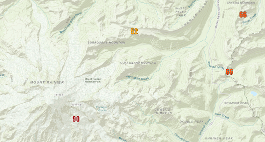
But if you really like winds, head to Mount Rainier, where gusts hit Camp Muir (at 10,000 ft), 52 mph at Sunrise Ranger station, and 66 mph at Crystal Mountain.
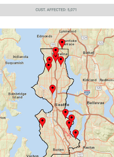
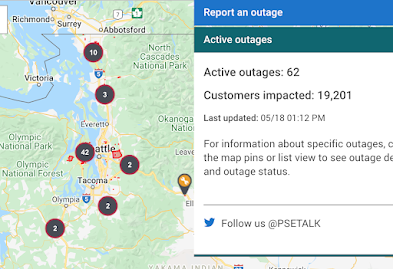
Strong winds combined with leafed trees led to power outages around the region, with about 5000 City Light customers losing power and roughly 20,000 Puget Sound Energy users (see outage maps below)
And now the exciting news, we FINALLY will have a truly decent weekend coming up. In western Washington, highs reach the mid-60s on Saturday and around 70F on Sunday (see forecast map for Sunday at 5 PM below). Even mid-70s in the Columbia Basin. Get ready to garden, hike, or take a stroll outside. It will be perfect...for a change.


I've lived on Vancouver Island for most of my life and I seriously can't remember another "spring time" like this. It's really been horrid. I'm so happy to finally seen sunshine in the weekend forecast. Let's hope that it comes to pass.
ReplyDeleteIf the forecast is from Environment Canada, don't put too much stock in it
DeleteYes, there was big wind here in east Snohomish county, very much like a winter storm. As for the weather this year so far; only slightly wetter that usual;so far. Slightly cooler also. I've lived here for 70 years, and have kept rainfall records at this location for 16 years since graduating from the University of Washington, class of 2006, degree in environmental science. The records are available on the net by typing in total rainfall washington (without quotes) at the google search page. The web page comes up first in 22,000,000 results. Also there, are observations regarding wind conditions, snowfall and temperature conditions at this location. Rainfall totals in the forest, and in the clearing.
ReplyDeleteI hold 1993 and 1999, in that order, as the worst summers I can remember. Although I think 1982 was rather dismal too.
ReplyDelete