Consider what happened today.
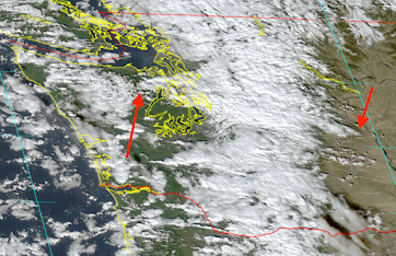
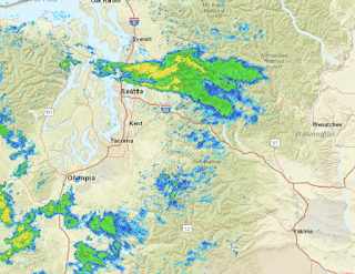
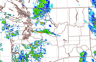
A Puget Sound Convergence Zone set up, producing a band of precipitation stretching from the northeast slopes of the Olympic Mountains, across Seattle and then eastward to near Wenatchee!
Just a reminder before I go on..... Puget Sound Convergence Zones are associated with westerly or northwesterly flow that is deflected around the Olympics and which converges together to the east of the Olympics.
The Thanksgiving Forecast
It is very nice to enjoy a walk, run, or any other outdoor activity before the holiday mean. But unfortunately, Thanksgiving is one of the climatologically wettest and stormiest days of the year in our region.
But I have some good news: Thanksgiving Day 2023 will be dry. It will be partly cloudy with highs in the upper 40s over western Washington.
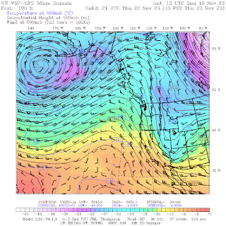
Thursday afternoon, a ridge of high pressure will have built over the eastern Pacific (see the weather map at 500 hPa..about 18000 ft forecast for 1 PM Thursday). A cool, dry pattern. I would expect low clouds in the AM, breaking up in the afternoon. Perhaps you can get enough exercise to deserve a little more turkey or whatever you enjoy...
.GIF)


No comments:
Post a Comment
Please make sure your comments are civil. Name calling and personal attacks are not appropriate.