3:30 PM Thursday. An intense Arctic front is moving southward through Puget Sound Country and Eastern Washington now. Some ice pellets and snow with it. Will blog about it later.....
_______________________________________
The threat of Puget Sound snow has now faded as the U.S. weather prediction model, the GFS, has come into agreement with the European Center model, the IFS.
A more serious threat is now front and center, extremely cold air moving south out of the Canadian Arctic.
Air that presents a mortal threat to the unhoused.
Let's start with the temperatures predicted by the National Weather Service National Blend of Models (NBM), which statistically combines forecasts from many different sources. A system that predicted the unusual heatwave in 2021 almost perfectly, days in advance.
The surface air temperatures predicted for Friday morning at 7 AM show the coldest air over the interior of British Columbia and starting to move south into northeast Washington.
Temperatures at this time are predicted to drop into the lower 20s F around Puget Sound and single digits in the Columbia Basin.

Saturday morning will be considerably colder, with temperatures dropping into the mid-teens over central Puget Sound to Portland. Eastern Washington will range from the single digits to well below zero.

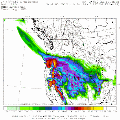
To show this, here are the snow totals through Friday morning at 4 AM. Some snow in the mountains and a subtle band near Everett.


Finally, to put this event in perspective, below are the lowest annual temperatures in Seattle for its entire record. If Seattle gets as cold as 16F, we would experience the lowest temperature since 2010.

Stay warm.


Just north of Ellensburg, Sat at 7am, I might see -4°F.
ReplyDeleteThat will put ice on the ponds.
I am happily awaiting that "subtle band" of snowy precip, that is forecast for us folks in Everett! So far, our Winter weather has been subtle in the extreme, more like an extended Fall, not much rain, etc. A moderate snowfall will be beautiful, and even fun.
ReplyDeleteYay! I get to defrost my basement freezer this year. Thanks for delivering the chill, Cliff.
ReplyDeleteThe NWS would seem to be a prime target for having their forecasts created using AI. The current snow forecasts for W WA out of the SEA office shows "0-14in" for Olympia, the range of the various models. If all they are going to do is parrot the computer models, who needs them.
ReplyDeleteCould you please go into detail about those "poor folks in Portland "?
ReplyDeleteHow much should we expect? The popular Weather apps are still all over the place.
I agree. Don't leave us poor Portland folks... out in the cold.
DeleteIFS, a new-to-me acronym for Europe?
ReplyDeleteThe Integrated Forecasting System (IFS) is a global numerical weather prediction system jointly developed and maintained by the European Centre for Medium-Range Weather Forecasts (ECMWF) based in Reading, England, and Météo-France based in Toulouse.
DeleteQ for the prof: I'm curious about the temperature scale given (shown) for the GoesWest satellite images (water vapor). That data relates to what altitude?
ReplyDeleteBTW - here at 12:30 pm on Jan 11 in Glacier (near Mt Baker), the temperature's dropped more than five degrees F since 7 am -- from 31.5 F to 25.9 F. That's an interesting situation, "for mid-day" (and it's not entirely clear, there are clouds). Just sharing!
DeleteDarn! I am not crazy about the cold, but if we have to have cold, I was hoping for snow! It is a nice change of pace, it slows down the urban hubbub and traffic decreases- and everything gets real quiet. Potentially, I could even cross-country ski to work. So rare. Once again, Portland steals our snow.
ReplyDeleteFlurries in Shoreline/Edmonds right now.
ReplyDelete345pm Fri and snowing lightly in Kingston.
ReplyDeleteI'm with you! No snow & the frigid Fraser Valley outflow in north Whatcom County is misery. On the other hand, if it snows alongside the northeaster, it wreaks havoc.
ReplyDeleteA strong artic front with little or no snow for most in puget sound, when was the last time that happened? . It cant be that strong.
ReplyDeleteStill about 40° F here near the coast at about 6pm, very windy though! When I went to WWU in Bellingham, those Fraser River fronts were brutal, but nothing like what's now predicted for all of western WA. This is really unusually cold. I have lived in WA for over half a century and can only remember one other time where things were predicted to get this cold. It certainly never gets much colder than about 28° F here along the coast where the ocean moderates the effects of extreme cold and heat and now they're saying it will go into the teens. There are going to be a lot of people really hurting, cold, with frozen pipes.
ReplyDeletePort Townsend is getting a fair amount and quickly at that: 1"-2" in town. Expect some black ice in the AM.
ReplyDeleteSnowing heavily on Olympic Peninsula, hwy 101 is crawling with about 8-9 inches piled between the lanes. Sheet ice under the snow. Almost blizzard conditions, snow falling sideways at times. Stay home and warm folks!
ReplyDeleteAt 7pm it looks like there's a strong convergence zone parked over Seattle and we're getting a little snow after all!
ReplyDelete6 inches at my house in Sequim and still coming down!
ReplyDeleteA whopping 6° on Friday morning at 8am a high of 11° in northeast whatcom county, the North easters are the worst.
ReplyDeleteGot one inch in S. Everett at 9pm...Seems innocuous, but we know that the ice that will form underneath that snow, can be difficult to deal with, even in my AWD SUV..Be careful, folks!
ReplyDeleteSnowing in Tacoma!
ReplyDelete