September 29, 2024

Dust Storm Hits Eastern Washington

The visible satellite image this afternoon clearly shows a dust storm over the Columbia Basin, stretching from around Moses Lake to the east (orange arrow shows the feature)


Here is  a better view from the NASA Aqua satellite


The Washington DOD cams, a great source of weather information, showed a very obscured sky near Ritzville around 2 PM.


Another cam near Moses Lake showed the beginning of the event around 9 AM this morning.


My colleagues at the National Weather Service in Spokane made an excellent forecast of this dust event, providing warnings yesterday when it was clear low-level winds would be strong.  In some places, visibility has dropped down to less than 1/4 mile.   Occasionally down to zero


The strongest gusts observed today are shown below, with some exceeding 50 mph!


High-resolution models have been forecasting this wind event for a while.  To illustrate here are the sustained winds predicted for 2 PM from this morning's model run (started at 5 AM).  Yellow colors are strong sustained winds of 20 kts or more.  Gusts are stronger.


Driving in dust storms is dangerous and often associated with multicar collisions, some with as many as 50-100 cars.   

So be VERY careful if you are driving in dust-influenced eastern WA today.    Winds should lessen tonight.  

_____________________________

Announcement:  Free Public Lecture at Kane Hall on October 10:  Global Warming, the Jet Stream, and Cold Waves

All of you are invited to attend what should be an excellent public lecture by Professor Jonathan Martin on how global warming affects the jet stream and cold air outbreaks.

It will be a timely and interesting lecture accessible to non-meteorologists and given in honor of UW Professor Peter Hobbs.

The talk will be at 7 PM in Kane Hall room 210.

If you would like to go, please register online here:

Parking is available (at a modest cost) in the UW Central Garage, which is located directly under Kane Hall.  Or take the light rail (the UW stops are a 5-10-minute walk away).

September 27, 2024

The Other "Hurricane" Has Just Hit Our Region!

There is a lot of coverage in the press about powerful Hurricane Helene hitting the southeast U.S. (see visible satellite image below yesterday afternoon).  The hurricane eye is quite apparent. 

But did you know that a massive storm, a Pacific "hurricane" hit the British Columbia coast at essentially the same time?  (see the satellite picture below from yesterday).  


When Hurricane Helene hit the southeast U.S., maximum wind gusts yesterday reached 99 mph in two locations.  Very dangerous


What do you the maximum winds along the British Columbia coast were yesterday as the Pacific storm approached?   Make sure you are sitting down right now.  95 and 96 mph along the northern Vancouver Island coast.  Wow.


Now shown above it the wind at Solander Island, right off the NW coast of Vanvouver Island, where it got to 105 mph.

To get more perspective regarding the similarity of the two storms, below is a pressure analysis of both (solid lines, called isobars, and the difference of pressure from normal, shading).   Look pretty comparable don't they?   

Only one is called a hurricane since that name is restricted to systems of tropical origin.


A satellite image of the two storms is shown below.   Helene was an unusually large hurricane, but the Pacific storm was even bigger.


Why such strong winds along the BC coast?  

Because as the powerful Gulf of Alaska low moved to the coast, it created a very strong pressure gradient (pressure difference over distance) over the northern BC coast, and strong pressure gradients create strong winds. (see a sea level pressure forecast for yesterday afternoon below)


Finally, to compare the winds of the two storms directly, below is the estimate by the European Center for the probability of wind gusts exceeding 34 knot (about 40 mph) yesterday around 11 PD PDT.  The Pacific storm has such gusts over a larger area!


It goes without saying that Helene was a much bigger threat, hitting a highly populated region.    Fortunately, the forecasts for Helene were excellent, which hopefully reduced the loss of life.

In BC, there were large power outages and substantial damage (see below)

_____________________________

Announcement:  Free Public Lecture at Kane Hall on October 10:  Global Warming, the Jet Stream, and Cold Waves

All of you are invited to attend what should be an excellent public lecture by Professor Jonathan Martin on how global warming affects the jet stream and cold air outbreaks.

It will be a timely and interesting lecture accessible to non-meteorologists and given in honor of UW Professor Peter Hobbs.

The talk will be at 7 PM in Kane Hall room 210.

If you would like to go, please register online here:

Parking is available (at a modest cost) in the UW Central Garage, which is located directly under Kane Hall.  Or take the light rail (the UW stops are a 5-10-minute walk away).

September 26, 2024

The First Strong Pacific Fronts of the Season. Amazingly Good Forecasts of Such Fronts are Now Common.

Yesterday, the first strong Pacific front of the season moved off the Pacific Ocean.

 There are some fascinating subtleties of how Pacific fronts such as this interact with our region's terrain....let me show you!

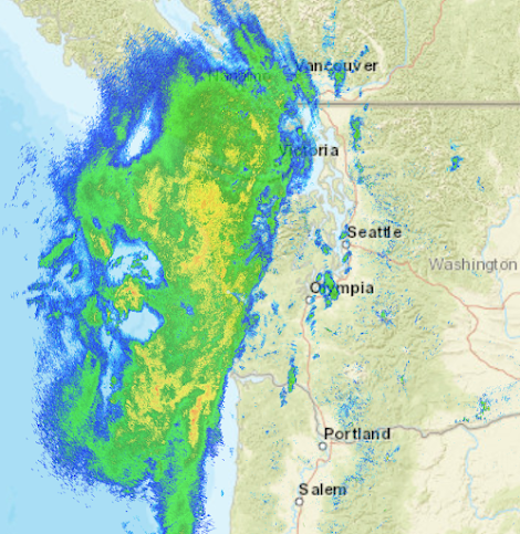
 The radar image around 8 AM yesterday (Wed) morning shows precipitation from the front reaching the WA coast and NW WA.  Green indicates light rain, yellow moderate, and red, heavy precipitation.  Umbrella alert.


By mid-afternoon, the front was moving through and the winds on the coast had switched from southerly (from the south) to northwesterly.  As a result of this wind shift, a rain shadow started to develop over the north Sound as northwesterly winds descended the northeast slopes of the Olympics (I have indicated the rain shadow with a red arrow).


A few hours later, air pushed eastward at low levels through the Strait of Juan de Fuca, with strong upward motion at the leading edge of the surge of marine air into the Strait.  Air was pushed upward at the leading edge of the marine air surge producing an arc of enhanced precipitation (yellow to red colors)


And after the main frontal rainband had moved through,  a Puget Sound Convergence Zone formed over the north Sound as air moved north and south around the Olympics convergence over Puget Sound.


The visible satellite image of the front around 1 PM is shown below.  The red line is the approximate location of the surface front, cold unstable air is behind (the area with white cloud elements over the ocean)


What is so exciting for me as a modeler, someone who simulates the atmosphere using complex physical models, is that the forecast models nailed this front in the days before.  

Let me show you.  A high-resolution forecast made the day before, produced simulated clouds very similar to those observed (see below).

An even higher resolution prediction from the previous day shows the primary front rainband and amazingly gets the arc of precipitation moving into the north Sound.


And yes, the high-resolution forecast correctly forecasts the location and timing of the Puget Sound convergence zone.


The advances in high-resolution weather prediction are amazing.   How can we do it?

Vast satellite-based observational assets provide a good description of what is going on over the Pacific in three dimensions.  Then high-resolution weather prediction models simulate the detailed interactions of air coming off the Pacific with our complex regional terrain.

We have come a very long way during the past few decades, providing far better forecasts and helping warn/protect the region's population.

_____________________________

Announcement:  Free Public Lecture at Kane Hall on October 10:  Global Warming, the Jet Stream, and Cold Waves

All of you are invited to attend what should be an excellent public lecture by Professor Jonathan Martin on how global warming affects the jet stream and cold air outbreaks.

It will be a timely and interesting lecture accessible to non-meteorologists and given in honor of UW Professor Peter Hobbs.

The talk will be at 7 PM in Kane Hall room 210.

If you would like to go, please register online here:

Parking is available (at a modest cost) in the UW Central Garage, which is located directly under Kane Hall.  Or take the light rail (the UW stops are a 5-10-minute walk away).


September 24, 2024

If You Care About the Environment and Worry about Climate Change, Vote YES on I-2117

Global warming must be dealt with scientifically and rationally, not with pork barrel politics. 

Unfortunately, in Washington State, we now have the Climate Commitment Act (CCA), an ineffective, wasteful political giveaway that does little to deal with global warming 

You can help the state deal more effectively and justly with climate change by voting YES on Initiative 2117.

The CCA is doing little to slow WA emissions growth

If you are like me, you care deeply about the environment and worry about the long-term effects of human-caused global warming.  I have studied the issue of climate change in the Northwest more than anyone, giving me a realistic view of its impacts.  

And when Congressman Jay Inslee wanted to gain a basic understanding of climate change, his staff called me and I met with the Congressman at my offices at the UW. 

What did I tell him, backed by the best science available?  

Global warming is a serious concern but not an existential threat.  

We need to deal with the problem in a rational and balanced way.  

As I will describe, the legislatively adopted CCA is wasteful and ineffective.  It is highly regressive, preferentially hurting low-income people.  It is also an obstacle to effective action regarding human-caused global warming.  

If you care about the environment, vote YES on I-2117.  We must replace the CCA with measures that are more effective and ethical. 

Reminder:  the Climate Commitment Act established a cap and invest system, where the annual CO2 emissions by the state are capped, with major emitters paying money to bid on emissions allowances.   The result is increasing prices for gasoline, heating fuels, transportation, and many things we buy.    The sales of emission allowances have given the state government billions of dollars for a politized environmental "slush fund."

Why the Climate Commitment Act is Essentially Flawed and Must be Replaced

(1)  Flying Blind

The central goal of the CCA is to reduce carbon emissions in Washington State. To do so, it is essential to have recently updated emissions data to know whether actions funded under the act are working and to make adjustments if necessary. 


The most recent emissions data available from the State of Washington?  You are not going to believe this.  2019Five years ago.

Can you imagine being a captain of a ship headed to a specific port and the only information you had was the path of the ship five years ago?   
You would have no chance of reaching your destination.  

The same thing is true of the CCA.  A serious effort to reduce carbon emissions requires near real-time information.

(2)  No Requirement that Projects Have Specific Emission Reduction Goals

Billions of dollars are being spent on CCA projects.  Unbelievably, there is no requirement for these projects to estimate or project how much they will reduce carbon emissions.  The vast majority of projects provide no such information.

You can't reduce emissions if the projects you are funding provide no information on how they would reduce emissions.  Pretty obvious.

(3)  No Tracking of the Effectiveness of CCA Projects

Vast sums are being dispersed to hundreds of CCA projects, but there is NO TRACKING of whether the projects are successful in reducing emissions.

You can't solve a problem if you don't know whether your actions are working.

Can you imagine paying someone to paint your house and not checking on whether he/she finished the job?   Or even started it?     This is what the CCA is doing.  Unbelievable.


(4)  Much of the CCA Money is Spent on Projects That Will Make Little or No Contribution To Greenhouse Gas Emission Reduction

The CCA gives new meaning to the term "pork barrel politics", dividing the CCA funds among well-connected special interest groups, with many of the projects having nothing or little to do with reducing greenhouse gas emissions.


Case in point, one special interest group,  the Cascade Bicycle Club, noted the CCA will supply 1.3 billion dollars to improve bike lanes and pedestrian projects. You read that number right.

Do you know the average % of folks in the US who commute by bike?  

About 0.5%  Do you think that massive investment in bike lanes will have much of an impact on emissions?   Not likely.  And cycling is getting LESS ecological with the invasion of heavy, electric bikes.


Large sums of CCA money are also being spent on a multitude of other projects that will have little or no impact on carbon emissions.  

For example, millions are being spent on fish barriers and habitat, as shown by the dozens of projects shown on this map. We all care about fish, but this has little to do with reducing greenhouse emissions.  


Tens of millions of dollars are being spent on "environmental justice communities", with spending ranging from vague administrative tasks to air quality sensors (see map below).  Again, little to do with CO2 emissions.


Don't get me wrong.   I care about the natural environment as much as anyone. But the bait and switch of the CCA, using money meant for reducing carbon emissions used for other projects is wrong.  

The language of the CCA is explicit:   CCA money is for reducing emissions (see a statement on the State's own web page below). 


Hundreds of CCA projects have nothing to do with greenhouse gas emissions, wasting billions of dollars.

(5) The CCA "Tax" is Greatly Raising Prices for Washington Citizens and is Highly Regressive, Hurting Low-Incoming Individuals the Most

The inception of the CCA has resulted in Washington gasoline prices increasing by 30-50 cents, with increased bills for home heating fuels (natural gas and oil) and for a wide variety of essentials.  These increased costs are very regressive:  they hurt low-income folks the most since energy costs are a far larger portion of their income.   Low-income folks often can't afford expensive electric cars or live in places with convenient chargers.  

The Washington Policy Center estimates that the CCA costs the average Washingtonian about $ 500-1000 a year. 
The effects of the CCA on gas prices were not small.


(6)  The CCA Effort Has Been Supported by Hype, Exaggeration, and False Statements by Politicians, Special Interests, and the Media

Exaggerations, hype, and outright fibbing have characterized the messaging of those pushing the CCA and attacking I-2117.

Governor Jay Inslee stated that  ‘Climate change is truly an existential threat for everything we hold dear’ and CCA author State Rep. Joe Fitzgibbon wrote: "The climate crisis poses an existential threat to all our communities."

Let us be clear.  This existential business is nonsense.  Unscientific and baseless.  Global warming is slowly warming the planet and our region. The effects are modest.  There is no threat to the existence of our state.  Very irresponsible language.    

Many media outlets have been equally irresponsible in hyping the effects of global warming, with the Seattle Times being one of the worst offenders.  I have written several dozen blogs over the years documenting the false statements in the ST regarding climate change that needlessly worry State residents and poorly inform legislators.


Talking about false statements,  don't forget the Governor's claims that gas prices would go up by "pennies" if at all.  The truth was very different (around 50 cents per gallon).

Unethical Conduct

In addition to telling tall tales about the CCA, state leadership has also taken actions that were ethically problematic.  When the polls this spring and summer showed substantial public support for I-2117, the Inslee administration and state legislature decided to give low-income customers a one-time gift of $200 on their utility bills BEFORE THE ELECTION.  Unbelievably inappropriate.  The email below from a state administrator shows how it was done.


What We Do Now?

The CCA is ineffective and essentially flawed for many reasons.  Importantly, the CCA is wasting huge sums of public money, displacing productive approaches that could meaningfully address climate change.

So what actions should be taken now?

Number one is to vote YES on I-2117 to end the ineffective and costly projects resulting from the CCA.

What are some effective alternatives for addressing human-caused global warming that would be appropriate to do on a state level?   Some suggestions are provided below.

(1) Pass a revenue-neutral carbon tax that would allow the market to make decisions, not government bureaucrats.   Revenue neutral means that all the collected revenue would be returned to Washington State residents.    Such an approach was proposed 8 years ago with I-732., which was defeated when Governor Inslee and others opposed it (they wanted the money).

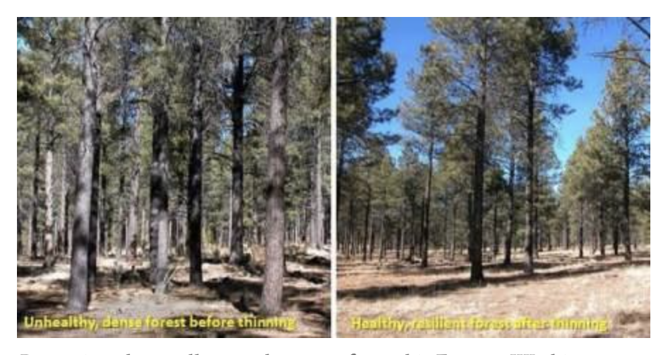
(2)  Instead of ineffectively spreading the funds to special interest groups, accomplishing little, use the funds to fix key climate vulnerabilities.  For example, a massive program to thin and restore Washington's eastside forests would greatly reduce wildfire impacts.  Or building new water reservoir capacity.


(3) Invest in modular small nuclear generation facilities or fund prototype fusion power generation.

Most importantly, be honest with the citizens of Washington State on the costs and impacts of any measures taken.


,


September 22, 2024

The Strongest Atmospheric River on Record for the Gulf of Alaska?

 The atmospheric river currently over the Gulf of Alaska may be the strongest on record in that area.

The latest model runs show extreme values of the key measure of atmospheric river strength, vertically integrated moisture transport (IVT), which describes how much water vapor is being moved over a period of time.

Below is the map  of IVT for this morning, with values exceeding 1900.  I have personally never seen anything like it.


An estimate of the strongest atmospheric river  over observed for 1990-2019 by Dr.  Lexi Henny of NASA/Goddard suggested this is the strongest atmospheric river during that period of record.  Impressive.


The plume of moisture was very apparent in water vapor satellite imagery this afternoon (below). Do you see the southwest-northeast directed plume aimed at SE Alaska and BC? Some of the associated clouds have moved into Washington.


This atmospheric river is predicted to hit land as an AR-5, the strongest level observed.  We can be thankful that the center of the river will make landfall north of Washington State, where only AR-2 levels should occur on the northern Olympic Coast.

By Tuesday, as much as a foot of rain will fall over the coastal terrain of BC


Strong atmospheric rivers are not infrequent over SE Alaska and BC this time of year, with the path of the moisture plumes reaching Washington State in November.  

The fact we are in a neutral to La Nina year means that there is a higher probability of more rain than last year (an El Nino year)...something shown for the western Washington lowlands below.


My advice.  Make sure you have a decent umbrella.

September 20, 2024

A Powerful Atmospheric River Takes Aim at British Columbia and Southeast Alaska

If you are taking an Alaska cruise starting this weekend, bring an umbrella and heavy rain gear:  you will need it.

Why?  Because a powerful atmospheric river will strike the BC/southern Alaska coast, dumping very heavy rain on the coastal terrain of the region.

 What really got my attention today was the forecast of the movement of water vapor in the atmosphere from off the Pacific, something called "water vapor transport" in the weather business (see forecast for 11 AM Sunday, below).

Wow.     This graphic shows the movement of water vapor integrated through atmospheric depth, although most of the action is in the lowest 10,000 ft.    The colors show the magnitude and the arrows indicate both the direction and magnitude.


Immense amounts of water vapor will surge toward the coastline embedded in a strong airflow from the west in what is known as an "atmospheric river."  And when the moisture-laden air hits the substantial coastal terrain it is forced to rise, cooling as it ascents, leading to water vapor condensing out into clouds and rain.

Heavy rain.

A group in San Diego has an atmospheric river rating system that parallels the 1-5 scale used by hurricanes, with AR-5 being the strongest atmospheric river (see scale below)


According to this scale and the latest model runs, this event will be an impressive AR-4 (orange color).  Here in Seattle, only an AR-1.   You won't be bragging to your grandchildren about it.


Want to see the latest precipitation forecasts for the next few days?

Through Tuesday morning, some coastal areas of BC will enjoy up to 15 inches of rain.


And coastal Alaska will be more than a little damp, with 3-6 inches being widespread.


Why will we get this damp situation?   I am authorized to tell you since I have written several research papers on such features.  

The upper-level map  (from about 18,000 ft) shows the classic pattern, with a strong trough (of low pressure) over the Gulf of Alaska and a ridge of high pressure off Oregon.  This contrast in pressure (or heights) produces a strong current of winds from the southwest that moves a lot of moisture to the coast.


So if you want to experience the torrential rains of a powerful atmospheric river, you might be able to secure a last-minute ticket for a cruise leaving on Sunday.  

Tell them that I sent you.


_________________________
NOTE:  I will do a special online zoom session at 10 AM on Saturday for Patreon supporters.  I will discuss the forecast for the upcoming winter and answer your questions.

Reminder UW students:  I will be teaching Atmospheric Sciences 101 this fall:


And if you are over 60, you can take the class for $5 through the UW Access Program...either online or in person.

The Highest Pressure in Ten Years

 Did you feel the pressure yesterday?    Feel a bit weighted down?    If so, it may not be due to the political energy in the air. Yesterday...