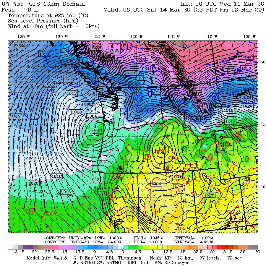
The sea level pressure and lower-atmosphere temperatures for 11 PM Friday (below) shows very cold air (purple colors) over BC and air cold enough to snow (blue colors) moving into eastern WA. Importantly, a tight low center is found along the northern Oregon coast. That will guarantee snow for someone west of the Cascades, depending on exactly the trajectory of the low.

I have talked to several agriculture weather experts at Washington State University (such as Drs. David Brown and Joseph Zagrodnik) and they note the real potential for damage to the cherry crop. Due to the relatively mild winter this year (and a warmer than normal start to March), cherries broke dormancy very early and many orchards in Oregon and south central WA have cheeries at a bud stage that is vulnerable to cold damage.
Growers have tools at hand (orchard fans, spraying water, propane heaters) to mitigate cold temperatures but such steps lose potency as the air temperatures drop into the teens. Apricots are also vulnerable as well (see below from the Yakima Herald).

I love Washington cherries and apricots.....so I am concerned.
So what about lowland snow?
Below is the latest forecast showing the total snowfall (not snow depth!) through 11 AM Saturday. Between the southward path of the low and easterly flow over the central Cascades (which causes drying), the Puget Sound lowlands will only see a few snowflakes. But there could be as much as an inch or two from Olympia to Portland (see below). Eastern Washington will get whitened up and a band of significant snow could form on the northeast side of the Olympics.

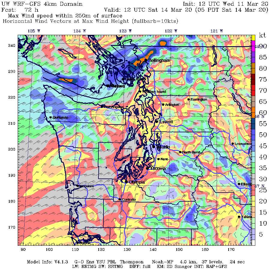
Why will the northeast Olympic Peninsula get hit hard by the white stuff? Because there will be a surge of Arctic air through the Fraser River Valley that surge across the Strait and move up the northeast Olympic slopes. To illustrate, below is the gust forecast for Saturday at 5 AM.
Gusts as high as 60 kts will hit north of Bellingham and across the San Juans.
Hopefully, our resourceful agricultural folks will be able to get through this cold blast without major damage to crops. But the threat is real.
And then there is the issue of coronavirus and influenza. There are some suggestions that such viruses like cold, dry weather. Well, they are going to get it.


What a mess! I've been wondering where the forecast of cold air was coming from. Now I know, thanks to you. It looks to be coolish to cold at night (not as cold as the upcoming weekend into next week) for about two weeks!
ReplyDeleteI also learned from you that the coronavirus might like cold, dry air. Double ugh! At least we have a proactive government, educators (i.e., people like you) and forward-thinking businesses in Washington. Thank you so much for keeping us informed. I read your blog daily.
I wonder if the birds headed south again, sensing what's coming our way?
It always seems to me that around mid-March Ole Man Winter gets very indignant when being shown the door. He slams it behind him. BTW picking cherries around the first week in July at Cherry Hill Farm among others in the Green Bluff Area just outside of Spokane is great family fun! You can make the trip there and back in one long day from Seattle...
ReplyDeleteThanks for the heads up; much appreciated.
ReplyDeleteI live in North Seattle, Haller Lake area, and have had at least two separate downpours today. In neither case was there any precipitation showing up on the radar anywhere remotely close to the Seattle area. And in both cases weather.com showed 0% chance of precipitation. Wondering how this could happen. Hoping you might comment on it. Thanks.
ReplyDeleteThat's interesting. Iv'e had that happen only it showed up on the radar as light rain, but we got very heavy rain.
DeleteRadar gaps.
DeleteAt least this cold snap is predicted to be over by Monday. Next week looks to be close to the 60's for highs here in Portland, perhaps this will help dampen the spread of the virus.
ReplyDeleteAnd of course, in my haste to celebrate spring, I took my dwarf lemon tree off the grow lamp and set it outside on Sunday, and the new growth got frosted by winter's parting shot. Rats!
ReplyDeleteThank you Cliff for taking the time to produce this very informative and helpful blog.
ReplyDelete