Imagine the ability to determine the three-dimensional distribution of wildfire smoke across the United States in real-time.

Such a capability--let's call it smoke radar-- would improve weather prediction, because smoke influences temperature and clouds.
A smoke radar would help protect human health by assisting in the prediction of the future distribution of smoke near the surface. Air quality forecasting would be improved.
Smoke radar could enhance aircraft safety
And a smoke radar would be a potent tool for research, from diffusion studies to climate change.
Best of all, the National Weather Service already has the hardware in place, but simply needs to find the funds to collect the data. And for a modest additional investment, the current units could be upgraded to dramatically improve their capabilities.
The Opportunity
The National Weather Service and the Federal Aviation Administrations have weather observation equipment at every major and minor airport across the U.S. (see map). Roughly 1000 of them.

The currently installed ceilometer (the Vaisala CL31, see below) has a laser that sends out light pulses that are reflected and scattered back to the ground by clouds and other atmospheric features. By timing the pulses and measuring the amount of return, the location and relative density of the target can be determined.
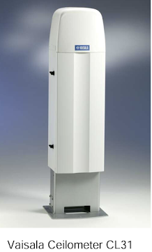
The Vasailla Ceilometer can see targets as high as 25,000 ft, although the National Weather Service only uses its capabilities over the lower 12,000 ft.
But now the exciting thing. These ceilometers can sense wildfire smoke and penetrate thin to moderate smoke to see smoke layers aloft. Here is an example from Tacoma earlier this year. In essence, this device is a smoke radar for the atmosphere above the unit. And there are enough of them across the U.S. to provide a detailed three-dimensional description of wildfire smoke (and clouds) around the nation.

But the tragedy of it all is that this data is never leaving the devices. The National Weather Service lacks the communication infrastructure to get this valuable data off the ceilometers, to collect it at a central site, and then to distribute it to eager users.
It is estimated that this would cost approximately 3 million dollars, a very small sum considering the huge value of the information.
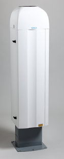
But there is more. The current ceilometers (CL31) represent old technology and Vaisala has a vastly more capable unit (the CL51) that could provide greatly improved smoke information...both in detail and in vertical extent.
A sample is shown below. Wow. Really impressive detail.


Yes: The Weather Channel App gets confused about temperature when there’s wildfire smoke: this makes much sense for many reasons. Thanks for showing us the devices and demystifying them as well.
ReplyDeleteCliff, how much smoke profile data can be derived from satellites? I'm thinking about ocean coverage since much of our smoke circulates in from the ocean. Also, how much do clouds interfere with laser smoke readings?
ReplyDeleteSmoke forecasts with some accuracy would be great!
ReplyDeleteSo important to help plan, and keep lung health.
Thank you!
Absolutely! Senator Cantwell should get this new technology on the government radar!
ReplyDelete$30M is a drop in the bucket for the feds.
Potentially excellent aurora viewing weather and conditions tonight!
ReplyDeletePrivatize the task of networking them together. NOAA is a gubberment agency and they tend to stagnate
ReplyDelete$30 million here and there and pretty soon you have a $3.5 Trillion dollar boondoggle that puts inflation into high gear. Been shopping lately?
ReplyDelete