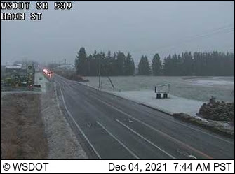
Before I discuss the potential snow event on Monday, let me note that as predicted, some light snow fell over Northwest Washington. illustrated by the WSDOT cam north of Bellingham.
Perhaps the most interesting snow reports were received from downtown Kirkland. Since I am particularly interested in highly localized snow events, I checked it out myself (picture below). Have not figured out the complex meteorology of that situation yet.

That morning, a weak upper trough will be moving through (see attached). From my experience, too far northeast and too weak to produce a significant snow event over western Washington.
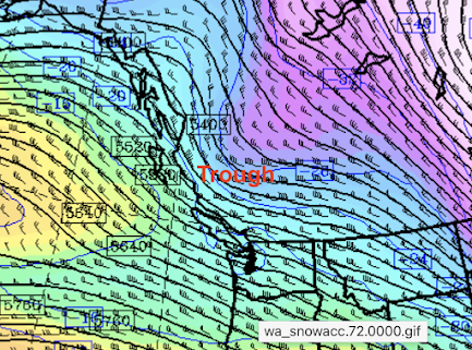
4 AM Monday 500 hPa (~18,000 ft)
Near the surface at 4 AM, the air will be plenty cold enough for snow east of the Cascade crest, but very marginal over western Washington and Oregon (green colors)

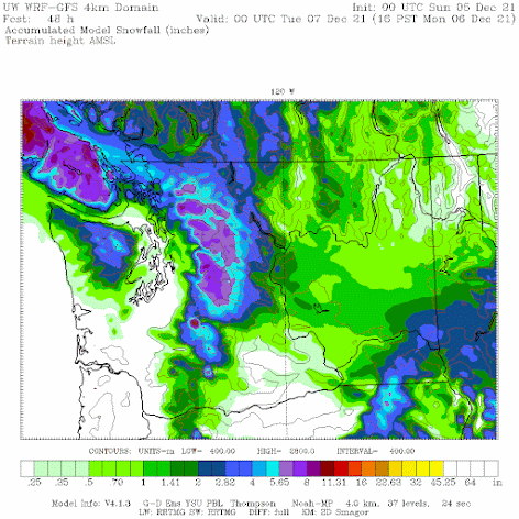
The latest UW forecast run (initialized at 4 PM Saturday) provides the predicted snowfall total through 4 PM Monday (below). With the exception of northwest Washington around Bellingham, the lowlands get nothing or perhaps a few flakes mixed with the rain. Bellingham and vicinity might get an inch or two of SNOWFALL.
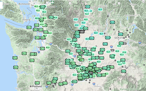
Here are the latest soil temperatures from the WSU AgweatherNet website. Upper 40sF around western Washington and mid-40s in the east.
With these warm soil temperatures in mind, take a look at the predicted snow depth at 4 PM Monday based on the same forecast as above. Lowland snow only accumulated on the ground around the Bellingham area.
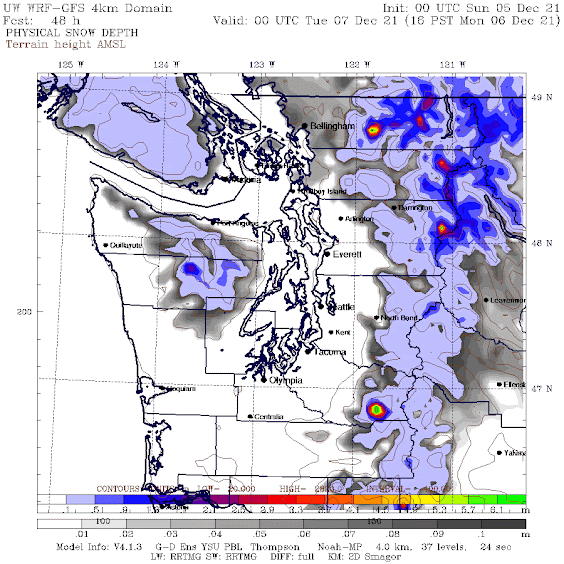
You have to admit, the Bellingham folks have been ground zero for active weather lately.
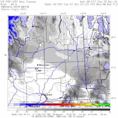
For eastern Washington, only the northern portion will end up with light snow on the ground (see below)
We have now switched into a much cooler, wetter configuration and expect snow to pile up in the mountains.
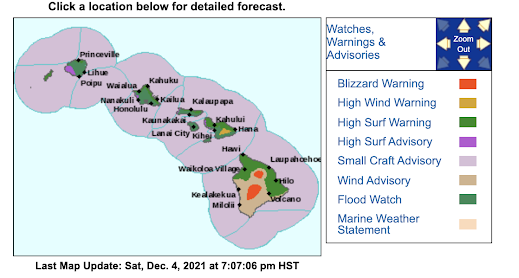
And if any of you are disappointed with the lack of snow, you have a new option!
There is a blizzard warning for the Big Island of HAWAII. I kid you not. Check the latest National Weather Service Forecast graphic:

.png)


Thank you for the insights, Cliff!
ReplyDeleteMauna Kea is a 13,000 foot peak. Of course it gets snow sometimes - like Mt. Whitney in southern California, less than 100 miles from Death Valley; or Kilimanjaro at 19,000 feet right on the equator.
ReplyDeleteLynden , Cliff— it’s ok to name our town North of Bellingham, Lynden!
ReplyDeleteWoke up this morn to a skiff of snow on the ground here 350 ft above Kingston.
ReplyDeleteCan you tell us what those streak type clouds are today way out west over the Pacific? They almost resemble huge jet contrails going in different directions
ReplyDelete