A shot of cold air will push into western Washington late Tuesday and Wednesday, with strong northeasterly winds from the Fraser River Valley extending into northwest Washington, and even a chance some of you will spot some snowflakes. In April.
The predicted surface weather map for 8 AM April 1st is, well, chilling. Very cold air (purple/blue colors) is pushing into southern British Columbia, with a low center near the Columbia River bars. If this was January, I would getting my snow shovel handy.
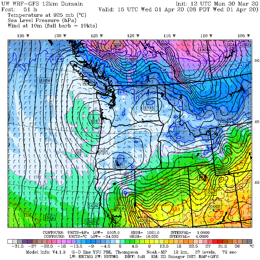
With cold, dense air and high pressure in southern BC and low pressure over southwest Washington, a large pressure difference (gradient) will develop over the Fraser River Valley, accelerating cold air into Bellingham and NW Washington. This is shown by wind gust forecast for 8 AM Wednesday, with winds reaching 35 knots. The northeasterly flow will then run into the Olympic Peninsula...and as we shall see, bringing low-level snow.

Later in the day, the strong, cold northerly winds will hit Puget Sound. I will guarantee you one thing...it won't feel like April 1st.

But what about snow you ask? The accumulated snowfall (not accumulation) through 5 PM Wednesday show lots in the mountains (up to 1-2 feet) and if you look closely you will note a few inches getting close to sea level on the NE side of the Olympics. Even some sea level or near sea level locations may see a few flakes.

The upside to all this is that our snowpack is getting enhanced, setting us up for plenty of water during the summer and a good omen for the upcoming wildfire season. If this was a normal year, I would be talking about good skiing--but it isn't. There is a chance there will be enough snow for some mountain recreation if the quarantines are lifting by the end of the month. We will see.
So let me give you the online snow experience and view the top of the Crystal Mountain run around 6 PM tonight.


It doesn't look like things will be warming up by the weekend either. Bummer! So much for Spring Break!
ReplyDeleteSnowing now on the west flank of Mount Constitution, Orcas Island...rather pretty, but the hummingbirds don't like it.
ReplyDeleteThat "encouraging forecast" from just a few days ago seems to have changed quickly. What happened?
ReplyDeleteThis post in contrast with the preceding post just two days ago shows just how hard it is to predict a large chaotic system like Earth's weather. The warmer temps, if they even come, won't be until next Wednesday. And now we are looking at snow. It would be good to see more humility from the weather and climate communities. Some who claim near certainty about climate far in the future are utterly absurd.
ReplyDeleteGrand Solar Minimum anyone?
ReplyDeleteCold weather on top of quarantine is no fun at all. And the snow in the mountains is driving my 18 year old crazy. He's willing to hike up the hills to ski and I must say, it's a big challenge forcing him to stay home.
ReplyDelete