You knew it wouldn't last.
This has been an extraordinarily fire-free and smoke free summer so far, but our run of smokeless skies is now ending.
A rapidly growing fire in northwest California is pushing smoke northward into Oregon and southeast Washington.
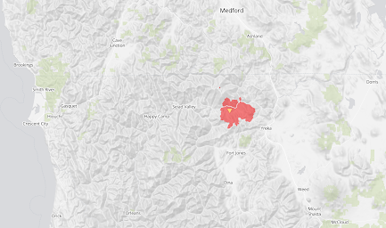
The McKinney Fire, which started on July 29 and was initially driven by strong winds, is now over 51,000 acres and uncontained. The map below shows its location: due south of Medford and due east of Crescent City Not far from I5.
Yesterday's satellite picture showed smoke from the fire pushing northward into southern Oregon.
And today, the smoke plume, thankfully aloft, has reached the Tri-cities and Walla Walla.
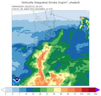
The wonderful NOAA HRRR-smoke model suggests that more smoke will move into Washington State by tomorrow morning at 5 AM (see below). Direct hit on Portland! This is total smoke in the vertical column.
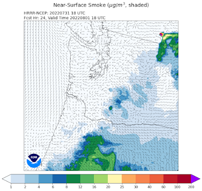
But fortunately, most of that smoke will be high aloft, as suggested by the forecast smoke concentrations at the surface at that time.
Smoke tends to loft over time, so smoke from distant fires tends to be aloft where it has little impact on surface air quality.
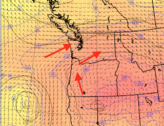
We are fortunate that the winds aloft are generally favorable to protect western Washington. Below are the winds at 10,000 ft tomorrow morning. The winds are generally from the southwest over western Washington, bringing in cleaner ocean air.
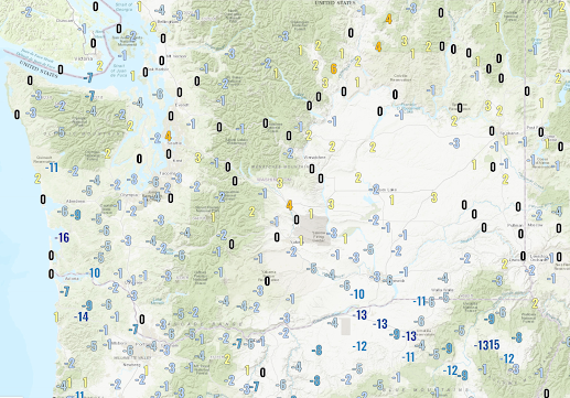
Finally, today is a bit cooler over Oregon and southern Washington and roughly the same around Seattle (see 24-h temperature change below), but tomorrow will a significant step down into the lower 80s.
No more 90s in western Washington for a while!
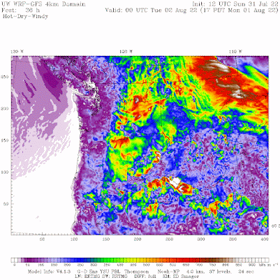
But with the cooling comes a threat. As western WA starts to cool, strong winds will develop over the eastern slopes of the Cascades, something shown dramatically by the hot-dry-wind fire index (below). Orange and red indicate great danger.
If you are living in eastern WA, please by very, very careful the next few days--any ignitition source could start a major fire.




It's been pretty hazy in the morning, presumably from smoke, the past couple mornings in Tri-Cities and you can definitely see it aloft. A lot of clouds yesterday and today were dominant in holding the temps back about 6-7F from forecasted highs but I wonder if smoke has had any contribution. Regardless, highs in the mid-upper 90s is downright enjoyable right now after that long heatwave.
ReplyDeleteFire now NW of Vantage and I-90. about 10,000 acres.
ReplyDelete