The rain over the past few days is just a taste of what is in store for us this week.

And by the end of the next few days, the annual precipitation for many Northwest locations will actually be above normal, even after the dry summer and early fall.
Tonight, another wet system is approaching (see the latest radar image below)

A view of the latest infrared satellite imagery shows that one system after another is lined up to move into our region (see below).

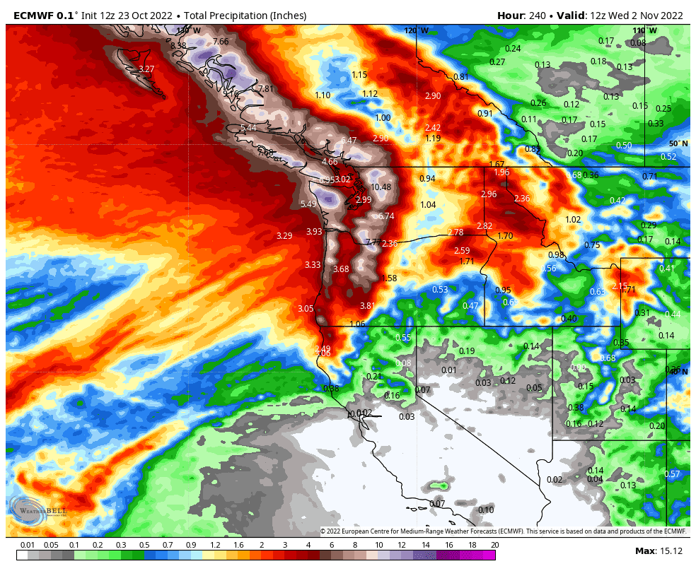
The latest European Center forecast for accumulated precipitation for the next 10 days is stunningly wet, with over ten inches on the western slopes of some of our regional terrain (see below).
The wildfires will be history--that is pretty much guaranteed--and the streamflow will zoom upward, which is good for fish migration up rivers. Reservoirs and dams will begin to refill.
You can turn off your sprinkler systems.
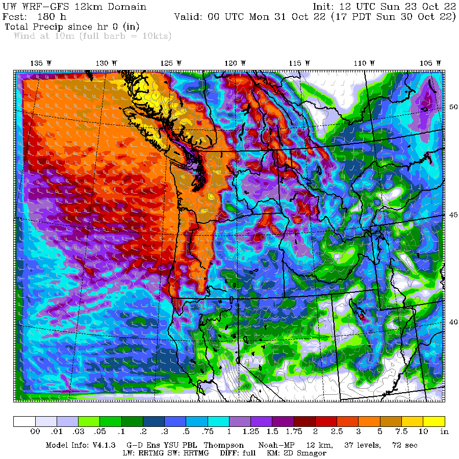
The UW forecast system shows a similar picture, with the total precipitation over the next 7 days reaching up to 10 inches in certain exposed terrain, particularly in BC.
I haven't talked about snow in a long time. Time to do so.
Here is the UW model's forecast snow totals for the next week. Wow. Several feet in the Cascades and much more over southern BC.


A reminder to hurry up and get fall planting done quickly before the frost!
ReplyDeleteGlad to have the rain but I wish it wasn't so cold. I love to run in warm rain.
ReplyDelete> You can turn off your sprinkler systems
ReplyDeleteYeah, but it also sounds like we won't need to, which is nice.
And landslides. Which are due to fires, which are due to ........oh nevermind.
ReplyDeletelandslides are generally not due to fire, but to heavy precipitation and vulnerable slopes/geology
DeleteTake a look at the Wildfire-Associated Landslide Emergency Response Team Report for the fires that have happened recently:
Deletehttps://www.dnr.wa.gov/sites/default/files/publications/ger_hazards_landslide_walert_report_bolt_creek_suiattle_boulder_toketie_2022.pdf
"Wildfires can significantly
change the hydrologic response of a watershed so that even modest rainstorms can produce dangerous flash floods
and debris flows. "
Yes I thought it was well documented that forest fires can ultimately lead to landslides due to loss of anchoring root systems
ReplyDeleteJust saw a bulletin on the tube, warning of pending flash flooding in KING county...we have to assume, I guess, that such flooding would most likely be in the Eastern portions of the county, in the foothill areas, etc...The bulletin was not really specific at all!
ReplyDeleteDon't worry. Flooding and atmospheric rivers have already been blamed on Global Warming previously, so they will just modify previous news stories with those words. By attributing every weather phenomenon to Global Warming you can never be wrong, it's genius.
ReplyDeleteNOAA is saying they are expecting below normal temperatures for the PNW. Will mean more sigificant snow in the higher elevations? What is the snow outlook for the lowlands? What is the current La Nina tragectory this winter?
ReplyDelete34mph gust at my house in Bellingham 4:50PM 10/25
ReplyDelete