Today we have a very vigorous front passage, with a very intense cold front.
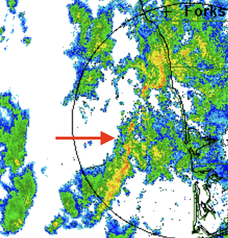
For example, here is an image from the Langley Hill radar (near Hoquiam) at 5 PM. The arrow points to an intense narrow cold frontal rainband, with red colors indicating torrential rain! Such intense fronts break down into wave-like undulations.
The National Weather Service was so worried about this cold front that they put out a flash flood warning for the south Sound area (see below)

The rainfall over the past 24 has been substantial, with some locations getting over an inch.
The wildfire season in western Washington is now over.

And yes, there is a lot more to come over the next week.
Interestingly, our rainfall for the year is almost exactly normal now in western Washington.
Here is the cumulative precipitation plot since January 1 at Sea-Tac, with the green line showing this year's total and the brown line showing climatological values. The wet spring balanced the dry summer/early fall.

.png)


34mph wind gust at my house in Bellingham today but not much precip - we were largely rainshadowed during this even
ReplyDeletethe balancing out act in nature is certainly one to behold and respect...you listening, seattle times...let mother nature be the hyperbole....
ReplyDeleteIts a good thing we had that wet spring. Otherwise, we might have had water shortages in Puget Sound cities. It isn't the end of the world to ask people to conserve water, but it is less than ideal.
ReplyDeleteSaw Snoqualmie pass recieved its first snowfall this fall. NOAA is saying Below-normal temperatures are favored from the Pacific Northwest. With the 3rd La Nina happening, will we see an increase in mountain and lowland snow?
ReplyDeleteYes, La Nina is favorable towards higher mountain snowfall and increased chances of lowland snow.
Delete