We have very warm air over us today...temperatures are already in the lower to mid 50s. There is some fog around and some high clouds associated with the warm front pushing north (see sat picture). The clouds should lessen during the afternoon..and where sun some through the temperature will rise rapidly to 60F and more. A short-term computer forecast (see image)...shows you where to go...warmest temps (deep orange and reds) are on the western foothillss of the Cascades and along the coast. Oregon will be much warmer and sunnier..particularly out of the often foggy Willamette Valley.
Eastern Washington will be fogged in..especially in lower areas...so don't head there!
Next system should get here late Monday...so most of tomorrow should be dry. I am heading out for a hike...
This blog discusses current weather, weather prediction, climate issues, and current events
November 30, 2008
November 29, 2008
Sunday still looks good
As I mentioned in my earlier messages, Sunday is the day to get out. Today is the transition day as a warm front moves through....mostly cloudy and some light drizzle in the Puget Sound lowlands....with showers in the mountains (see cam shot at Crystal mt). Not much snow in the WA Cascades...and Whistler had barely enough snow for their upper runs. Temps are relatively warm this morning (see regional plot) and winds are generally light. Anyway, tomorrow we should see sun and temps going into the upper 50s...and perhaps more. Rain later on Monday...and some snow in the mountains. Next week will be boring...a "dirty ridge" situation in which we are clipped by systems going mostly to the north. Lots of clouds, occasional showers. No big precip events and no strong windstorms. The persistent underlying ridging (high pressure) in the eastern Pacific seems to be major feature this winter.
November 28, 2008
The Worst Day
Good day for shopping. This will be the worst day of the weekend. Light rain is slowly spreading south through the region now (see radar). Right now it is raining in the northern portion of western Washington..although the rain shadow ne of the olympics is keeping it fairly dry in the sequim/port townsend area. So clouds and light rain will be the general rule. Tomorrow will be the transition day..still plenty of clouds and some showers in the mountains...but generally dry in the lowlands. Sunday is still on track for warm, dry weather. Upper 50s will not be rare...and some locations...such as North Bend, WA...will be warmer. Unfortunately, next week is a return to a generally wetter pattern....rain every other day, but no major events. And not a large snow accumulation in the mountains.
November 27, 2008
Thanksgiving and the Upcoming "Heat Wave"
The second half of November has been one of the driest and sunniest in memory...and the fun is not over yet! I just got back from a long run on the Burke Gilman Trail and the mountains were sharply defined and a clear zone was northwest of Mt Rainer. An altocumulus cloud deck with breaks was overhead..the harbinger of a weak front that is now nearing the coast (see sat pic). See that white arc on the coast..that's the front. Eastern Washington is full of low clouds and fog. That is their plague during the winter...eastern Washington is a basin and cool, foggy air tends to collect there during the cold season.
Today the front will approch, clouds will increase, and their will probably be a few light showers this afternoon and early evening. No storm. No power outages and turkey in barbeques as often happens here.
There will be a break tommorrow morning...but it won't last. A warm front, with rain, will move in late morning and afternoon. Good shopping weather. Saturday will be the transitional day with clouds lessening into the afternoon and temps getting in the mid 50s. Sunday will be amazing. Warmer, sunny, offshore flow. Temperatures will reach the upper 50s and even lower 60s in some locations (away from water). Southern Oregon and the Oregon coast will be tropical. No need for that trip to Hawaii. The National Weather Service is playing things cool and conservative...but you don't come to this blog for such forecasts! I think they are too cool.
November 26, 2008
The Banana Belt
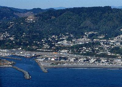
Want to enjoy temperatures in the 70's and go sun bathing this weekend?...it is only a car ride away....head to the southern Oregon coast this weekend. The area around Brookings is known as the banana belt of the Northwest...and for good reason. Any time of the year...even in the dead of winter...if there is strong offshore flow the temperatures can soar as air sinks down the high terrain to the east...the Siskiyou Mountains (see picture). Air warms as it sinks, because higher pressure compresses air..and compression warms.
This weekend there will be very strong offshore flow over Oregon and the "Brookings Effect" will be seen in full force...take a look at the predicted temperatures on Saturday and Sunday from our local high resolution weather prediction model (see graphic). Sunday will be fairly warm everywhere and locally the hot spots will be near the western footfills of the Cascades. North Bend will be warmer than Sea Tac!
Thansgiving Day will be dry...with increasingly clouds during the afternoon. Rain that night.
For those living in the north end.....I will do a book signing at the Mukilteo Ivar's on Wed, Dec 3. from 5-7 pm. This restaurant has a whole section in my book....it was destroyed by an interesting local weather phenomenon...a Strait of Juan de Fuca westerly wind surge in October 2003. The rebuilt restaurant has taken on the storm as its theme...really fun place.
November 25, 2008
Big Ridge
This week will be uneventful. Today, a week front will move in during the day--with some light rain in the interior somewhere between roughly 10 AM and 5 PM (see front on satellite picture). Wednesday will be dry with sun. And then a weak system will move through late Thursday, But the big story is what will happen on Friday through at least Sunday...a huge ridge or area of high pressure.
The main chart used by meteorologists to see such ridging progress is the 500 mb chart...which shows conditions around 18,000 ft. At the level approximately half of the air is above and below. The lines are height lines, the height of the pressure surface above sea level..with high heights corresponding to high pressure. So if you see the lines buckle to the north....that is what we call a ridge and is associated with fair weather. Wind parallel the height lines with higher heights to the right.
The three images show the height lines for Friday, Sat, and Sunday around 5 PM. Note how the heights over the eastern Pacific and west coast are very high. The area of strong winds...the jet stream..is where the lines are very close together and the jet stream will be avoiding us...heading north.
The end result will be complete drying out. The exact weather depends on the exact location of the ridge. In one orientation we get offshore flow and clear skies...and in another we tend to fog in and get poor air quality. We will know more about that in a few days.
November 24, 2008
The Greatest Local Weather Threat
What do you think is the greatest local weather threat? Heavy rain? Strong winds? Flooding? No way...it is black ice on the roads. Clearly, icy roads kill more NW residents than any other weather phenomenon. When is the greatest threat? Now! The worst situations are generally during late fall and early winter when there are clear skies, radiation cooling to space, relatively light winds, and fog. If you are interested in this threat...and want to learn how to protect yourself...check out the roadway icing tutorial I wrote a while back:
http://www.atmos.washington.edu/~cliff/Roadway3.html
Today will be partly sunny with highs in the lower 50s. Tomorrow...a weak front will move through midday...with some modest showers...it wont hit till around lunch time and the rain (except for a possible convergence zone) will be done by dinner. Wednesday will by dry with sun.
What is really amazing is what the computer models are predicting for this weekend. An extraordinary, high amplitude ridge. No rain. Above normal temps. The place to go will be southern Oregon...where offshore flow could drive temps into the 70s. They don't call the Brookings area the banana belt for no reason. And sixties up the Oregon coast. Make your coastal Oregon reservations for this weekend now....it will be magnificent if the models are correct...
November 23, 2008
The Subtleties of Clear Weather
It is clear over much of the reason, EXCEPT for the normally foggy areas, like the Willamette Valley...a bowl that tends to collect cool, saturated air (see pic). Some obvious fog in the valleys of NE Washington.
This morning there was frost outside but my thermometers read 37F. How is that possible? The reason is that on clear nights the earth radiates heat to space more effectively than the atmosphere above...and if the winds are light...as last night...an inversion forms where temps warm with height. So on such nights always be careful driving if the air temps drop into the mid 30s.
On such nights there are often large horizontal variations in temp...take a look at the reading around sunrise (see figure). The air temps range from the lower 40s over water to freezing inland. Not unusual at all.
Tomorrow looks like another dry, partly sunny day and a weak front with rain and clouds on Tuesday. Then we go dry. Not supposed to be this way in late November....but for those who suffer from SAD...seasonal effective disorder, a godsend. Winter ends here in mid-February...less than three months away.
November 22, 2008
Showers and Sunbreaks
Today is classic postfrontal conditions around here. Showers and sunbreaks. Interestingly, this is completely different than the eastern part of the country...there when a front goes through temps fall, skies clear, and precipitation is over. The reason we have a lot of our showers after frontal passage? The Pacific Ocean. As cold air from Alaska and Asia passes over the relatively warm waters of the Pacific it destabilizes since there is a lot of temp change with elevation. Just like your hot cereal pot as you put it on the stove and the bottom warms.
Take a look at the latest visible satellite image...you see the white speckled area....that is the instability showers coming in. Those showers will be moving in today...and there will be showers...and snow showers in the mountains. We can catch a few of them as well...although there will be some rainshadowing from the Olympics. With westerly flow on the coast, we have had a weak Puget Sound convergence zone and that may rev up a bit later....so if you are in some steady rain showers in the seattle area...go north or south and you should be able to get out of it...
The surface data plot (see attached) shows weak winds over the region, with showers over the coast, NW Washington, and in the mountains.
Tomorrow is looking dry...everywhere in the region. And still no major weather next week....
November 21, 2008
An Unusually Good End of November
Typically the last weeks of November are the bottom of NW weather...the wettest, stormiest time of the year. But not this year. I am going to fix up my bicycle for some nice rides.
Today is a break before the next system..poised off our coast, arrives around dinner time (see satellite pic). The approach of this system is clearly showed by high-resolution regional weather prediction models (see graphic of 3-hr precipitation ending 4 PM). The serious rain will occur overnight...and tomorrow morning will have a few showers in the lowland and more steady showers in the mountains.
Talking about mountains, we did get some post-frontal snow showers in the Cascades yesterday (see pictures at Stevens Pass, which got around 9 inches). There will be more tonight and tomorrow am...but not enough to even think about skiing.
Sunday should be a sunny day with no precipitation, with highest getting into the lower 50s.
Right now the long-range forecast models show no major weather events next week, just a few weak weather systems and a generally ridge (area of high pressure) over the western U.S.
November 20, 2008
Another Frontal Passage
Take a look at the radar this morning from Camano Island (see attached). A frontal zone is moving through now with the yellows indicating moderate rain. You will also see the lack of rain to the NE of the Olympics...the old rain shadow.
An infrared satellite picture clearly shows the front and convective clouds (cumulus type) clouds behind it. Those speckled convective clouds are very typical in the NW after frontal passage, producing the "showers and sunbreaks" we all love.
The reason they exist? Cold air over warmer water produces a large change in temperature with height....and that leads to instability and convection. My book describes this process in more detail. These showers will put down perhaps a half foot of snow in the mountains at and above pass level.
So today will be clouds with showers, and we will see a generally dry period tomorrow morning and afternoon until another front comes in around dinner time. Saturday will have some clouds and showers....but Sunday looks very nice. Another weak front on Monday. No major storms next week and Wed and Thursday look exceptional dry and stormless. One of the best end of Novembers in years. This is typically the stormiest period of the year. But forget skiing this month...it won't happen.
November 19, 2008
Easterly Flow
Today will be a partly sunny with no precipitation. Temps will get up into the lower 50s. Right now there is fairly high pressure over British Columbia and eastern Washington..with lower pressure offshore. This produces what we call an offshore pressure gradient....a change of pressure that accelerates winds to the west...particularly in gaps in the terrain (see pressure analysis this morning).
Take a look at the observed winds...the winds accelerate to the east in the Strait at Juan de Fuca...with reports of 50 mph winds at Seiku at the western exit. (see figure). Bellingham is getting modest northeasterlies gusting out of the Fraser River valley gap. And look in the Gorge...Troutdale (east of Portland) has moderate easterly flow. A computer simulation of the winds this morning shows these features and another easterly wind hot spot (eastern King County near Enumclaw and Black Diamond)--see figure. This is not a major easterly wind event...
A modest Pacific front will influence western Washington tomorrow...so expect rain to start around or just after breakfast. Another front later on Friday. Sunday still looks very nice...warmer and dry. So plan your outdoor activities (or raking leaves) then.
November 18, 2008
Weak front and rain on Thursday
A weak front moved through last night and this morning, bring some light showers and clouds. Yesterday was extraordinary with some favored locations getting into the mid-60s. The clouds are dissipating and there is considerable sun...particularly not of Seattle (see image). There is considerable cirrus cloud cover over the region and if you look carefully over the ocean you can see some contrails.
Tomorrow should have considerable clouds, but should be dry...with a modest front--with rain--coming in Thursday morning around breakfast time. Thursday should be wet. Friday will be a break before the next front comes in that evening. Clouds and rain will extend into Saturday morning, followed by rapid improvement. Sunday looks warm and dry. In fact, I am amazed by how good it looks early next week....normally the snowiest period of the year.
You can forget about skiing over the Thanksgiving break this year. Very little chance of that.
November 17, 2008
Better than your average November
Yesterday was generally dry and warmer than normal. The biggest issue for some near Puget Sound was that the fog held around in some areas into the afternoon. Other places cleared out by noon and climbed into the upper 50s. Take a look at the graph of our temperatures versus the normal highs and lows (light red..normal highs, light blue...normal lows). Over the past few weeks the low temperatures have been consistently above normal...some days more than 5F higher than usual. And a number of days have had maxima well above the usual. The plants know about this....at my house annuals are not dying off and some of the bushes are still growing.
Today and tomorrow should continue this trend and the next major system will not come in until Thursday am--a very wet front. Another system passes through on Friday and could bring strong winds. Amazingly, it looks like another unseasonably nice weekend...and we are now getting towards the stormiest period of the entire year. The key issue for us is the persistence of a ridge of high pressure aloft over the western U.S.---how long this will keep up, I can't tell you.
November 16, 2008
A Respite from the Rain
So far this month we are running about twice the normal rainfall, mainly due to last week, but temps have been considerably above normal.... my garden is still very much alive. See how dense the fog is this morning (see photo)...that is a very good sign. Generally that means that is mainly clear above, allowing good radiational cooling to space..until the temp drops to the dewpoint and fog starts forming. Thus, we end up with cold air near the surface and warmer air above...an inversion. Right now we have a thin veneer a few hundred meters thick of cool, foggy air...which will burn through by lunch nearly everywhere. The temp observations at the National Weather Service Office in Seattle show this clearly (see figure).The latest satellite picture shows the fog in lower elevation and some scattered clouds (see picture). Expect to see sun this afternoon, with temps getting into the mid to upper 50s.
Tomorrow also will be dry and sunny in the afternoon since the high pressure will remain over us.
November 15, 2008
Nice Weekend and LA Fires
This weekend will be better than average. There are some clouds and a few sprinkles over the northern portion of the state, but they will slowly push northward later today (see computer model precip forecast for 1 PM today). The showers and clouds will be even further north tomorrow as high pressure builds--so for most of western Washington we will see partly sunny skies and temps in the 50s.
In LA there are major wildfires associate with Santa Anna conditions...strong offshore flow that is prevalent this time of the year. Why? In the fall, cool, high pressure systems often push down into the intermountain west. This produces an offshore-directed pressure change (lower pressure offshore) that accelerates winds to the east (see surface pressure graphic). The winds are particularly strong in canyons and gaps. Take a look at the visible satellite image from this morning..you can see the plume of smoke from the fires.
November 14, 2008
The Weekend
The weekend looks generally dry over the southern portion of the state, with a chance of showers over the north. This is particularly true on Saturday when a very weak frontal zone will be stretched over the northern portion of the State. This band will tend to move northward on Sunday...so I expect that to be the better day. Temps in the mid 50s.
Right now a weak warm front is moving northward up our coast producing clouds over the western portion of the state (see sat pic). Go south for sun!
Monday and Tuesday should remain dry and temperate.
Reminder: I will be talking at the downtown library at 2 PM on Saturday if anyone is interested in attending.
November 13, 2008
A Major Improving Trend
The heavy precipitation event is over now...and some of the rainfall totals in the mountains were impressive: over the past 48 hrs this is how much rain fell:
Snoqualmie Pass 8.66 inches
Stampede Pass 8.60
Rainier Paradise 6.74
Hoh Ranger Station 6.40
while at Sea Tac is was only 1.15 and at the UW about .5 inch. A wonderful example of what happens here under strong westerly flow--lots of precipitation on the western slopes of the mountains and a mega rainshadow over the lowlands downstream of the Olympics and the Mts. of Vancouver Island. We did get a Puget Sound convergence zone forming late yesterday and it was evident this morning (see radar and sat picture). As westerly winds move around the Olympics they converge--providing upward motion and a band of clouds and often precipitation.
The CZ will weaken today, with party clouds skies...and yes, even some sun. By the air mass is cooler and we will stay in the lower 50s in general.
Just a note: I will be on KUOW tomorrow at 9 AM for an hour and then will give a talk on local weather (and sign my book) on Saturday at 2 PM at the downtown (central) Seattle Public Library.
November 12, 2008
Flooding and Rainshadow
Today I biked to the UW and was perfectly dry. No rain gear needed and the temperature was so warm I had to remove my sweater. In contrast, it is pouring on the coast, over SW Washington, and in the Cascades, with a number of locations getting close to .5 inches per HOUR. The reason: a very evident rainshadow to the lee (east) of the Olympics (see radar image). There is also rainshadowing in the lee of the mountains of Vancouver Island...so the San Juans and Bellingham are doing well. Why is the rainshadow over us and not Sequim?...because the winds are westerly. Usually during wet situations it is southwesterly and rain shadow is centered to the NE of the Olympics. The high resolution computer models had the rainshadow in it yesterday (see the graphic of an 18-h forecast)....we have really come a long way.
The computer models suggest the heavy rain will slowly sink southward during the day and the area should dry out after dinner. Then we are dry until Friday when a weak warm front will bring some light rain to the northern part of the State and clouds over the rest.
November 11, 2008
The next two days will be very wet in mountains, but much less so in the lowlands. Winds will also pick up later today...but once we get through this, a very much improving trend is ahead.
The satellite image shows the story, one (weak) disturbance is over us now, and a second, beefier one, is moving rapidly our way. Note how the clouds of the second system stretches thousands of miles to the SW to somewhere around Guam. This moist flow will be heading directly towards us this evening.
Today will really be no big deal...this weak system is moving through with only some light rain and modest winds. Good day to rake those leaves...particularly those that might clog a drain. The serious rain will start tonight after 10 PM and will go into the afternoon tomorrow. The mountains will be hit hard (see the forecast graphic for 24-h rain ending 4 AM tomorrow am), but the central Sound will be rainshadowed by the Olympics. The rainshadow is really amazing in the forecast precip--particularly on the northern portion of the Kitsap...it will be hardly raining there. This is a good example of something that makes weather so much fun around here...the startling contrasts of our region. It will raining 5-10 inches on the SW side of the Olympics but nearly dry on the lee side.
Winds...strong southeasterlies in NW washington right now..gusting to 30-40 mph..that will weaken later today. Breezy tomorrow from the south...but no major windstorm. Then strong westerlies in the Strait and N. Sound on Thursday morning
November 10, 2008
Hell, Then Heaven
Today will be pleasant break in the weather with some sun and temps getting into the mid-50s. But things are going to change in a big way.
A very moist pattern will set up for a few days and flooding will probably occur along some of the local rivers. A warm front will approach the region tomorrow am...and we should be cloudy and raining on Tuesday morning. This will bring a warmer air mass in and the winds will strengthen during the day from the south. Particularly strong SE winds over NW Washington from Everett, across Whidbey, into the San Juans. The mountains will get several inches from this first pulse. The rain will lessen a bit in the afternoon, before the second and stronger system hits. This one will be very wet and some windward slope regions will be hit by 5-10 inches. You can bet on river flooding. The saving grace for the central and northern sound is that we will be somewhat rain shadowed because the winds will have a large westerly component.
The graphic you see shows the 24-h rainfall ending Wednesday morning at 4 AM. The reds are 5-10 inches--enough to cause the rivers to really surge. What makes this event even more of a problem is that is the two rain events have very little separation...the soils will be saturated from the first and then they will be hit hard by the second.
Wednesday morning will see drying. The end of the week should be relative dry with normal temps and a huge ridge of high pressure builds in Friday and Saturday (see figure for Friday upper air pattern and huge ridge along the west coast). The weekend may be extraordinarily nice...dry and fairly warm. But it is too early to be sure about this.
November 09, 2008
A few showers today
A weak trough is over us today and you can see the associated clouds in the the infrared satellite picture. The radar shows light showers moving through in the radar (pink colors are light rain). As this trough moves through expect improvement today with rain ending most lowland locations by lunch (although there could be a few isolated light showers). Higher probability of showers in the mountains. Yesterday ended up warmer than expected, reaching into the lower 60s..but not today...should only see mid 50s.
There is a front looming offshore (see satellite photo) and although it is not a strong one, it should bring clouds and showers tomorrow. Bu ta stronger system will come in starting Tuesday as the jet stream becomes directed straight towards us (see upper level chart below). This is for roughly 18K ft (actually 500 millibar pressure) and the winds are parallel to lines and the closer the lines are packed the stronger the winds. The jet stream is associated with the band of packed lines, and stretches into the Pacific.
November 08, 2008
Sunday Break
Well, the continuous moderate rain is over, so the rivers should start to recede, but one more strong precipitation line is about to hit at 8:30 AM (see radar). There will be moderate rain for roughly an hour as this line passes through and then by lunch we will be in sunbreaks and light showers. Temperatures should also be cooler today as we get into the postfrontal air behind this line.
There is a fairly strong low center offshore right now (look at swirl in the satellite pictures and the sea level pressure analysis), but this low will rapidly weaken as it moves in...no big windstorm in the lowlands. But it is quite windy now in NW washington (strong southeasterlies gusting to 30-40 mph) and strong wind winds along the coast (with Destruction Island reaching 50 mph).
So later this afternoon should be much better everywhere with only some showers..highs in the low 50s. Tomorrow and Monday will continue the pattern of sunbreaks and a few showers...not bad for November. Tuesday the torrent returns....but more on that tomorrow.
November 07, 2008
The Worst Will Soon Be Over in Seattle
We are now in a very warm, wet pattern, with rain falling at all elevations. At Sand Point in Seattle we have a device called the profiler that continuously measures wind and temp above (see figure). Time increases from right to left, the heights are in meters (1500 m is roughly 5000 ft), temps are in red and roughly 15C in the lower atmosphere right now . The winds switched from southeasterly to southwesterly and are now moderately strong.
During the last 24 hr, the lowlands have received 1-2.5 inches, with Sea-Tac getting a little over 2 inches. Shelton and coast roughly double that and exposed windward mountain slopes between 5 and 8 inches. Look at the radar (see below)--the rain now is mainly north of Olympia and there is a wonderful rain shadow. The satellite shows moisture streaming in from off the Pacific, but the tail of this pineapple express appears to have weakened (see photo). The National Weather Service has flood watches out for a number of rivers of the Olympic Peninsula and north-central Cascades.
You can think of this pattern like a hose, one that shifts north and south in time. Computer models indicate that the hose will shift a bit north today and the rainfall should back off this afternoon...so I suspect the worst will be over here by midday. Then we will enjoy intermittent showers with some breaks. A cold front comes through late tomorrow...rain will pick up with it, but after its passage we will definitely be in the shower regime. Temps will cool and the higher mountains will be back to snow. Sunday and most of Monday will be a break...but we will be in an active pattern next week after that. This IS November.
Subscribe to:
Posts (Atom)
Is Hawaii Prepared for the Next Wildfire Event? I Worry That the Answer is No.
Just over a year ago, western Maui was hit by a powerful downslope windstorm that initiated a wildfire that destroyed the historic town of L...
-
Mother Nature seems to have forgotten about the current strong El Nino and the record warmth of the past month. Massive snow will fall over ...
-
Update Tonight On the Arctic Air Entering Our Region and Localized Areas of Snow __________________________ The buzz is up regarding the pot...