January 30, 2023

Is Freedom of Speech at Risk at the University of Washington?

Freedom of speech is the essential foundation for a democratic society.  It is also a requirement for a functioning university.   Freedom of expression is particularly protected by the First Amendment of the U.S. Constitution for public entities such as universities.

Disturbingly, a number of groups have noted serious problems regarding freedom of speech at the University of Washington.  Groups both inside and outside the institution.

The Report of the Foundation for Individual Rights and Expression (FIRE)

FIRE is a highly respected non-partisan group dedicated to protecting freedom of speech at U.S. colleges and universities.  Recently, it released a detailed report on freedom of speech at over 200 American colleges/universities, based on input from tens of thousands of students and faculty, as well as the review of materials from each institution.

The University of Washington was the lowest-rated of any public university in the nation.  

Let me repeat:  the UW was at the bottom of a long list of major public universities/colleges regarding freedom of speech.  In fact, the UW was rated as "code red" for "clearly and substantially restricting freedom of speech."


Several hundred UW students were queried and most were fearful to speak their minds in public.  For example, only 43% of students say they have rarely or never self-censored on campus. In other words, 57% are self-censoring.

FIRE noted that UW's Executive Order 31 allows the university "to discipline or take appropriate corrective action for any conduct that is deemed unacceptable or inappropriate, regardless of whether the conduct rises to the level of unlawful discrimination, harassment, or retaliation".  Totally chilling and potentially illegal.

UW Students Organize For Freedom of Speech:  Huskies for Liberty

The situation at the UW has gotten sufficiently serious that a large group of students has organized a new, nonpartisan student group to defend freedom of expression at the UW:  Huskies for Liberty.

I attended one of their meetings a month ago and the stories I heard were disturbing.  

For example, one young woman described unfortunate behavior by a faculty member after the student expressed an unpopular viewpoint in class.  The faculty member even called out the student by name on social media and encouraged other students to make formal complaints. Shameful and outrageous.

The Huskies for Liberty group tried to post flyers around campus advertising their meetings, but those opposed to free speech tore many of them down (see below).  Others had "editorial" comments marked on them that I cannot repeat on this blog.


The American Association of University Professors

The American Association of University Professors (AAUP) was born out of the attacks on academic freedom, including the loyalty oaths and communist purging during the cold war period.  Unfortunately, AAUP has "evolved" during recent years to become a promotional organization for "progressive values."   Their commitment to freedom of speech and diversity of ideas has waned.      

For example, the UW AAUP  website states: "where legally permissible speech shows potential to harm individuals or undermine the fundamental purposes of the academy, UW AAUP will advocate for resources that prevent or mitigate harm"  Unfortunately, they have followed through on this approach, restricting freedom of speech of individuals with differing viewpoints.

For example, the AAUP has a popular listserv to which thousands of UW faculty and administrators subscribe.  This moderated listserv is dominated by "progressive" viewpoints, with AAUP moderators frequently rejecting messages that differ from the AAUP moderators' viewpoints.   I could supply dozens of examples of such censorship.

Here is an explanation by the current head of UW AAUP on why the listserv needs to be moderated (i.e., censored)

"The reason this list requires moderation is precisely so that it may function as an open forum for faculty to address and debate their issues and concerns. "                 

Censoring to foster an open forum?  The Brave New World of the UW AAUP.   

And a moderator of the AAUP list stated the following after rejecting a contribution with a different viewpoint:

Our concerns remain about giving so much air time to those who seem to be hostile to the university’s attempts to amplify diversity, equity, and inclusion.”

So much for freedom of speech and diversity of viewpoint on the UW AAUP listserv.


The UW DEI Establishment

One of the most worrisome changes at the UW has been the establishment of a huge Diversity, Equity, and Inclusion infrastructure encompassing over 100 "diversity" deans, administrators, staff, and advisers.  

The cost of this establishment is huge:  from my analysis, it costs at least 5 million dollars a year in State funds. Students and their parents are paying for this. So is every state resident.

The UW DEI establishment advocates a highly politicized agenda, including pushing faculty to acknowledge that they work on stolen land, advocating for "equity" (equal outcomes for all demographic groups), preferences/affirmative action for a limited collection of favored demographic groups, and guidance on the use of pronouns and wording, to name only a few.   

The UW community is told not to use words such as "whitebox, whitelist, master, dumb terminal, and "sanity check."

Some DEI staff have monitored the social media of professors, encouraging public criticism and attacks on faculty with "problematic" viewpoints. (more on this later!)

To ensure that incoming faculty support the politicized UW DEI viewpoint, applications from prospective faculty must include a DEI statement that notes their experience in fostering DEI and their future plans to push a DEI agenda.

To put it frankly, a political litmus test.  And it is just as inappropriate as the loyalty oaths of the 1950s.


Last year, there was an attempt to require that current UW faculty provide a statement supporting DEI for promotion (e.g., tenure).  This proposal was narrowly defeated by a vote of the faculty.


The essential fact is that the hugely expensive UW DEI bureaucracy is pushing a very narrow vision of diversity, favoring only a handful of special groups.   In many ways, it is anti-diversity, rejecting the unique diversity of every human being, and assuming that all of us are characterized by our race, ethnicity, sex, or sexual orientation.

Attacking Faculty for Possessing Differing Viewpoints on Social Media or in Class

A key requirement for a functioning university is that students and faculty should be exposed to a range of viewpoints.  Differing viewpoints that are discussed and analyzed in the search for truth.

Unfortunately, several UW faculty and staff have been attacked for alternate viewpoints.  Let me give you some examples.

Consider, Professor Stuart Reges,  a faculty member in computer sciences and the winner of several teaching awards.   Professor Reges was concerned by the pressure to include a Native American land acknowledgment in the class material, and, in protest, came up with an alternative version that was not to the UW's liking.   He was threatened and hectored by administrators and told he faced investigation and potential punishment.  Startlingly, his department set up a parallel section of his introductory class and then encouraged students to transfer out of his section.

Professor Reges has taken legal action against the UW and has a very good chance of winning.

Professor Stuart Reges

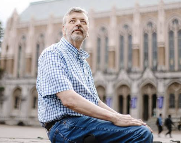
Or consider  Research Meteorologist Mark Albright, former Washington State Climatologist, who noted in 2007 on a listserv outside the UW that Washington State snowpack was not declining rapidly (we now know he was correct).  At that time, he was the Associate State climatologist, and was FIRED from his position at the UW, because it might encourage "climate skeptics."   Mr. Albright was a staff member in my group at the time, and I was pressured to fire him or take away his email privileges (which I did not do).

Finally, let me mention one of my own experiences.  In 2016, I was a strong supporter of a non-partisan initiative for a state carbon tax to discourage fossil fuel use, with the funds returned to state citizens (I-732).  Several climate activist groups opposed it because they wanted the cash.  Two years later, they proposed I-1632,  this time for a carbon tax in which they controlled the money to spend on their pet projects.  

I wrote a blog opposing their poorly conceived approach.   My department chair (a strong supporter of the initiative) and the College of the Environment Dean then encouraged the College's Dean of Diversity to write an email sent to my entire department noting the racist nature of my blog.   They were trying to suppress speech even OUTSIDE the UW.   Even worst, my department chair then invited the department to a "shaming session", where he and department activists called me all kinds of names.  A member of my faculty grew up in China:  she said it was exactly like the cultural revolution.

The UW should not be like this

I have other examples of UW's attempts to suppress freedom of expression, but the above will suffice for now.

UW Faculty Fight Back

 A growing group of faculty, from many departments and varied political viewpoints, is fighting back against the attempts to constrain speech and viewpoint diversity on the UW campus.  Many are members of the national, non-partisan group known as the Heterodox Academy (HxA), started by well-known social scientist Jonathan Haidt.    The UW HxA group has a very active listserv, local meetings, and a book discussion group.   It helped organize the successful effort against mandatory DEI statements for advancement.   If you are a UW faculty member, please join us (just join the national group or let me know).

A University in Fear Cannot Function

The UW has become highly politicized and there have been active attempts by UW administrators, some faculty, and a number of students to suppress viewpoints they don't like.  

A university cannot function when freedom of speech is suppressed and students/faculty are afraid to express their viewpoints.

And let's be clear:  many UW community members are afraid to frankly reveal and discuss their viewpoints on a range of topics.

Dozens of faculty and students have told me of their fears; even some members of the UW HxA group want to keep their association with HxA secret, fearful that their positions could be threatened.

The tools of fear are two-fold:  (1) fear of being criticized, attacked, or threatened for their views and (2) fear of being denied tenure, advancement, good grades, or academic opportunities.  The combination is powerful.


The UW Must Change Direction

The University of Washington is one of the leading universities in the world.  We can be proud of that.  But it will not retain this lofty position if freedom of expression continues to be undermined.

It is time for the leadership of the UW to make a clear commitment to free expression.

It is time to drop all political litmus tests, such as mandatory DEI statements. 

It is time for the huge, expensive, and problematic UW DEI bureaucracy to be dismantled.  Instead, the UW should treat each student and potential faculty/staff member as a valued, unique individual and not a representative of some group or special interest.

It is time to follow the law, both in letter and spirit. 

Federal law REQUIRES that public institutions protect freedom of speech.  And the Washington State Civil Rights Act,  enacted by the voters through Initiative 200 in November 1998, specifically prohibits racial and gender preferences by state and local government.

It is time for the UW to act upon the words of UW President Ana Mari Cauce:

"Speech by people we strenuously disagree with, and that is, in fact, hateful and repugnant, is the price we pay for democracy and to ensure our own freedom of speech. When we give the government the power to become the arbiter of what views are acceptable, then we have taken a step toward authoritarianism."

"Universities are by their very nature places for discussion and debate of controversial issues. These debates are absolutely critical to the educational experience and in developing citizens prepared to engage with democracy."

Whether you are a student, parent, staff member, faculty, donor, or state citizen, make your wishes known, both to the university and the Washington State legislature.

January 29, 2023

Why Does High Pressure Produce Low Clouds in the Pacific Northwest. Plus, the Latest Forecast

 My new podcast answers a question several have asked:  

Why Does High Pressure Produce Low Clouds over the Northwest?

Such a situation occurred this week, as illustrated by the satellite image on Tuesday afternoon below.  Puget Sound was socked in, as was the Willamette Valley.  Low clouds are also evident offshore.


High pressure promotes low clouds in several ways...all explained in the podcast.

My podcast also provides the weather forecast for this week:  a pretty benign situation.

Most notable will be the cool morning temperatures as a modified arctic air mass is over the region.  The lows this morning were in the 20s for western Washington and in the teens and single digits over eastern Washington (see below for minima on Sunday morning).


Even colder temperatures are expected tomorrow morning, followed by a slow warm-up on Tuesday through Thursday.

To listen to my podcast, use the link below or access it through your favorite podcast service.


Some major podcast servers:

 HTML tutorial HTML tutorial
Like the podcast? Support on Patreon 


January 26, 2023

Near-Record High Atmospheric Pressure Followed by the Big Chill

If you feel some pressure in your forehead today, there may be a cause.

Right now, the Northwest is experiencing unusually high atmospheric pressure.

In fact, the third highest pressure in the past 25 years, hitting around 1042 hPa, something shown by the plot of pressures at SeaTac below (the dashed red line shows the highest pressure observed yesterday).


This uber-high pressure has been suppressing water levels, resulting in the high tides at Seattle being far less than would have occurred under normal pressure (see below, red is observed, blue is predicted)


Later tonight and tomorrow morning, a front will move through, bringing some rain to the lowlands and snow to the mountains.   Nothing exceptional.

And then the chilly fun starts on Saturday.  That morning, cold air (purple and blue colors) will start moving in from the Northeast.


And by Sunday morning will have spread over the entire region.


The cold air will bring high sea level pressure and large pressure differences that will drive strong winds in and downstream of gaps in our terrain.  

As shown in the wind gust forecasts for Sunday morning, powerful northeasterly winds to push out of the Fraser River Valley into Northwest Washington, and downslope easterly winds will descend the Cascades from North Bend to Enumclaw, moving westward in and south of Sea-Tac.  Some bumpy landings can be expected.


And now I am going to disappoint some of you.  Virtually no lowland snow will accompany the cold air.  The set-up is just wrong.

Below is the accumulated snowfall through Sunday at 4 AM. 

Perhaps a few flakes between Portland and Chehalis, but other than that, all snow will be at higher elevations.   Good amounts in the Rockies.


Sunday and Monday mornings will be quite cold (in the mid-20s over the western lowlands), so disconnect hoses and keep your pets indoors.

January 24, 2023

Cold and Some Lowland Snow Arriving This Weekend

We have roughly another month remaining of meteorological winter, and mother nature will not be letting us transition to spring without another taste of cold and snow. 

The cold is for sure, including a hard freeze over the region.

The snow forecast is less confident--but it does look like either the Washington or Oregon western lowlands will see the flakes--the question is which one.

The movement of cold air into the Northwest has another implication:  substantial additional precipitation for a sodden California.

The Cold

For Wednesday and Thursday, a high-pressure ridge will dominate the region, producing cool, cloudy, but generally dry conditions (see upper level--500 hPa pressure level--map for Wednesday morning below).  

A benefit of the high pressure will be a suppression of the astronomical King Tides, minimizing flooding and tidal overflows.


But on Friday and Saturday, an upper-level trough will move south down the eastern flanks of the big ridge, pulling cold air from northern Canada into the interior of British Columbia and then into the Pacific Northwest. 

Here is the upper-level map for 7 PM Saturday.  You can see the offshore ridge of high pressure, but a significant rough is moving over our region.    

I have studied these snow situations for decades. This is not quite the right structure/position for major snow over the Washington lowlands, but close enough to worry.


Now let's look at the surface pressure chart for 7 PM Saturday, with colors showing the temperature just above the surface. Wow....I am going to get my gloves and wool hat ready! Purple and blue indicate cold air....cold enough to snow.

You will note a low center off the northern Oregon coast. Kind of weak, but with enough "juice" to bring snow to nearby locations. Too far south and weak to whiten Seattle....but a small error could change things.


By Sunday at 4 PM, uber-cold air will spread over the Northwest.  It will be important to get the homeless off the streets for Monday and Thursday morning.  Temperatures will drop well down into the 20s.  A hard freeze.


OK, you want to know about snow.  Below is the cumulative snowfall through Sunday night.
 
The Cascades get some and there will be lowland snow south of Tacoma and over SW Washington.


A small error in the forecast could greatly change the snow prediction....so keep tuned.


January 22, 2023

Atmospheric Pressure Explains a Wimpy King Tide Plus Cold Air Ahead

 In my podcast today, I spend the second segment talking in depth about atmospheric pressure.  That information is particularly important this week: 

A very large astronomical King Tide will be reduced considerably by much higher than normal atmospheric pressure.

Normal pressure at sea level is approximately 1013 hPa (hPa is the metric unit of pressure).

This week the pressure is forecast to be around 1030-1035 hPa! (see forecast below).

Such high pressure will reduce the high tide by roughly 7 inches.   As you can see below, the water level predictions (blue lines) are substantially less than observed (red lines).   This situation should continue for the next few days.


As described in the first part of the podcast, a weak front will move through on Monday morning, followed by a dry week.

But excitement will await next weekend, as very cold air moves over the region (see forecast of lower atmosphere temperatures and sea level pressure for 1 PM Sunday).   Blue colors are cold enough for snow.


Will there be lowlands snow over western Washington and Oregon?  Stay tuned...

To listen to my podcast, use the link below or access it through your favorite podcast service.


Some major podcast servers:

 HTML tutorial HTML tutorial
Like the podcast? Support on Patreon 


January 19, 2023

The California Drought is Over. Definitively.

After over a month of torrential rain and massive mountain snow, the drought is over in California.

Yet with all the liquid bounty, some in the media and elsewhere don't want to give up on it, as noted in the NY Times headline below.


And the U.S Drought Monitor has severe drought over much of the state.

I believe the evidence for the end of California drought is quite overwhelming. But consider the facts found below and decide for yourself.

Reservoirs and Snowpack

Let us start with the most critical measure of drought...the total water storage in the reservoirs plus the water that will be available from the snowpack (see below).

It is now WAY above normal.  

In fact, the total water available right now is greater than normally available in April after months of additional precipitation.

The previous deficit in California reservoir water storage is now gone.  For example, consider the huge Lake Orville Reservoir in northern CA" during the past month it went from roughly 60% of normal to 106%!  Wow.


Current snowpack, a critical water source for late spring, summer, and fall?

It is now over 200% of normal for all major Sierra regions...and nearly 300% for the south Sierra area.  Good skiing as well.
Soil Moisture and Rivers

The state has experienced flooding and highly saturated conditons from all the rain.   As you might expect, the soil moisture values arecurrently  very, very high (see below from NOAA National Integrated Drought Information System, NIDIS).  Green is above normal.  Dark green indicates the top 1% wettest period on record for the date.

Rivers around California are generally very high, with many running above the 90th percentile (top 10% flows for this period).

And the Palmer Drought Severity Index, which considers current and past precipitation plus temperatures, indicates wet conditions over the state.  No drought.

Making Up For Several Years of Precipitation Deficit

An important aspect of the massive amount of recent precipitation is that it has erased a multi-year deficit in precipitation.  Consider San Francisco, where the observed cumulative precipitation for the past two years is shown by green (and climatological variation indicated by the brown line)

For most of the past two years, San Fran has been behind normal precipitation, but the recent torrent has pushed it above normal!


A similar situation for Los Angeles.


But What About Lake Mead/Lake Powell and Ground Water?

The media has been fixated on Lake Mead/Lake Powell, whose water levels are both well below normal; both are fed by the Colorado River, not the Sierra Nevada reservoirs/snowpack  (see Colorado watershed below).   The water in these lakes supports water needs in southern CA and Arizona and provides electricity from Hoover Dam.


It is true that the water levels in the critical storage lakes/reservoirs (Mead and Powell) are dropping (see a plot for Lake Mead below).


But this decline is not from changes in meteorology/climate, but from increased usage to support a growing population and water-intensive agriculture.  You can see this by looking at the long-term trend in Colorado River Basin snowpack and water flow into Lake Mead (below).


Dropping groundwater levels in California are a similar story, with the largest drops during the past 20 years in agricultural areas of the southern Central Valley (see below).  We are mining too much sub-surface water to be sustainable.


The Bottom Line:   Much of California is a relatively arid, with little long-term trend in precipitation.  There is a reason that that Spanish did not move northward into California for two centuries:  the place was too dry for agriculture. Only a massive reservoir and water transportation system made a heavily populated state possible.

Much of California goes through natural periods of above and below normal precipitation, and we have just gone through such a cycle, moving from a few years of dry condition to a very wet winter.   

The recent meteorological drought is now over.  But California needs better long-term planning and infrastructure to sustainabley support the current and future pooulation and a huge agriculural industry.

 Blaming climate change as the primary cause for current problems and recent "drought" leads to not dealing with the real problems.

_________________________________
Annoucement:  I will have a special online zoom session for my Patreon supporters this Saturday at 10 AM.


January 17, 2023

A Superfront Will Reach the Northwest Coast on Wednesday Morning

Most weather fronts that reach the Northwest coast are generally wimpy.   

Only a slight change in temperature, a minor wind shift, and a modest change in humidity.  

Quite a contrast to the often strong fronts of the central and eastern U.S.

The reason for our generally unexceptional fronts is two-fold.

First, the fronts reaching our coast are generally aged, declining occluded fronts, compared to the prime, active fronts of the western Pacific.   Cyclones and fronts are driven by large temperature gradients  (changes of temperature over distance) and a strong jet stream, something that exists over the western Pacific, where cold air from Siberia meets the warm water of the Kuroshio current.  Not true off our coast.

Frontal Image Produced by Dall-E Machine Learning

Second, the temperature changes across our fronts are generally weak because they have traveled across thousands of miles of temperate ocean, which progressively warms the cold air following the fronts (see Pacific sea surface temperature below).   Temperature contrasts weaken as a front crosses the Pacific, and temperature contrasts, in turn, drive pressure and wind contrasts.  Thus, our fronts have unremarkable changes in these parameters.


The result:  wimpy fronts.

Tomorrow:   An Exceptional Front

But occasionally, conditions produce a strong, landfalling front on the Northwest coast and that will happen tomorrow (Wednesday) morning.  Let me show you.

A very strong front will reach the Northwest coast early next morning.

Below is the forecast radar image for 1 AM Wednesday morning.  You see the narrow, corrugated line off the coast (I put in a red arrow to help)?  That is the front.  Meteorologists call this a narrow cold frontal rainband, and it possesses intense precipitation and wind shifts.


Three hours later, the front will be on the coast (see below).


This front will be associated with a well-defined surface trough of low pressure and an abrupt shift in winds from southwesterly to northwesterly, as illustrated by the forecast sea level pressure and winds below at 1 AM.


The front will savage the coast and then be weakened on the lee (eastern) side of the Olympics, sparing Puget Sound the worst.

But Puget Sound will pay the piper later as strong winds push down the Strait creating another line of heavy rain and wind shift that will move into the Sound during the afternoon (see forecast radar image for 2 PM below).  A Puget Sound convergence zone will then set up around Seattle after that.


Why is this front going to be so strong?  Because an unusually strong slug of very cold air has been rapidly pushed southeastward out of Siberia and Alaska towards our region, drawn southward by a strong trough of low pressure.

Here is a forecast map of the temperature and winds Wednesday morning at around 10,000 ft (700 hPa pressure, blues and purples are the coldest temperatures).   You can really see the cold, arctic air pushing off our coast.  The Arctic will be paying us a visit!


The uber-cold air is evident in the visible satellite image this afternoon (below).  The mottled, pop-corn area indicates the cold air.


Interestingly, the temperature contrast with the front is stronger at 10,000 ft than at the surface--a real classic around here due to the moderating effects of the mild ocean waters.

Expect a wet/windy day tomorrow west of the  Cascade crest, with noticeably cooling temperatures.  I may not bike to the UW....

Should I Let AI Write My Blogs?

I spend a lot of time thinking about and writing my blogs.   Could AI apps do the work for me?   Could any of you tell the difference? Well,...