As advertised and fairly well predicted by the models, yesterday brought lots of rain, particularly in the mountains, and some notable winds. Looking at the 24 rainfall totals ending 10 PM Saturday (image), you will see some great contrasts. A few hundredths in southeast Washington to 4-5 inches in some of the terrain.
A closer view over western Washington reveals only a few hundredths of an inch in Sequim while more than 5 inches fell a few dozen miles away over the Olympics. 2-5 inches over the western slopes of the Cascades.
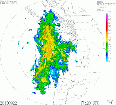
There were quite a few power outages yesterday (10-20 thousand out at the peak), mainly due to the strong winds associated with a powerful front that came through around 4-5 PM. The radar was impressive...a classic narrow cold frontal rain band (see line of red in the radar image below...red indicates downpour intensity).
The weather observations on the roof of the UW Atmospheric Sciences building shows the front well. The top panel presents the winds (sustained and gusts)..see the spike of high winds? Also nice wind shift and drop in temperature. Some locations had gusts to 35-45 mph.
The first storm can really knock down branches and trees. Lots of untested growth over the summer. If the ground is wet, trees fall more easily. And leaves on the trees allow the wind to be more effective.
So what about today? Showers are over western Washington and Oregon now (see radar at 9:45 AM) except for some rain shadowing in the lee of the Olympics
According to the latest run (that is why I waited until now for this blog!), rainfall will increase this afternoon, with healthy totals today as well (see 24 hr rainfall total predicted for the period ending 5 AM Monday). A number of mountain locations will get another 2-5 inches, with the heaviest amounts in central and southern Oregon.
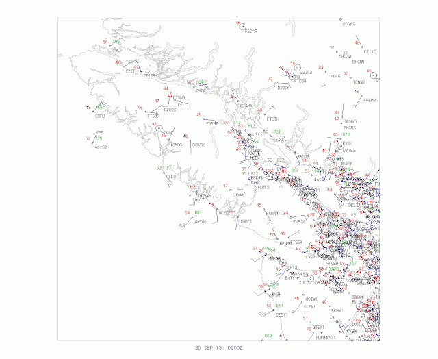
But the most interesting story will be the winds. Right now the winds over the region are gusting to 15-25 mph, with some higher gusts in exposed location. But the big issue is the rapid development of an intense low pressure system offshore. Most of the models indicate the rapid development of an intense, small scale low pressure center offshore that will make landfall on central Vancouver Island (see graphic). The center deepens to aboout 970 mb (hPa)....quite strong for anytime of the year. Huge pressure gradient over the offshore waters and along the coast.
The latest (10 AM) water vapor channel satellite image (tells us about the amount of water vapor in the upper troposphere), shows the developing system well, with dramatic darkening (drying) behind the system. The meteorologists in the crowd know what this implies: rapid deepening of the low.
Off of Vancouver Island there will probably be winds sustained at 40-55 mph with hurricane-force gusts. The UW WRF surface wind forecast at 5 PM (see below) shows sustained winds of 35-45 mph on our coast and a bit weaker winds over the Strait and NW Washington.
As the low moves past us to the north, winds will increase over Puget Sound and NW Washington. For example, at 11 PM tonight (Sunday) there will be a large north-south pressure difference over western Washington, aided by troughing (lowering of pressure) to the lee of the Olympics. A blustery night, particularly over NW Washington. There will be more power outages..so be prepared.
PS: A few of you have noted that NWS NAM model is far more threatening. However, the GFS and European Center Models are both going for the less threatening solution with landfall on central Vancouver Isl. That position, plus the small scale of this system, is the basis for my forecast.


 .
.


