This blog discusses current weather, weather prediction, climate issues, and current events
February 28, 2009
Warm Front
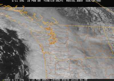
You see the increasing clouds aloft...these are associated with an approaching warm front aloft...one associated with a vigorous offshore system (see sat pic). But that system..and its strong winds will not make landfall in the NW and strong winds will not reach our interior.
With low pressure offshore and high pressure inland, strong offshore (easterly) flow has developed west of the Cascades. So I would expect breezy conditions as one approaches the passes today--on I90 east of North Bend. The Seattle profiler shows the easterlies aloft...and such flow often produces warm temperature over the lowlands...so I expect temps in Seattle to surge into the 50s today.
The precipitation should hold off until this evening...so today should be a fine one, expect for some high and middle clouds. Then tomorrow we will see considerable clouds and some showers...and mild temps on the south side of the warm front (50s).
The weather pattern this week is a familar one..with a major low/trough over the Pacific (see sample upper level chart on Sunday). Low centers will spin up the coast offshore and most of the precipitation will head into California..where they need it. A boring collection of clouds and showers for us through Wednesday, after which the models indicate the chance of a cool down again. But I will wait before talking about that...
PS: For those interesting, I will be on KCTS on Sunday at 7 PM, answering weather questions (see link at right). Also I wanted to note the NW weather workshop on March 20-21st for those interested...it is open to all, but you should register in advance--but this does include technical talks (see link to right).
February 26, 2009
Good News
Some news:
(1) The Camano radar was fixed ...but unfortunately broke down again. Lets face it, this radar really doesn't break down very much..considering the constant rotation and movement of the antenna and the high-powered electronics.
(2) I had a nice talk with METRO technical and management people today. They promised that they are going to replace the servers of the bus track information system and this problem, which inconveniences hundreds or thousands of us unnecessarily.
(3) I learned yesterday, that partial support for a new coastal radar is in the 2009 Omnibus legislation (that has yet to pass). Thanks go out to Senator Maria Cantwell, who has spearheaded this. I have also heard from Senator Murray's office, which is also supportive. We aren't there yet, but we are making progress. So please keep letting your representatives know that this radar is needed. Today and yesterday convinced me more than ever of the importance of the coastal radar. Not having our own radar really made forecasting and understanding the weather difficult. I could not imagine being without it permanently...the current situation to our fellow citizens along the coast.
(4) The mountains have gotten a decent amount (roughly a foot) during the last week..which should make skiing far more palatable.
Tomorrow should be dry and the next weather feature will be a weak warm front late Saturday afternoon.
Snow Blindness
It is really frustrating to be meteorologically blind--with the NWS radar covering western WA out of commission. It makes it hard to understand what is happening and to diagnose the situation--something those living on the coast have to deal with all the time.
There was quite a bit of snow yesterday and last night, depending on where you are, and the amounts were very variable. The two biggest snow dumps in the lowlands were near Bellingham and NE of the Olympics (Port Angeles to Sequim), where some locations received up to 10 inches or so. Bellingham has the Fraser outflow, with air accelerating SW as the trough of low pressure moved through yesterday. As air flowed around the low it rose up over the Fraser outflow giving snow. Later as the low moved south the Fraser outflow pushed southward toward the Olympic peninsula...rising on the terrain and causing snow on its NE flanks and adjacent areas (even the usual dry spot Sequim---see image for surface chart at 2AM).
There were some snow showers last night over Puget Sound, and they dropped very variable amounts of snow..something that is evident on the DOT cams. Some places have only a dusting, while others...like in central Puget Sound from Seattle to Bellevue...received 2-4 inches. I have three on the ground in my home in NE Seattle.
The KING-5 radar (which is running in degraded mode) shows some showers over Puget Sound producing a few light snow showers and the 6 AM observation revealed weak convergence over the south (northerly wind on north side, SW winds to the south) that is helping to maintain them. These showers should weaken over the next few hours and skies should begin to open up. The first decent visible satellite picture is now available (see attached)..and you can make out the clouds and shower over Puget Sound and clearing to the north and south. The coast is clear and sunny. Anyway, the worst (and for some the best) is over.
NOTE: Metro's Bus Tracker software AGAIN is overwhelmed and not functioning during a snow event. After everyone complained in December. Someone really needs to be relieved of duty in Metro's IT department and those in Metro that oversee this important application. When we most need to see where the buses are, the system fails. Just incompetence.
February 25, 2009
Update
The worst is probably over now for most..particularly those living near Bellingham. The air is now cold enough for snow throughout the region (see temps from profiler over Seattle). The band I was worried about it my afternoon note has moved through central and northwest Washington and we have a few showers remaining...but nothing serious. The latest snow total forecast map ending 4 PM tomorrow is attached --indicating the rainshadowing (or snow shadowing of central Puget Sound), with SW and NW Washington getting most of the action. Fraser River outflow is still occurring, with cold air exiting the gap, and strong NE winds gusting to around 30 mph. The perfect place to send that Foreman-guy from KING TV...the one that is always in the big parka.
Anyway, there will be a few snowshower now, but no serious accumulation...and then things will dry out tomorrow.
Snow in Bellingham and Elsewhere
The cold front has moved through and cooler air is now spreading over western Washington. Northeasterly winds have pushed through the Fraser River Valley and associated cooler, drier air has made its way into Bellingham and vicinity. Cold enough that snow is occurring at Bellingham Airport. (Look at the attached figure showing observations at Bellingham..time is in UTC (GMT). You can see the change from rain to snow and falling temps as the wind shifted to the NE.
Snow is also falling at Quillayute on the coast. Right now it is still to warm for snow over Puget Sound, but that will change by this evening. A big problem is that the NWS weather radar at Camano Island is down and won't be back up until tomorrow at the earliest...thus, we are somewhat blind to local precipitation details. The KING 5 radar is up and available on their web site.
The million dollar question is lowland snow. The temperatures will be cold enough for snow everywhere by this evening. The only question is moisture. The problem for snow lovers is the things will dry out tomorrow morning after the upper trough over us now noves through. The winds approaching the coast are now southwesterly...leaving much of the central sound rain shadowed right now, with the convergence zone over Whidbey Island into Bellingham (see Canadian radar image). So at this point the focus of snow will be north of Everett...and later as the trough and associated low moves south tomorrow the focus of the snow will be south of Olympia. There could be some snow showers around Seattle, but no more than an inch. And lots of snow in the mountains. The 24-h snow forecast from the high resolution model is attached.
I really wish I had a coastal radar now to see more into a band that is now making landfall.. perhaps in the future.
February 24, 2009
Uncertain Snow in Seattle
Not an easy forecast. A cold front will move through tomorrow...bringing rain showers with its passage. Temperatures will cool behind it, and by later tomorrow evening the air mass will be cold enough for lowland snow, particularly where there is significant precipitation . The problem is that Puget Sound will be at least partially rain shadowed (or snow shadowed in this case). There doesn't seem to be much evidence of a convergence zone developing over the central Sound. Another issue is that there really won't be that much precipitation in the cold NW flow.Clearly, there will be far higher chances of snow showers south of Olympia and over NW Washington.
So to summarize...frontal passage tomorrow with some rain. Show showers later tomorrow evening and Thursday morning, not amounting to much over Puget Sound, but perhaps dropping an inch or two in some locations south of Olympia and north of Everett. Not a big deal, really. But we need to watch the model run tomorrow...if the flow was more westerly, allowing a convergence zone to form over the central Sound, it could be more interesting.
More SNOW?!&%$
There has been some hyping of wind in some media outlets...it will get breezy as low pressure moves north of us this afternoon...perhaps 15-20 mph sustained for a few hours in well-exposed locations, but no windstorm. The showers we have been getting has produced significant snow in the mountains (see image), and this will continue the remainder of the week. FINALLY, we are starting to rebuild the snowpack...and I expected 1-2 feet snowfall at pass level and above by Friday. So grease your skis now.
But I did want to note the threat of snow showers in the lowlands on Thursday...something the National Weather Service hasn't mentioned yet. I cold front will move trough around dinner time on Wednesday, bringing in much colder air (see image, sea-level pressure--solid lines, colors are temperature, blue and purple are coldest). A upper trough will move through behind the cold front providing upward motion. A surface low associated with it, is heading towards the snow "sweet spot" off of SW Washington, and a Puget Sound convergence zone may for Thursday morning (graphic). There should be some cold air moving SW through the Fraser River Valley. Finally, this mornings high resolution run is showing snow reaching the surface Thursday morning (graphic--which shows 24-h snow ending 4 PM Thursday) . There is substantial uncertainty...and considering the time of the year and marginal temperatures, we are on the edge of this, but there is a significant chance (perhaps as high as 50-60%) that some snow showers with some accumulation could occur on Thursday AM. So I hope our friends in Metro and various DOTs are keeping a sharp eye on this!
Finally, let me note I will be at Town Hall tomorrow night (Wed) at 7:30 PM talking about the science of local weather prediction. And at the same time Knute Berger will be talking in another room at the same venue about his book "Pugetopolis"--which includes "weather wimps" in the title.
PS: There have been several snow events during the last few days of Feb, first week of March. But if we don't get it then, the probably drops precipitously the second week of the month.
February 23, 2009
The Coastal Radar
The KIRO newspecial tonight hit the radar issue hard. It really is time we get this done. Virtually all sectors of the community agree..from the environmentalists, to the timber industry, to fishers, to the Port of Gray's harbor, to meteorologists, and almost everyone in between. The expense, although significant--4-10 million--is dwarfed by the costs of a single major storm or the savings--both in safety and economic--that the radar would allow. This is key infrastructure and it is shovel ready. NOAA is being given $600 million for infrastructure enhancements...surely this project deserves support from that. Senator Cantwell and Murry are supportive. Gary Locke, who will head the Dept of Commerce, surely knows why this hardwae is needed.
If you want to help, please contact our Senators and your local congressmperson....asking them to make this happen this year. Ted Buehner, the Warning Coordination Meteorologists at the Seattle NWS office, made the case better than I could on the KIRO show....this radar will save lives and property. It is outrageous that the wettest, most storm coastal area of the continental U.S. is the only location without a coastal radar. And for those of you who love weather...imagine being able to see the details of storms as they approach the coast!
Coming in faster
The band of precipitation is moving through now...and should be through by dinner time for most of the lowlands. About 3-6h faster than the model's indicated yesterday. Such timing errors are not unusual, unfortunately. Lack of detailed observations offshore is a major contributor to these errors. Another reason why we need a coastal radar.
February 22, 2009
Tomorrow
Well, it looks like we will have a break in the weather tomorrow morning and afternoon, but later in the day the next system will start moving in (see the satellite picture). You see that swirling cloud mass off of California? That's it.
I show these picture a lot..so a word of explanation. This is an infrared satellite image taken by a geostationary satellite 35000 km above the surface. We get these pictures every 15 minutes. These satellite look at the earth in wavelength that the atmosphere is transparent (an atmospheric "window" in the biz). Basically, it is measuring temperatures...white indicates cool and dark indicates warm. Since temperature generally decreases with height, these images can tell us how how clouds are. And infrared pictures are available 24-h a day, unlike the visible imagery. These satellite pictures are the reasons why we always know where the big storms are now..compared to 50 years ago. In fact, the first weather satellite was launched in 1960...TIROS 1.
One of the major things I teach my students is how to be expert interpreters of such imagery...a key skill of a meteorologist. Humans are really excellent at pattern recognition, so after a few classes they gain quite a bit of skill. A frustration at time is to watch the occasional inexperienced TV weathercaster who points at the wrong thing on these images...generally one of the weekend folks. But I better stop before I get into trouble!
PS: Remember the KIRO TV weather special tomorrow night at 7 PM on the big December storm! I taped a segment on the coastal radar for it...we will see whether it made the cut.
A break
It is nearly impossible to time accurately the passage of rainfall bands accurately the day before..so it is time for what we call a "nowcast" in the business.
A band of precipitation is now moving through the central sound (see satellite and radar imagery at about 9 AM). The implication...there should be a major break this morning and early afternoon...so it will be a good time to get out there for recreation or gardening. Nothing really organized behind it...so this should be a decent afternoon. I will be heading to the NW Flower and Garden show at n0on to sign books....so I will have to hit my garden later...
February 21, 2009
Uncertainty II
Several of you have asked about forecast uncertainty...something I started to discuss yesterday.
The truth is that all forecasts are uncertain. That uncertainty increases in time. The amount of uncertainty varies by weather situation. Sometimes even a 3-4 day forecast is highly uncertain (like yesterday),while other times there is substantial forecast skill out 7-8 days. The fact that TV stations (and even the NWS) usually give single numbers for forecasts...particularly long-range ones is really crazy...we just don't have that kind of precision and skill. Forecasts are essentially probabilistic...and should be communicated that way. We should not forecast the temperature will be 64 in three days, but rather give the probabilities of various ranges.
This is a very active area of research and development right now...and the key tools are ensembles of forecasts. The old way is to run one computer simulation of the future and use that to provide a single potential weather evolution and single forecast numbers. Now we have much more computer power we can run many forecasts, each with a slightly different (but reasonable) starting condition or with somewhat different model physics (e.g., how clouds form). The forecasts will be different and the differences will generally increase in time. When the forecasts are very similar...then uncertainty is low, and vice versa. You can get probabilities from them as well. If half the simulations give rain and the rest do not...then a 50% chance of rain is reasonable (we have much more sophisticated ways of doing this, but it will serve as an example).
The NWS has several ensemble systems, as do we at the UW.
They are actively used to determine how uncertain the forecasts are and to understand the range of possibilities. We are now trying to develop the techniques to provide high-quality uncertainty/probabilistic information from the ensembles. In five years we should have reliable forecasts of this kind. But then there is the next problem....how do we communicate the information? Are people ready for such guidance? Are you ready for it?
Regarding today's forecast...lots of low clouds in eastern WA, but generaly sunny elsewhere. High clouds are moving in overhead as a system approaches from from the SW (see images). Tomorrow we will have considerable clouds and showers. And that will be the character of the upcoming week...with the mountains finally getting a modest amount of snow (particularly midweek). From my viewing of the ensembles, there appears to be very little likelihood of lowland snow...one of the reasons I was discouraging such talk from those looking at long-term forecasts.
I will be at the NW Flower and Garden Show in Seattle tomorrow at noon if anyone want to talk in person. And don't forget the KIRO weather special at 7 PM on Monday...it should be good.
February 19, 2009
Uncertainty
I often warn about taking long-range forecasts (beyond 5 days) too seriously...particularly when we talk about snow. Today is a good example where even 3 day forecasts are very, very uncertain. Attached are the 500 mb upper level charts for 3 days out...from the National Weather Service GFS and NAM models (the top two models used by my colleagues in the NWS). They are radically different--much more so than we usually see. What does that tell us...very substantial uncertainty. If 3 days out is uncertain, what do you think is the case for the 7-10 snow events some are talking about? The GFS model usually is the best...but this is the kind of situation that really reduces my confidence.
Meteorologists have a powerful tool for assessing uncertainty ...ensembles collections of many model runs. We run an ensemble system at the UW and it shows major differences between the solutions from modeling centers around the world. Attached is a graphic showing the differences in 500 mb heights (think of it as pressure in the middle troposphere). The yellow and brown colors indicate very major differences in the 72 hr forecasts of the ensemble members...indicating large uncertainty. It can be intoxicating to view the long-range forecasts and think about what they imply. But you need to understand the uncertainty that exists. Furthermore, the uncertainty varies by situation--and understanding that uncertainty and how to estimate it is the difference between my skilled colleagues in the NWS and people who simply look at the model output.
PS: Will be signing books at the garden show in seattle at noon on Sunday...
Weather Special on Monday Night on KIRO TV
For all you weather lovers, KIRO will have an hour long special on Monday night on the December 2007 storm. The info link with a short clip is below. It is a bit scary...so if you are faint of heart weatherwise, don't view it...cliff
http://www.kirotv.com/station/18725264/detail.html
February 18, 2009
Spring...and then the return of rain
The models are all in agreement that the next three days should be mild and sunny, with some high clouds invading on late Saturday. Highs in the mid 50s will be widespread, as they were today. The sun is clearly higher in the skies and the days are perceptibly longer. The big transition is on Sunday, when the protective ridge will give way to moderate southwesterly flow and cooler, cloudy conditions, as well as certain rain. This pattern will continue through the week...I have attached a few upper level charts that show the new flow pattern clearly (for Sunday and Monday afternoon). Note how the protective ridge has moved inland and a series of troughs are making their way towards us in the SW flow. With moist flow and falling freezing levels, the mountains will start getting snow again, and it looks like there should be at least a foot over the entire week.
The latest prediction by the National Weather Service's Climatic Prediction Center is for cooler and wetter than normal conditions over the next month. Sounds like a La Nina forecast to me.
February 17, 2009
Finally, Spring is coming
Most years there is a transition after Feb. 15th that makes one realize that Seattle winter is over. When thoughts trend to the garden center, rather than the ski slopes. And for us, this shift will occur on Thursday through Saturday of this week. It is clear now that with the low developing offshore, southeasterly flow will bring warm air from the south and descent off the mountains. Temperatures will climb to between 55 and 60 over most of the lowlands, with Saturday probably being the warmest day over the Puget Sound lowlands. Some locations will be even warmer (low sixties...such as the Oregon coast and in the immediate lee of the Cascades. Just to give you a taste, I have attached surface temperatures from our regional model (12-km WRF), which shows the story. One image is for 2 PM on Friday, the other for 1 PM on Saturday.
On Sunday our luck runs out and showers and clouds move back in. But after the warmth, it won't seem the same. My grass is already growing.
If any of you are going to the garden show on Sunday, I will be there at the University Book Store area from 12 to 3 PM.
On Sunday our luck runs out and showers and clouds move back in. But after the warmth, it won't seem the same. My grass is already growing.
If any of you are going to the garden show on Sunday, I will be there at the University Book Store area from 12 to 3 PM.
February 16, 2009
Cloudy East, Sunny West
If you needed proof that western Washington can be sunnier than eastern Washington in the winter...today is a good example. Look at the latest satellite picture. The east side is covered in low clouds, which are pushing into the Cascade passes (sorry, lots of clouds at the ski resorts in the pass). West of the crest, there is sun in many locations...with the south Sound still in fog and low clouds and the remainder of yesterday clouds/rain over NW Washington (see radar). But both of these locations should improve during the day with sun reaching most of western Washington. The real weather is to the south over Oregon and particularly California...where heavy rain and strong winds are hitting.
The rest of the week....more of the same for us. The upper pattern is absolutely amazing...with a very deep low center over the eastern Pacific...this is quite unusual.
February 15, 2009
When lack of weather is unusual
We are now in the midst of a fairly unusual weather situation...an extended midwinter drought extending well over a month (see figure..red is this year, blue is climo average). And it is not over yet. But lets be clear...such droughts have occurred before and some worst then this year's. If you are really careful about picking period--mid January to mid-February--this is the driest year on record...but that really is artificial. If you started two week earlier, the heavy precipitation in early January would be included and we would be far from a record (an example of how one can.
The persistent upper level flow with a ridge offshore and a trough over the western U.S. (see figure) is predicted to persist, both by the National Weather Service GFS forecast, a collection (ensemble) of such forecasts, and the forecasts of other forecasting centers. We should have a dry week with partial sun in the lowlands, with little snow accumulation over the mountains. The latest snowpack observations indicates that some locations in the north Cascades and the Okanogan have dropped to roughly two-thirds of normal (figure).
Today, the situation will be very different in the northern and southern portion of the state. The southern half is in clouds associated with a weak ban associated with the low to the south (image). Light rain has made its way up as far north as the Portland metro area, while Seattle and north are sunny. This band should slowly move north as it dissipates . Light showers could move into southern WA...but I don't expect it to move further northward (see forecast for 4 PM this afternoon).
And there is some good news for weather watchers. A key weather observing station that had been offline...Stampede Pass at 4000 ft in the mountains--is back online. It provides the most high quality observations in the mountains..so many of us missed it.
Finally, let me note my talk on the 25th at Town Hall....it will be a comprehensive review of what we have learned about forecasting NW weather...a link about the talk is found to the right.
February 14, 2009
Saturday
As you can see from the latest satellite picture, we have a mixed field of cloud and some break over the region, with a few scattered showers (see images). The real action is going into CA and in the picture you can see a well-defined cyclone, with strong fronts heading towards the northern portion of that state. Temperatures are generally in the mid-40s over the lowlands. No real change in that today. There is a decent pressure difference across the Fraser River Valley and some gap flow is moving SE from it into Bellingham. The surface wind field shows (see image)...and the generally light winds over the area. This dull, cool weather is our fate for a while.
Several of you have been commenting on the long range forecasts by the GFS (Global Forecast System) model. This is a numerical weather forecasting model that is run over the entire globe and is run by the National Weather Service. Be careful after taking its predictions too seriously past 5 days out...the skill is really minimal at one gets to 7 days and beyond...particularly for cold waves.
Finally, there has been all kinds of scary global warming articles in the paper based on the release by the UW Climate Impacts Group of their analyses of future climate of the region over the next century. There are some very good people in CIG but there is a decided tendency to overstate the local implications of global warming. And the media sometimes exaggerates things further (if you want evidence of this, check out the over-the-top article in the PI on the climate refugees that will be flocking here -http://seattlepi.nwsource.com/local/399958_climate13.html- Perhaps in a future post I will tell you more about this.
February 13, 2009
The Weekend
This is going to be a benign weekend with little weather action. We are in a pattern where the storms are deflected towards California and we get some weak cloud bands on their northern side. Today is a case in point....with the visible satellite picture showing the situation (see image). This morning the Cascades were really clear due to easterly flow sinking along the western slopes of the mountains (easterly flow causes drying of the air as it descends). There were also lots of mountain wave clouds.
So in the lowlands there should be temps in the mid to upper 40s for the weekend, with partial sun. The mountains will get some occasional snow showers (mainly late Sunday, nothing heavy), with periods of intermittent sun. The snowpack is a stable hardpack now...and plenty icy. I was going to go cross country skiing...but may wait until better conditions occur. The rest of the week looks like more of the same.
The silver lining? California will get the precipitation they really need.
February 11, 2009
The Drought
This morning there was considerable black ice as the wet roadways froze after the skies cleared.
Most of the Puget Sound lowlands and the Cascades have been in a virtual drought the past month, as most of you are are. The precipitation trace at Sea-Tac shows the story (see image). The precipitation of the last day didn't change the story much...except for locations like Shelton near the SE side of the Olympics. The snowpack is rapidly declining to well below normal...and this is a La Nina year when snowpacks are typically above normal! But what is really disturbing for weather lovers is the latest long range weather model forecasts that show the dry conditions continuing for the next week. The West Coast is stuck in a major large-scale trough, with the jet stream and most of the weather going into Oregon and California (image). We are generally left high and dry. But this is all very good news for a drought-stricken California.
Very little new snow in the Washington Cascades for the next week. The snowpack, which generally peaks around March 15, has time to recover, assuming the pattern changes, but winter in the lowlands has only about another week or so to run. Typically, the chance of major storms and floods declines rapidly after the third week of the month.
The good side...lots of sun today.
February 10, 2009
Showtime
The major act of this play is now beginning. So far the models have done a splendid job. As predicted southeasterly flow developed, with downslope on the western slopes of the Cascades causing drying and upslope on the SW of Olympics forcing some moderate to heavy snow. Look at the radar...you can see the large gradient of precipitation and the heavy snow over the Kitsap. Shelton is reporting very heavy snow right now...and one of our correspondents has 4 " on the ground near the Hood Canal at 500 ft. And they are going to get a lot more.
The main front is now making landfall (see high res satellite picture). As a result, precipitation intensities will increase over the interior of western Washington--and it has been snowing along the coast all morning from it. The big question is temperature...can they stay low enough to maintain the snow and for how long--since temperatures will be increasing aloft due to the warm front. Some insight into the temp structure aloft is available from the Seattle profiler (see image). When you look at the temperatures, subtract 1C...since it is showing something slightly different than temperature (virtual temperature). The freezing level has risen to about 400 meters (1300 ft), with a snow level of roughly 300 ft. But that will come down quickly when real precipitation starts. In fact, snow has already begun in earnest at Olympia (see image), with light snow spread to Sea Tac. Fortunately, the temps are above freezing and the roads are relatively warm...so the snow should not stick well on busy hiways.
Snow
We are going to see snow today in the western Washington lowlands. The Pacific warm front is now moving in and precipitation is now entering the western Puget Sound lowlands (see radar). Central and north coast stations are now reporting snow as is Shelton. The air mass in place is cold enough to support snow, as indicated by the latest profiler data (see graphic). Offshore flow has not developed yet, and without it, the drying and warming that would have lessened the snow threat over the eastern Sound will not be in place. However, SE flow should develop as the system approaches, producing a large E-W snow gradient across the Sound..lighter on the Cascade western slopes and heavier towards the Olympics. Between now and 9 AM the snow shield should progressively move into area. SW Washington will also see light snow (up to a few inches).
The big question is how fast the temperatures will warm up aloft and whether the precipitation will be heavy enough to delay the transition to rain into the afternoon.
February 09, 2009
Tomorrow's Snow
The convergence zone is still evident at 8 PM, but appears to be weakening. It should fade out this evening. The latest winds really show the convergence...take a look at the dense winds over the Sound from the Washington State Ferries....very dramatic difference in direction over the waters between the Vashon Is and Bainbridge ferries.
The offshore weather system is now approaching (see image). The UW flagship model (WRF-GFS) indicates that the precipitation should reach the Sound between 7 and 10 AM. The model suggests that the Kitsap and lower Hood Canal area..the zone immediately SE of the Olympics..is going to get hit by substantial snow (see 24hr snowfall ending 4 PM). Six inches or more are possible..with higher amounts closer to the Olympics. Snow in the mountains and over SW Washington, and even NW Washington gets a piece of the action. Looking at other model diagnostics that show the snow distribution with height, I suspect that some snow will reach the surface even over the eastern side of the Sound...but will be the wet, melting variety . There will be considerable precipitation over the whole area....so where there is no snow there will be rain. Temperatures should warm up aloft by mid-afternoon..which will contribute to a change to rain after lunch in most areas away from the Olympics.
What worries me about this situation is that the temperatures are right on the margin..it would not take much of an error for there to be substantial snowfall over Seattle during the morning. So those of you who are responsible for public safety and the roads need to be prepared for plan b if more snow does hit.
7 PM Update
As per the earlier forecast, a new Puget Sound convergence zone has formed over north Seattle. There are heavy showers, some with small hail pellets, and even some lightning (my dog is in hiding now). The radar shows this well (image) as does the surface chart (image). Temperatures are a little warm for snow in most locations, but in the most intense areas, wet snow could reach the surface. And strong thunderstorms can produce lots of soft hail, ice pellets, or graupel that can turn the ground white anyway.
Subscribe to:
Posts (Atom)
Update on the Windstorm and Power Outages
The most recent model forecasts are shifting the low center towards us, illustrated by the animation below. This means more pressure diffe...
-
Mother Nature seems to have forgotten about the current strong El Nino and the record warmth of the past month. Massive snow will fall over ...
-
The latest model forecasts are consistent: an unusually powerful storm with extreme low pressure will develop rapidly offshore on Monday a...