We have roughly another month remaining of meteorological winter, and mother nature will not be letting us transition to spring without another taste of cold and snow.
The cold is for sure, including a hard freeze over the region.
The snow forecast is less confident--but it does look like either the Washington or Oregon western lowlands will see the flakes--the question is which one.
The movement of cold air into the Northwest has another implication: substantial additional precipitation for a sodden California.
The Cold
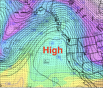
For Wednesday and Thursday, a high-pressure ridge will dominate the region, producing cool, cloudy, but generally dry conditions (see upper level--500 hPa pressure level--map for Wednesday morning below).
A benefit of the high pressure will be a suppression of the astronomical King Tides, minimizing flooding and tidal overflows.
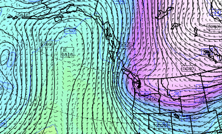
But on Friday and Saturday, an upper-level trough will move south down the eastern flanks of the big ridge, pulling cold air from northern Canada into the interior of British Columbia and then into the Pacific Northwest.
Here is the upper-level map for 7 PM Saturday. You can see the offshore ridge of high pressure, but a significant rough is moving over our region.
I have studied these snow situations for decades. This is not quite the right structure/position for major snow over the Washington lowlands, but close enough to worry.
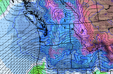
You will note a low center off the northern Oregon coast. Kind of weak, but with enough "juice" to bring snow to nearby locations. Too far south and weak to whiten Seattle....but a small error could change things.


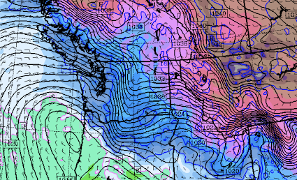
The barometric pressure is quite high this evening - 30.64inHg/1037.5mb at the moment. BLI and environs have received ~0.10" of precip today - rather unusual to see measurable precip co-occurring with such high pressure.
ReplyDeleteCurrently driving from Kansas to Seattle, will be keeping an eye on your blog. Still deciding whether to take 90 or 84 or just skip around south if things get too rough(I fortunately have plenty of time). Will appreciate updates!
ReplyDeleteWhat I want to know is will we have any clear skies from now till the end of the month to view the comet?
ReplyDeleteSunday night looks like the best opportunity to view the comet. It should be pretty clear, but this isn't a bright comet. You'll probably need binoculars to spot it if there any light pollution. The moon will be in its first quarter and contributing a moderate amount of light.
DeleteBarometer remarkably high today - 30.75inHg/1041.4mb at BLI as of this writing (>99.5%ile); and again with measurable precip! The Quillayute sounding from early this morning measured a new daily record max 850mb height at 1619m (the daily mean is 1449m).
ReplyDeleteMany moons ago when I was much younger than I am today, some friends and I took our snowmobiles to Yellowstone National Park in mid-December 1973 and managed to catch a good view of Comet Kohoutek in the night sky.
ReplyDeleteWe got a much better view of the comet than most people could get at the time -- no light pollution in the night sky and the nighttime temperature was minus 42 F.
After nightfall, on the way back to West Yellowstone from Old Faithful, an array of bright green dots suddenly appeared ahead of us in the dark.
We slowed to a stop as quickly as we could and just managed to avoid the buffalo herd which was then crossing the road.
I see the 'big' 3 are diverging sharply on Bremerton lows. Underground showing barely below freezing, Weather Channel 25, and Accuweather 19. I will check again before bedtime, I have one tender potted plant that 19 would not be good to!
ReplyDelete