Tomorrow will not feel like late May, with a winter-like Pacific weather system making landfall, bringing lots of rain, wind, and cool temperatures.
The latest infrared satellite image shows a potent weather system moving in from the Northwest; it will arrive around daybreak tomorrow.

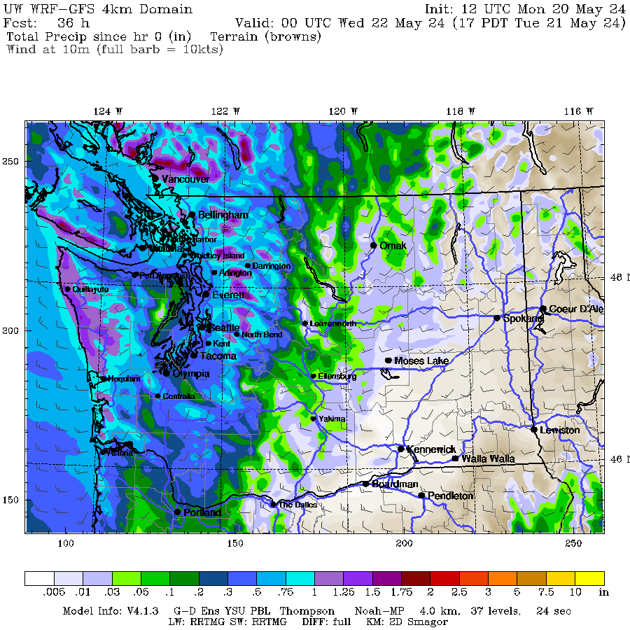
The whole day should be cloudy and damp. Here is the predicted accumulated precipitation by 5 PM. The entire western side of the region will enjoy several tenths of an inch, with over an inch in the mountains. Not a good hike day.
The rain will continue into Wednesday, with the total accumulation through 5 PM reaching impressive levels (2-4 inches) in the mountains.
.gif)
Consider the Snoqualmie River at Carnation. The latest National Weather Service forecast is for a rapid rise to near historical maximum levels before falling back to near normal (below).


I suspect May precipitation totals will end up near normal by the end of this event for most stations, making up for the dry period earlier this month. And the good wetting will help fill reservoirs, reduce water use, and push the fire season out in time.
All and all good news. Except for tomato plants. 😆


Non-native plants seem to be having a hard time, not so grass, including Cheatgrass. I suggest a major initiative to reduce ignition. East of the Crest was beginning to dry. Most ignitions have a human factor. One study claimed >80%.
ReplyDeleteNot to mention some cold overnight lows. I woke up Sunday and my outdoor thermometer read 42 degrees!
ReplyDeleteThis seems like a cold atmospheric river. BLI has already set a new daily max precip record with plenty more on the way. This event appears to have the potential to produce one of the wettest May days on record at that location to mention nothing of the very cold daily maximum temperature which may tie with the daily record set in 1964.
ReplyDeleteYes, I wish it were a warm atmospheric river like the one that brought us the thunderstorms in May 2017.
ReplyDeleteHoping this is a sign of summer pattern with cooler than normal summer. I am glad only 30 days until days start getting shorter. Going to be great camping weekend , able to enjoy campfire all day not too hot and keep bug activity at minimum. Am sure the burn bans will follow soon after this weekend earlier than needed.
ReplyDeleteNo kidding. I've got tomato plants I thought would be outside a couple of weeks ago growing into leggy monsters four feet high under lights.
ReplyDeleteDefinition of a Seattle optimist: Plants Tomatoes before June 1st.
ReplyDelete1.23 inches in my lake stevens yard
ReplyDelete