The latest model output supports the threat of serious snow tonight for our region.
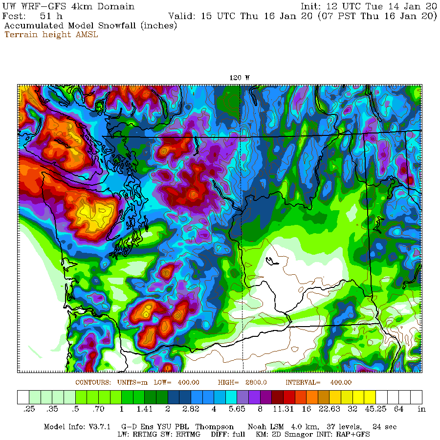
The UW's highest resolution forecast model shows substantial regional variations, with the heaviest lowland snow from Seattle northward, with far less over Tacoma. But there is uncertainty on the exact location of the snow band...so keep that in mind. Seattle will face 2-5 inches if this forecast is correct. Road temperatures are now near freezing...so this is going to stick in places where SDOT and WSDOT have not pretreated or where plows are not active.
The very latest NOAA/NWS HRRR forecast (made hourly!) has a similar pattern but only about 1-2 inches over Seattle (see below). This even does not have the strength to give us mega snow event (8 inches plus, but it will be more than few days ago for many.
The official National Weather Service totals is for 2-3 inches over Seattle, which is quite reasonable.
This blog discusses current weather, weather prediction, climate issues, and current events
January 14, 2020
Another Snow Event Tonight
An unusual weather system is approaching Washington and the models are suggesting a significant snow event tonight, with the potential for more snow than Sunday around Seattle. But uncertainty is substantial.
The feature of interest is a trough offshore (area of low pressure, indicated by the white oval) in a forecast of sea level pressure (black lines) for 4 PM today. The colors are low-level temperatures, with blue and purple showing air cold enough to snow.
The latest infrared satellite image shows the feature. Not very impressive-- would not call my mother about it.
But the models are putting down substantial snow with it: 2-5 inches in places.
For example, the latest NOAA/NWS high-resolution rapid refresh modeling system (HRRR), brings the leading edge of the snow into the Olympic Peninsula by 7 PM.
With a strong snow band over central Puget Sound by 10 PM tonight.
The latest UW model forecast for snow accumulation through 7 AM Wednesday is a bit different, with 2-5 inches from Seattle northward and huge amounts of snow in the Olympics.
The vaunted European Center model is similar to the UW prediction, with less snow over the southern Sound.
The bottom line: a good chance of significant snow from Seattle northward, with up to 3-5 inches, particular from north Seattle to Everett.
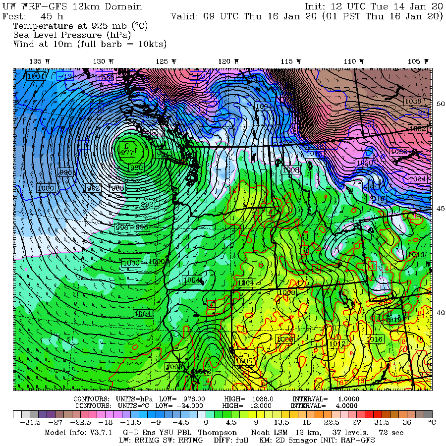
At this point, it appears that tonight will be the big snow event for the rest of the week, with the situation less favorable on Wed-Thursday as a powerful low center (and warmer air) moves up the coast (see sea level pressure map for 1 AM Thursday. Snow will have a greater tendency to stick to the roads after a few days of cool temperatures.
The feature of interest is a trough offshore (area of low pressure, indicated by the white oval) in a forecast of sea level pressure (black lines) for 4 PM today. The colors are low-level temperatures, with blue and purple showing air cold enough to snow.
The latest infrared satellite image shows the feature. Not very impressive-- would not call my mother about it.
For example, the latest NOAA/NWS high-resolution rapid refresh modeling system (HRRR), brings the leading edge of the snow into the Olympic Peninsula by 7 PM.
With a strong snow band over central Puget Sound by 10 PM tonight.
The latest UW model forecast for snow accumulation through 7 AM Wednesday is a bit different, with 2-5 inches from Seattle northward and huge amounts of snow in the Olympics.
The vaunted European Center model is similar to the UW prediction, with less snow over the southern Sound.
The bottom line: a good chance of significant snow from Seattle northward, with up to 3-5 inches, particular from north Seattle to Everett.
At this point, it appears that tonight will be the big snow event for the rest of the week, with the situation less favorable on Wed-Thursday as a powerful low center (and warmer air) moves up the coast (see sea level pressure map for 1 AM Thursday. Snow will have a greater tendency to stick to the roads after a few days of cool temperatures.
Subscribe to:
Posts (Atom)
Smoke and Fire During A Cold Wave
One of the most interesting aspects of the current smoke/fire event is that it is occurring during a cold wave. Over the past few days, temp...
-
For those worried about below-normal mountain snow, your worries are over..... a major snow dump is ahead. You can also expect great skiing,...
-
A number of you have asked about this coming winter and the status of La NiƱa. Will the snowpack continue to increase? Will those worried ...