June 17, 2022

The Origins of the Yellowstone Flooding and a June Gloom Forecast: All in My New Podcast

 Several of the rivers in and around Yellowstone Park experienced record-breaking flows this week and my podcast today tells the story.   And I also provide the forecast for the Northwest over the next week


As I discuss in my podcast, there are two main elements behind the Yellowstone flooding:  (1) the melting of an extreme snowpack and (2) heavy localized rain.   And to make this happen in such an extreme way, a lot of moving pieces had to come together.

The snowpack on June 11th, right before the flooding, was extreme, with the regional terrain having snowpack water percentages of hundreds of percent above normal (see below).  That means LOTS of water ready to melt.  This snowpack was the result of our cool, wet spring.

June 11th snowpack percent of normal

Warming temperatures before and during last weekend resulted in substantial melting.

And then there was the rainfall.   A plume of moisture moved in from the southwest--an atmospheric river--and was directed right into the Yellowstone region, where a small area of enhanced precipitation occurred (see forecast precipitation for the 72 h ending Tuesday at 5 AM PDT).  Forecasts were excellent by the way.


This rain not only contributed to the river rise but helped melt the snow as well. Take a look at a few of the regional precipitation totals below:  impressive, with values as high as 3-4 inches over the weekend.


Another way to view the combined effects of precipitation and melting is to examine the observations at a USDA Snotel site, where both snowpack and precipitation are measured.

Consider the nearby Monument Peak, Montana location.  The accumulated precipitation is black and the amount of water in the snowpack is shown by blue. Early this week the black line went up quickly (lots of rain) and the snowpack plummeted.  A LOT of water became available for local rivers.


I end the podcast talking about whether global warming played a significant role in the flooding, something claimed by several major media outlets and some climate activists.

The evidence clearly suggests a minor role for global warming.   The huge snowpack was a major contributor and global warming generally REDUCES snowpack.  The position of key features, like the atmospheric river and a developing low over land, have no evident global warming connections.  

The planet has warmed by roughly 1 C during the past century, and let's assume that humans are the sole cause.   1C increased would increase atmospheric water vapor by 6-7%, perhaps enough to slightly enhance the flooding, but nothing more.

The devastating event would have happened anyway.

To listen to my podcast, use the link below or access it through your favorite podcast service.


Some major podcast servers:

 HTML tutorial HTML tutorial
Like the podcast? Support on Patreon 


June 14, 2022

Sun Dog

Even the sun can have a pet:  the sundog.  

And last week, as high clouds streamed in overhead, a good example of this feature was captured by weather videographer extraordinaire Greg Johnson of Skunk Bay Weather.

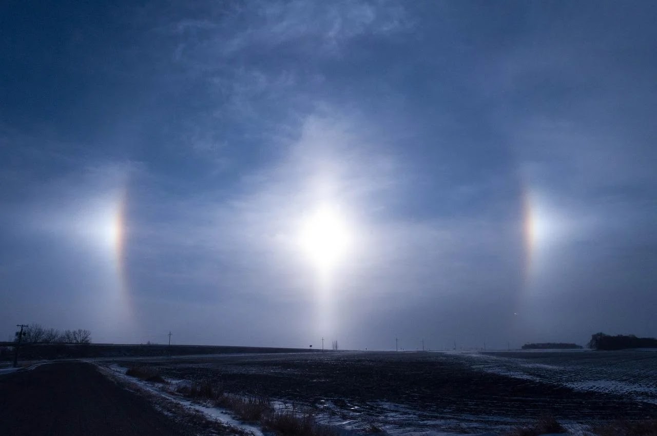
During a sundog event,  areas of light are seen on both sides of the sun (see example below).  These are the "dogs."    Sundogs are also called "mock suns"

The ancients thought that sundogs were ominous signs, foretelling events such as the death of kings.  Today we know that sundogs generally occur when the sky is filled with a thin veil of ice crystal clouds, generally cirrostratus.


Now let me show you a video captured by Greg Johnson from his location in northern Kitsap County around 6:30 AM last Wednesday.  From his camera, you only see one of the dogs.


The sky at the time of sun dogs was full of high ice crystal clouds, called cirrostratus.    You can see the extensive veil of such clouds from the visible satellite picture taken about this time (see below):


Why sun dogs?     

They occur when ice crystals in the clouds--shaped in six-sided plates--are oriented roughly horizontally.    With that orientation, they preferentially bend the light by 22 degrees, creating two areas of light (22 degrees on both sides of sun), as illustrated by the figure below.


Ice crystals that are smaller and tumbling about create circular halos.

As shown in the picture above, many sundogs have rainbow colors as well, something also illustrated in the picture below. 


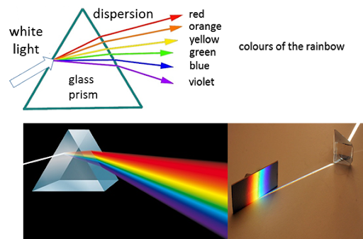
These colors are produced by dispersion, the breaking up of visible light into its component wavelengths, as it passes through the ice crystals, not unlike what happens in a prism (see below).


Cirrostratus and associate halos and mock suns are often a sign of an approach weather system, such as a front or cyclone.   Thus, although it may not foretell the death of kings, it can suggest the end of nice weather.

And then there are the "other" sundogs...


Forecast Triumph

Yesterday, a strong front, associated with strong winds gusting to 40 mph or more, moved through the region, resulting in numerous power out...