And that it not only can sense lightning from thunderstorms but the discharges produced by major volcanic eruptions?
An amazing technological achievement, based at the University of Washington, is called WWLLN (World Wide Lightning Location Network, website here). Led by Professor Robert Holzworth of the Earth and Space Sciences Department of the UW College of the Environment, this network is based on a collection of sensors that receive the electromagnetic pulses emitted by lighting.
But before I talk about this system, lets discuss about volcanoes and lightning. A few weeks ago, the Calbuco volcano erupted in Chile, producing a huge ash cloud and associated lightning. Volcanoes can produce lightning because the turbulent ash clouds can result in charge separation, in which there are large differences in electrostatic charges in the clouds. Such charge differences result in lightning.
The intense lightning pulses associated with the volcano-produced electromagnetic signals are picked up by the WWLLN network, which measured over 1000 lightning events over a few day period (see graphics below).
Most major eruptions produce lightning, including our local favorite: Mt. St Helens.
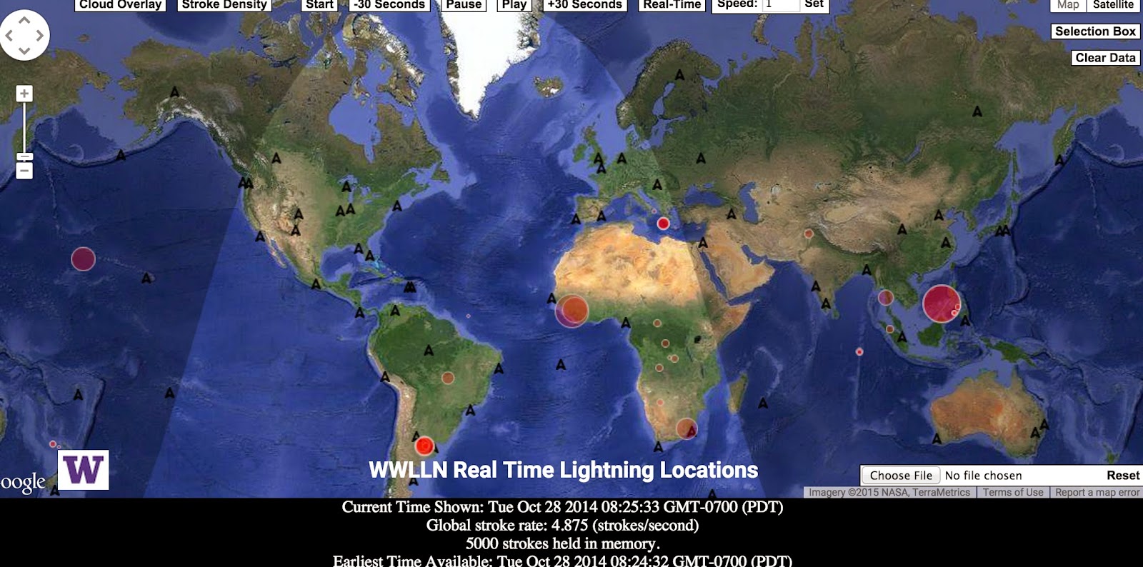
But back to WWLLN. This network encompasses roughly 50 sensors around the world (see map, large red asterisks show the current sensor sites).
These sensors measure electromagnetic emission in the Very Low Frequency (VLF) band (3-30 kHz). When a lightning event occurs there is a pulse of electromagnetic radiation (much of it in this band) that is called a "sferic." When I was kid I used to listen to a lot of AM radio and I noticed I could tell when thunderstorms where approaching by the increasing static--which was produced by the radio waves propagating out from local thunderstorms. Same general idea.
As the electromagnetic pulse propagates away from a lightning event (either cloud to ground, cloud to cloud, or cloud to clear skies), it is picked up by multiple WWLLN sensors. Since we know how fast radio waves travel (speed of light), by getting the time of arrival of the lightning pulse at multiple sensors (WWLLN demands at least 5), the location of the lightning pulse can be determined. Anywhere in the world. Pretty neat.
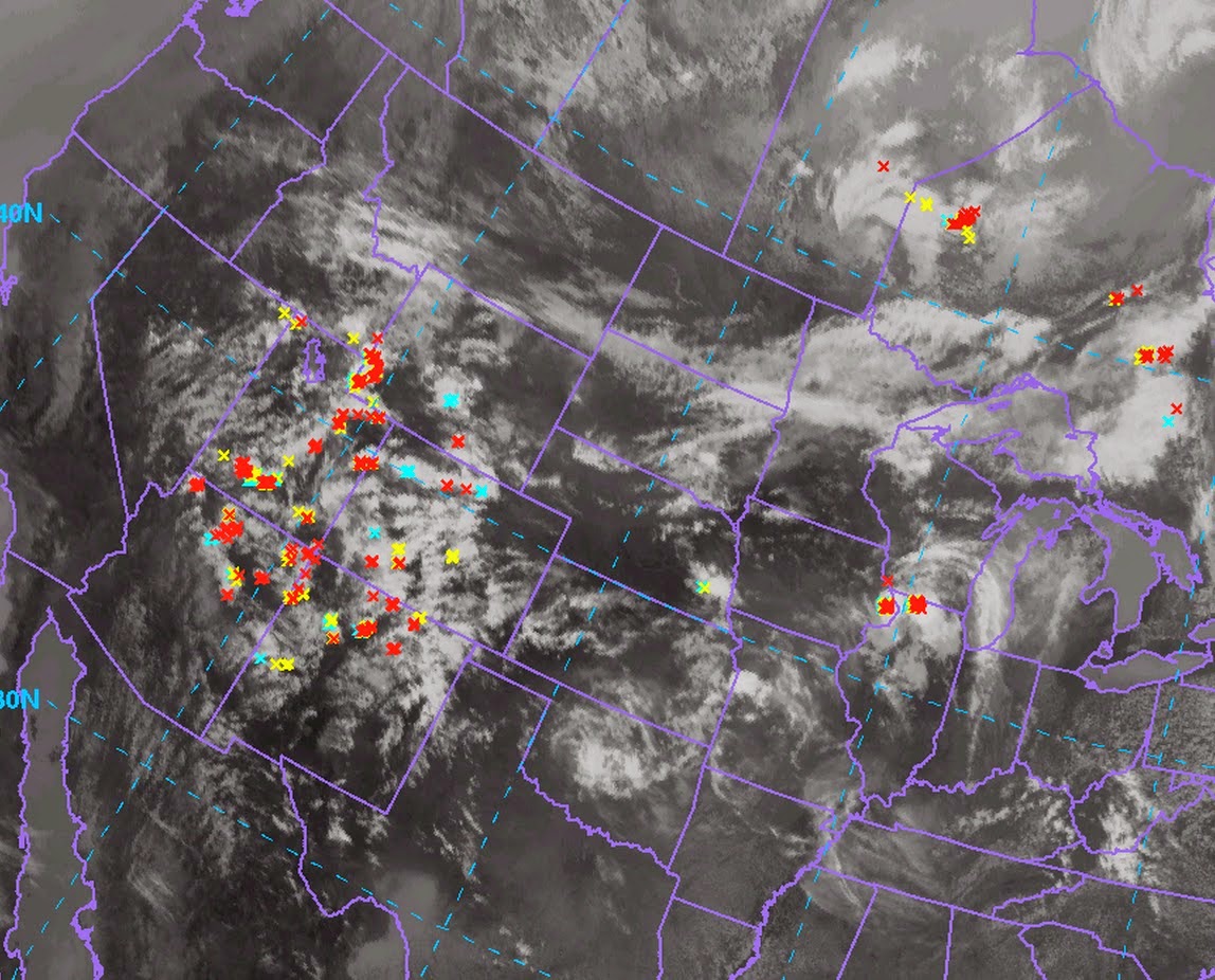
Here is the WWLLN lighting totals for 30 minutes ending 11:15 AM Sunday (plus the infrared weather satellite imagery). Lots of lighting over the SW U.S.
Or how about the average lightning over the world on Friday? No problem. (see below)
Lots of lightning in the tropics, which is not unexpected.
But what I really love is their real-time interface in which you can watch in real time as lightning strikes around the world. You can view it here or click on image.
Lightning detection networks, like WWLLN, are powerful tools for meteorologists. It helps us warn folks of approaching lightning. We can use the information to understand the climatology of lightning and the physical processes inside of storms. Some of us are using lightning to improve weather forecasting by using lightning information to better initialize our numerical forecasting models.
In fact, I have had a project to do this with graduate student Ken Dixon, Robert Holzworth, and Greg Hakim. Here is an example of a forecast of what a weather radar would see without (left, control) and with (right, nudge) the use of lightning for a major convective event that hit the U.S. east coast on June 29, 2012 (2100 UTC, 5 PM EDT). Big difference.
As shown by the observed radar (below), using lightning data from WWLLN really improved the forecast.


Faskernatin'!
ReplyDeleteHowever, the "real time" streaming data seems to be from last October - how does one set it to ~real~ real time?
http://www.climatecentral.org/news/northwest-wet-drought-climate-future-18910
ReplyDeleteVery interesting. We have so little lightning here, I feel left out...
ReplyDeleteI like the graphics on this lightning site better.
ReplyDeletehttp://www.blitzortung.org/Webpages/index.php?lang=en&page_0=30
Don't miss this one, which I think is related to the one Joe sent:
ReplyDeletehttp://www.lightningmaps.org/realtime
These are said to be the strikes that reach the ground, not cloud to cloud. They also give instructions on how you can make your own station and join the network.
One of my fondest childhood memories:
ReplyDeleteWhen I was a teenager in the days of black & white TV, my brother and I would turn the TV contrast to all black, the channel to 2, and the sound to it quietest setting and then watch the lightning patterns on TV just the instance before we saw them in real time.