Days are sunny and the sun still has some strength, resulting in decent daytime warming.
Nights are much longer and with relatively clear skies, there is good radiational cooling to space.
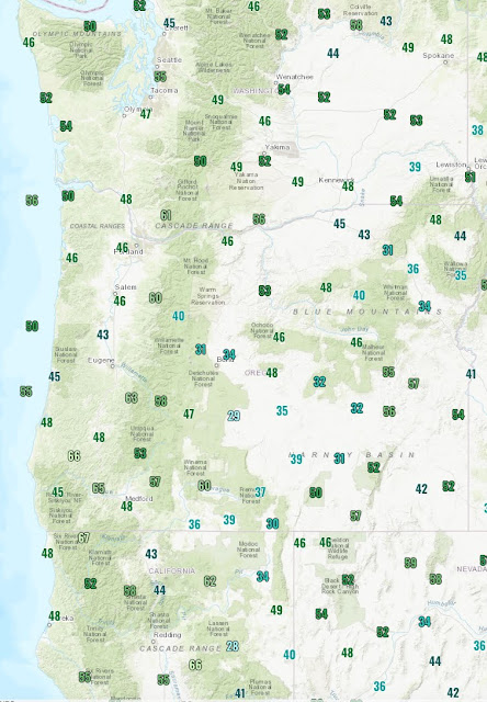
To illustrate, here are the high and low temperatures today (click on maps to enlarge). In western Washington we were in the mid to upper 70s....warm for this time of the year. But western Oregon was in the mid 80s to 90s, while lower to mid-90s were observed over northern CA. Mid-80s over the high desert of southeastern Oregon.
But now look at the minima. Wow. Mid-40s in western Oregon and Washington. And 30s and even below freezing temperatures in eastern Oregon.
Can you imagine, going from mid-80s to around freezing in a matter of a few hours? That would crack some concrete!
Need more convincing? Here are the plots of temperature at Olympia,WA and Medford, Oregon (central eastern OR) for the past three days. Olympia (purple line) ranged from the mid-40s to the mid-70s today, but Medford went from 50 to roughly 90F.
But even these swings are eclipsed by a few stations in Oregon and northern CA, where yesterday some went from 100F to the low 40s.
So if you don't like the weather, wait a few hours. My advice: get outside tomorrow (Saturday)....clouds and light showers expected on Sunday.


I'm surprised that a city like Ukiah, CA can cool down at night as much as it does. A cursory check indicates that the highest minimum temperature recorded in Ukiah this summer was 62, and they only got there during a stretch where daytime maximums were well over 100. Ukiah has roughly the same elevation and summer max temperatures as Wenatchee but the latter consistently experieces summertime nightly lows over 60. I guess Ukiah's more southerly location is offset by extremely low dew points and strong radiation cooling.
ReplyDelete