I am really looking forward to two events this week: the potential for a meteor storm on Monday evening and the arrival of warmer than normal conditions on Tuesday and Wednesday.
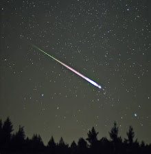
First, the meteors. On Monday between 9:45 PM and 10:15 PM, the tau Herculid meteor shower will reach the earth. There is considerable uncertainty on the number of meteors that will enter the earth's atmosphere, but it potentially could be a major event.
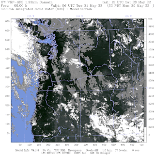
The latest high-resolution weather model output suggests that it may be clear or nearly clear over much of the Northwest (see cloud forecast map for 11 PM below)
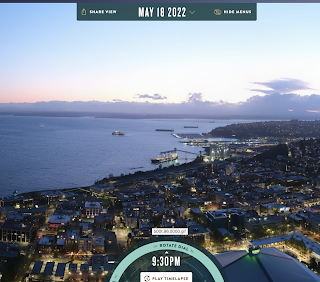
The other issue is moonlight and sunlight. We will have a new moon....so no light there. But there is an issue with sunlight. Sunset is very late now (about 8:55 PM). Civil Twilight ends around 9:36 PM--which is right before the meteor shower. What does the end of civil twilight look like? Here is the analog situation on May 18th for the sky at the start of the meteor shower: too much light!
By the end of the shower (around 10:15 PM), it will look like this (see below). Maybe we will have a chance then of seeing some meteors.
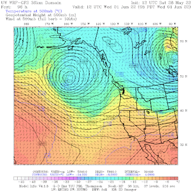
A ridge of high pressure aloft will develop over us starting late Monday and amplifying a bit on Tuesday and Wednesday (see upper-level map at 5 AM Wednesday below).
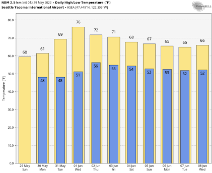
As a result, temperatures over the western lowlands will surge to around 70F on Tuesday and mid-70s on Wednesday (see the daily forecast by the skillful National Weather Service blend of models). Unfortunately, we will descend into the murk later in the week.
The weather in eastern Washington will be far warmer, rising into the 80s for much of next week, and cooling will only be into the upper 70s.
Keep your fingers crossed for an impressive meteor shower!



Rain arrived a little early, while I was out on a run. But now an hour later the rain really is coming down hard, and the wind out of the north. I suspect we are getting a convergence zone storm, as I am seeing winds coming from the west near Belfair, and wrapping around the north Olympics before coming south.
ReplyDeleteAnother aspect of this unusual Memorial Day weekend is that it’s been atypically cool ar elevation. Paradise Lodge didn’t have a historic snowfall winter but there is still over 120 inches at the measuring station and Snow-to-water equivalent is currently 124% of average. Daily Statistics
ReplyDelete(inches)
Min Median Average Max
0.50 (2015) 64.80 64.10 108.20 (1999)
30 Year Average: 64.10 inches
Latest Observation is 79.40 inches which is 124 % of median: “The Median/Average is based upon the 30 year period 1991 to 2020.
The Min/Max is based upon the Period Of Record (POR)”.
https://www.nwrfc.noaa.gov/snow/snowplot.cgi?AFSW1
DeleteThis spring is disgusting. Just disgusting.
ReplyDelete