November 14, 2021

The Pacific Northwest is in the Subtropics for a Day

 The air feels different today.

Warm, humid, and with a determined breeze that should be moving a grove of palm trees.

Your skin feels moistened and supple, and temperatures will rise to near 60F in the west and as high as 70F over the Columbia Basin.

Seattle, November 14, 2021?

The Northwest has been transported into the subtropics for a day, the result of an odd meteorological wormhole in meteorological space/time.

This blog will explain.

Some of you may demand proof of the tropical origins of our current air....here it is!  

The top figure below shows the trajectories of air over the past five days ending above Tacoma at 500 meters (red), 1000 m (blue), and 2000 m (green).  All three air trajecotires come from south of 30 N west of Baja California.  

The subtropics.  

The bottom  panel shows the heights of the air over the past five days.


The transition occurred last night.

Below are observations of wind, temperature, and moisture (dew point temperature) at the University of Washington.  Early last evening, the winds switched from northeast to south and accelerated greatly, with some gusts to 15-20 meters per second (around 38 mph!). Temperature and dew point (a measure of moisture) surged upward to around 14 C (roughy 57F)


In the map below, the temperatures (black numbers)  this morning at 7 AM show upper 50s over the lowlands of western Washington to the low to mid 60s around the Tri-Cities and Walla Walla. 

The red numbers are gusts and the wind direction shown by the wind barbs:  strong warm southwesterly flow is noted along the coast and descending into eastern Washington, with 25-35 gusts all over the place.


What caused our transition to tropical breezes? 

The passage of an unusually strong warm front last night.

Here is a forecast map for 4 PM yesterday (Saturday).  A strong warm front projected eastward from the low center and was approaching our coast.  The colors show temperatures at around 800m above sea level, going from cool (green) to warm (orange).


While all of you are enjoying your tropical drinks today, consider that mother nature will make us pay for this tropical interlude.

A very strong cold front is approaching and some locations will experience powerful winds.

At  7 AM tomorrow (Monday), a very strong cold front it right off the coast.  The solid lines are isobars, lines of constant sea level pressure), and the front has an intense trough of low pressure associated with it.  Note the large nort-south pressure difference over western WA (which means strong winds) and the big contrast in temperatures (colors) associated with the front


By 4 PM Monday, the front has moved into eastern Washington and an intense pressure difference is positioned over the Cascades.


The strong pressure difference with the front will first cause a surge of powerful westerly winds in the Strait of Juan de Fuca and then strong winds, gusting to 60-80 mph, over the eastern slopes of the Cascades.  The wind gust forecast for 7 PM tomorrow is shown below--pretty scary east of the Cascade crest.  Expect some power outages on northern Whidbey Island and over the eastern Cascade slopes.

And behind the front, our temperatures will greatly cool, with temperatures over the western lowlands only climbing to the mid-40s for the rest of the week. Snow will return to the mountains.  And skiers will hope.....

Announcement:

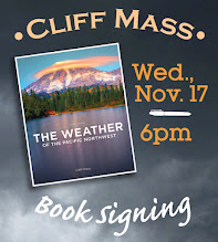
I will be doing a book signing and dinner event at Ivar's Salmon House in Seattle on Wednesday, November 17th (6 PM).  You can come just to purchase a book and get it personalized or you can stay for a special dinner, where I will be giving a weather talk.   More information on the event is found here.  You need to make reservations for the dinner (only 80 spaces available). And information about the new edition of my book is here.

Half the spot are now reserved, so if you want to go, reserve a place soon.


November 12, 2021

The Story of Northwest Flooding and the Weekend Forecast (Very Wet): All in My New Podcast

 My new podcast is out, and I go into detail about the origins of Northwest flooding and describe the VERY active weather that is expected over the new few days.

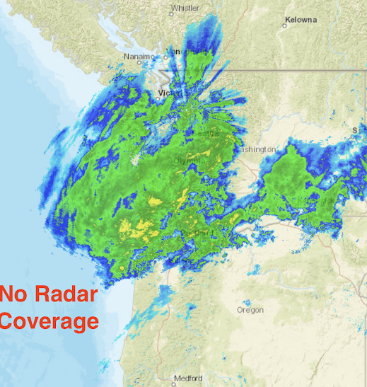
The current radar shows the atmospheric river precipitation over us (below)...and it clearly displays the radar gap along the central and southern Oregon coat.


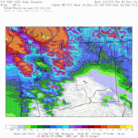
ANOTHER atmospheric river hits Saturday night/Sunday morning (see 24-h total ending 4 PM Sunday in the graphic below),  which will be most problematic over western Washington and southern BC.


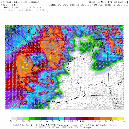
And THEN a powerful front comes through on Monday that will bring even MORE rain (as much as 7 inches in the mountains and several inches over Puget Sound).  Expect street flooding.


The front will be accompanied by strong winds and followed by MUCH colder air, with the snow levels plummeting to roughly 2000 ft in the mountains.

More details in the podcast!

You can listen to the podcast below or through your favorite podcast server.


Some major podcast servers:

 HTML tutorial HTML tutorial
Like the podcast? Support on Patreon Become a Patron!


__________________________

Announcement:

I will be doing a book signing and dinner event at Ivar's Salmon House in Seattle on Wednesday, November 17th (6 PM).  You can come just to purchase a book and get it personalized or you can stay for a special dinner, where I will be giving a weather talk.   More information on the event is found here.  You need to make reservations for the dinner (only 80 spaces available). And information about the new edition of my book is here.

Half the spot are now reserved, so if you want to go, reserve a place soon.

_______________________________________________

I will be doing a special online zoom session for the podcast/blog Patreon supporters this Saturday at 10 AM.

An Extreme Lightning Event Started the Recent Northwest Wlidfires: Did Global Warming Play a Role?

On July 15/16, a massive lightning storm initiated several major wildfires east of the Cascade crest. As shown below, this was one of the mo...