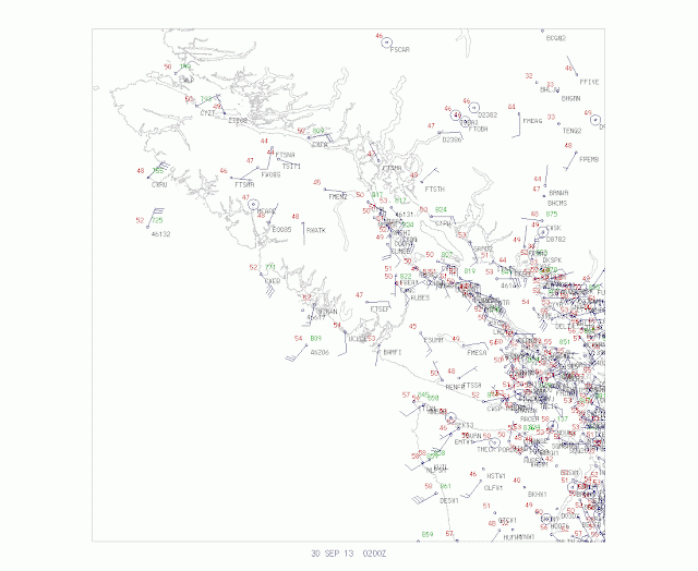
The better models (GFS and European Center) were right...the intense low center is making landfall on central Vancouver Island, sparing the Puget Sound region a major windstorm.
Here are some marvelous satellite images a few minutes old...one an infrared image and the other a water vapor image. Extraordinary.
The latest surface plots clearly show the circulation on Vancouver Island. Looks like a roughly 970 hPa low.
The coastal radar has been very helpful, showing that the circulation was not approaching the WA coast.
As the low moves inland and north of us, the north/south pressure differences will increase, as will our surface winds. Already, the winds right about the surface are 25-35 mph and some of that is mixing down.
Winds at exposed mountain locations will get to 80 mph, plus. Northwest Washington will see gusts to 40-60 mph. And it will be quite winds here in Puget Sound (gusts to around 40-45 mph. So get ready...the winds are about to increase.


Thanks for the updates, Cliff!
ReplyDeleteWill the north Oregon coast see the strong winds that were predicted as recently as this evening? So far winds have been light at best.
ReplyDeleteIt looks like the NWS has cancelled the High Wind Warning that was originally in effect until 11:00pm.
"Only" 29 mph here for east Bellevue... but really, I'm glad that it's mostly missing us.
ReplyDeleteThanks for the Nowcasting.
Wow, Forecast BUST! Not even a storm in Bellingham! RIP OFF! Time to pull up the socks on forecasting around here!
ReplyDeleteMust ask: What was with the east winds earlier? Blew over some of my garden trellises. Looking at the map, if I understand correctly, it looks like wind from the west.
ReplyDelete