Had enough of the coldest mid-April on record? Problem solved. The frigid temperature regime is over.
But there is a catch. The atmosphere is transitioning to a new regime, where the weather will be cloudy and wet over the Northwest and northern California.
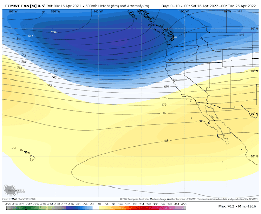
A deep trough of low pressure will settle in over the northeastern Pacific, as illustrated by the forecast upper-level flow at 500 hPa (about 18,000 ft) for the next ten days. The blue colors indicated whether the upper-level heights/pressure will be lower than normal...something called a trough.
Take a look at the predicted precipitation through Wednesday afternoon. Oranges and reds are the heavy stuff, with lighter precipitation in green and blue.
Precipitation everywhere, but heaviest over Oregon and northern CA, where they need it. Good for water resources.


Cliff, if la Nina sticks around this summer will it be cooler then last year?.
ReplyDeleteHey, any summer will be colder than last year.
DeleteSince 2012 our summer has been getting much warmer I which cliff would stop denieing that because it's a fact, we're now averaging 40+ days at or above 80 degrees in Seattle every year now that's never happened before 2013.
DeleteYes, I second that: What, in general, is the effect of La Nina on summer weather?
ReplyDelete