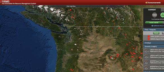
Satellite-based sensing has become an important tool for determining wildfire intensity in real time.
And the latest satellite data suggests a profound lessening of the Bolt Creek fire on US 2 near Index.
Many weather satellites have sensitive radiometers that can sense the heat emitted by wildfires. The Bolt Creek fire really was apparent in satellite imagery over the weekend, but today there is no obvious heat signature (see below). No orange/red dot.
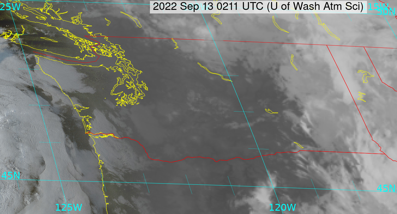
The infrared satellite image tonight shows no black dot (black indicates warm temperatures in such imagery).
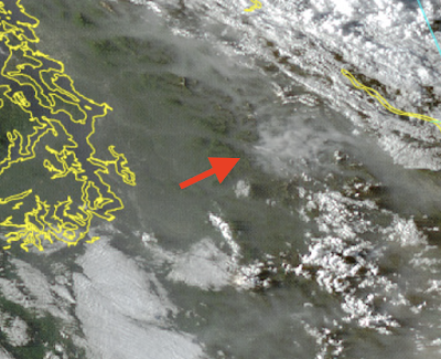
The visible satellite picture had an unimpeded view of the Bolt Fire area before sunset. There is still some smoke (which means some low-level burning remains), but nothing like a few days ago.
Conditions have become MUCH more favorable for suppressing the fire. Some rain fell on the fire yesterday.
Importantly, the strong easterly (from the east) winds that stoked the fire initially are gone, replaced by weak winds from the west. Temperatures have plummeted and relative humidity has gone up substantially.
To illustrate the major changes, consider the observations of a nearby fire-weather site (the Johnson Ridge RAWS site at 2000 ft). The temperature went from near 90F on Sept 10th to 66F today.

Temperatures should stay cool and skies will be partly cloudy the next few days in the vicinity of the fire.


Thanks for the good report. Wondering what the cause of the fire was?
ReplyDeleteGreat to hear. In addition to the improving weather conditions would Forest Management also play into the rapid decline of the fire? Deadfall, brush, slash etc. tends to burn extremely rapidly and so hot that it dies down quickly. I help my community in Firewising in the spring and one thing I observe is that that the dry fuels burn much quicker and then smolder. The dead pines with brown needles go up like jet fuel when ignited which is particularly unsettling to witness.
ReplyDeleteSome pretty big storms over Cle Elum and Leavenworth heading north. What is the likelihood that these will start new fires?
ReplyDeleteRelated - here's some interesting pictures of the smoke clouds from the "Mosquito" fire, northeast of Sacramento CA. https://wildfiretoday.com/2022/09/13/photos-of-smoke-columns-not-often-seen/
ReplyDeleteSome lenticular clouds, and others that are quite interesting.
"The worst is over folks." I wish!
ReplyDelete